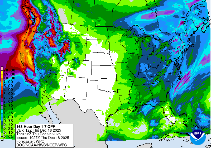
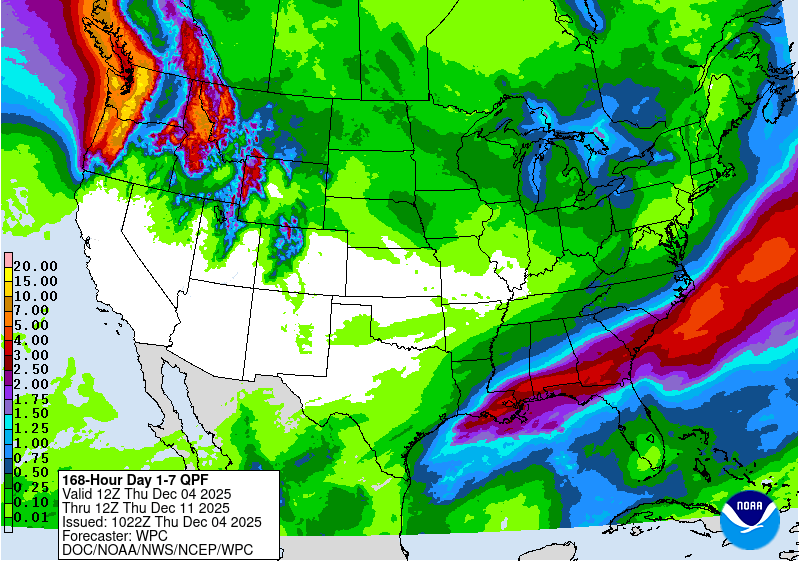
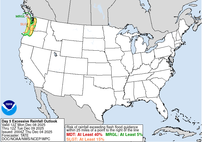
A series of atmospheric rivers (ARs) pounded the Pacific Northwest last week, resulting in catastrophic river flooding. The NWS Weather Prediction Center (WPC) seven-day Quantitative Precipitation Forecast (QPF) issued at 1022 UTC 04 December 2025 had rainfall amounts approaching 15 inches across the Coastal and Cascade Mountain ranges of Washington and Oregon. A Slight Risk for excessive rainfall was also introduced with the first issuance of the Excessive Rainfall Outlook (ERO), five days in advance of the first round of heavy rainfall on 08 December 2025.
In viewing the GOES-West Full Disk Air Mass RGB imagery, the AR can be seen tracking from the Central Pacific on 07 December, before reaching the Pacific Northwest Coast on 08 December and persisting through 09 December. Waves of low pressure developed in an environment with high amounts of potential vorticity and tracked into Southwest Canada, maintaining the moist flow into WA & OR.
Figure 3: GOES-West Air Mass RGB imagery from 0000 UTC 07 December to 2350 UTC 09 December 2025. Credit: NESDIS/STAR
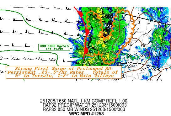
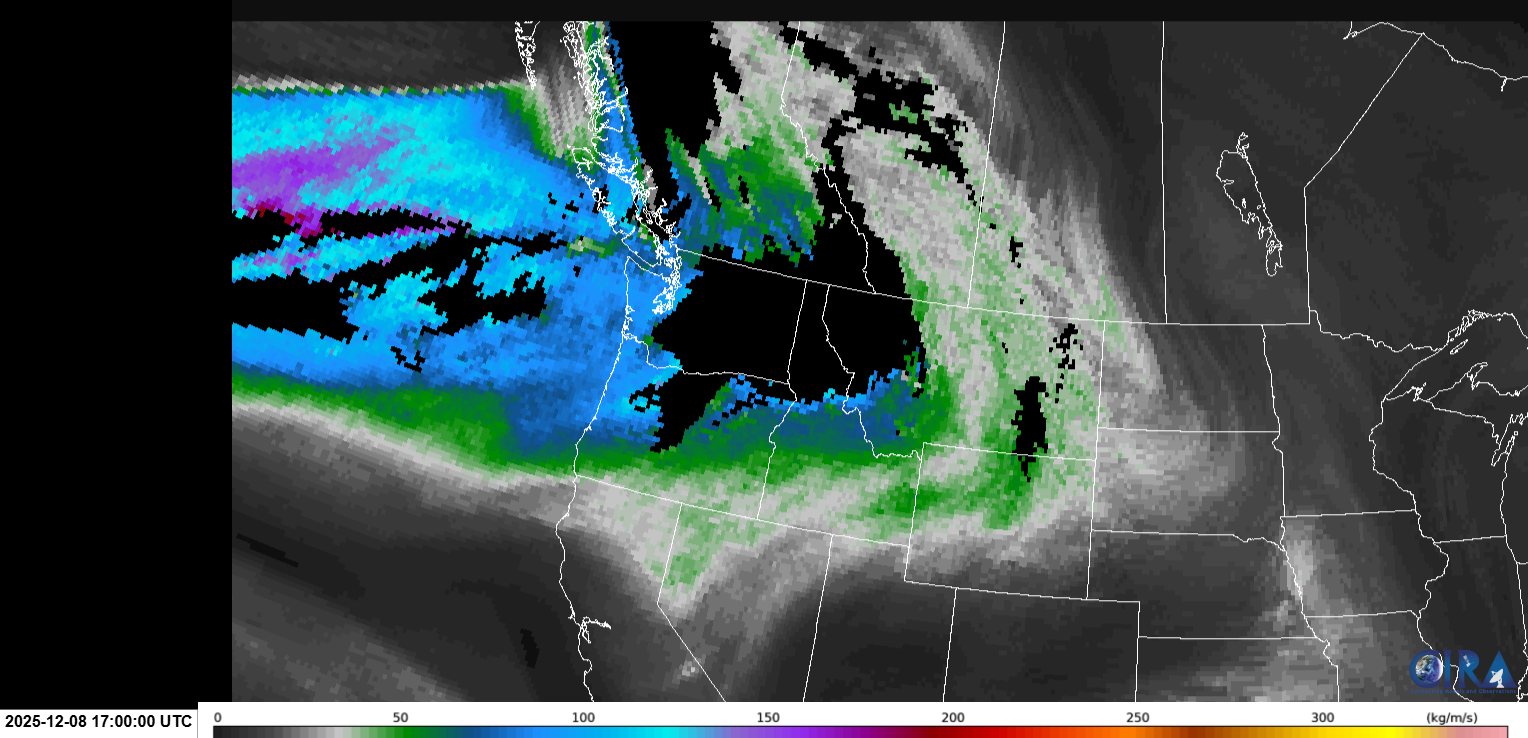
The WPC MetWatch Desk issued a Mesoscale Precipitation Discussion (MPD) at 1652 UTC 08 December 2025 for much of western WA, noting Integrated Vapor Transport (IVT) “values very near 1000 kg/m/s analyzed just offshore while remaining above 700 kg/m/s into the Cascades currently, but…expected to rise”. The CIRA Layered Vapor Transport (LVT) product also showed elevated moisture even at upper levels, with values exceeding 100 kg/m/s. The CIRA LVT product should be available in AWIPS at WPC in the next few months, and will have the same colorbar as IVT to allow for direct comparison. To note, WPC MPDs usually are in effect for six hours, but can extend out to 12 hours for ARs.
December 8th was “round one” of the series of ARs. December 10th brought an additional strong AR, bringing heavy rains on already saturated soils and causing rivers to flood. The Advected Layered Precipitable Water (ALPW) product makes it easy to see the AR heading to the Pacific Northwest from the Tropical Pacific near Hawaii. At all layers, abundant moisture is observed rotating around the subtropical High Pressure system off the coast of Southern California.
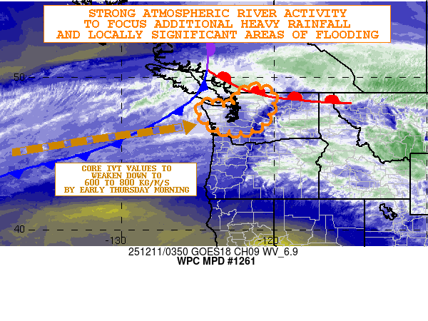
Multiple MPDs were issued through 10 & 11 December, including the one issued at 0407 UTC 11 December 2025 once again for western WA for “locally significant areal flooding, including potential for debris flows, landslides and localized flash flooding.”
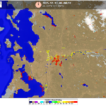
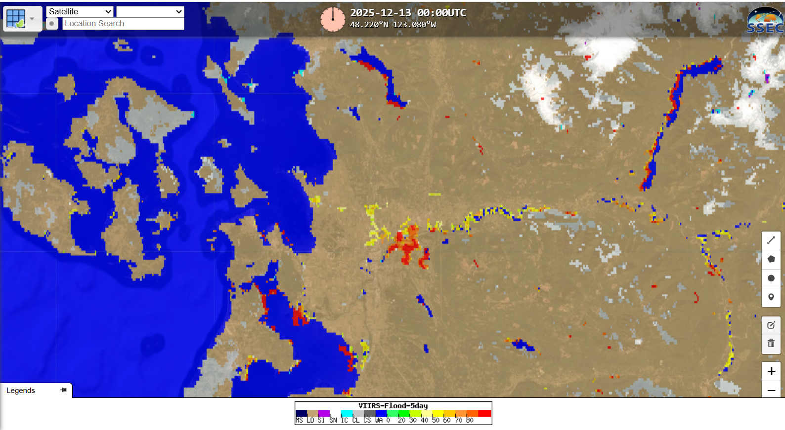
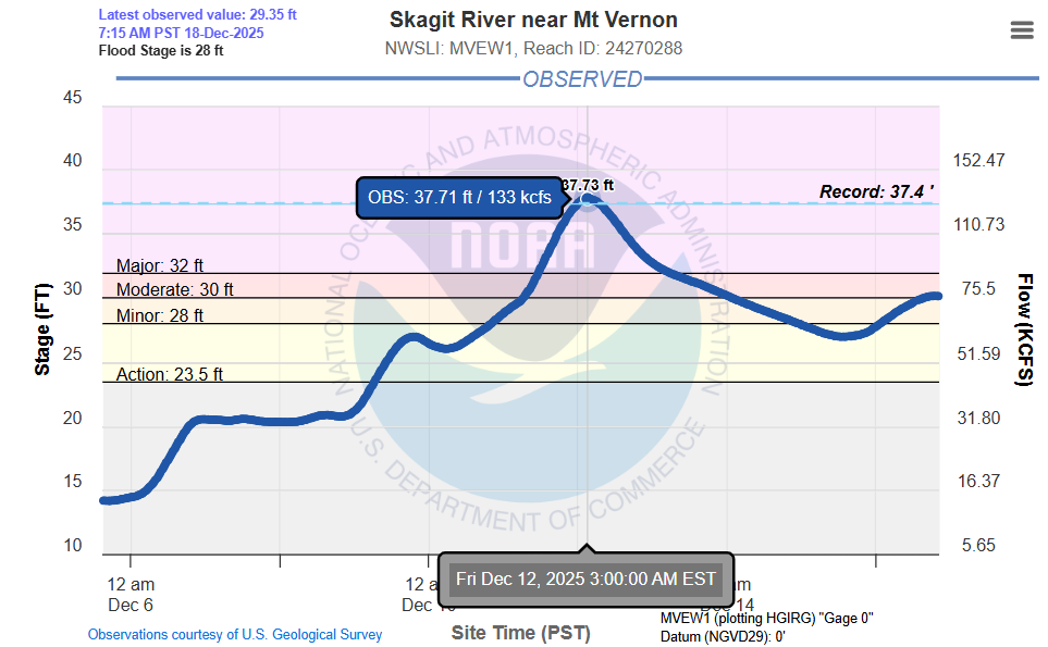
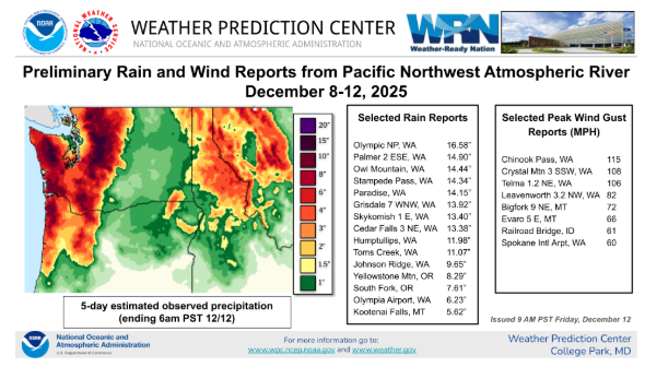
The CIMSS VIIRS 5-Day Flood Composite captured the flooding along the Skagit River near Burlington, WA, with over 90 percent of pixels showing floodwaters. Preliminarily, the gauage near Mt Vernon, WA, reached a record 37.7 feet, breaking the old record of 37.4 feet. Rainfall amounts across the higher elevations of western WA approached 15″ and wind gusts surpassed 100 mph.
Additional ARs are expected to impact the West Coast over the next seven days, with areas further south in California also receiving heavy rainfall.
