The long-duration intrusion of Arctic air delivered a snowstorm to the Southern Mid Atlantic and parts of the Southeast over the weekend. Snow wasn’t the only hazard, however, as a powerful hurricane-force (HF) extratropical cyclone exploded off the Mid Atlantic Coast. The NWS Ocean Prediction Center (OPC) North Atlantic 96 Hour Surface Forecast predicted a 970 hPa HF low just off the coast of North Carolina at 1200 UTC 01 February 2026, which verified quite well. Throughout this period, OPC was providing specialized briefings to the U.S. Coast Guard for vessels to create avoidance plans.
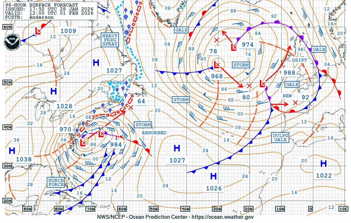

Figure 1: NWS OPC North Atlantic 96 Hour Surface Forecast (left) and North Atlantic Surface Analysis (right), valid at 1200 UTC 01 February 2026.
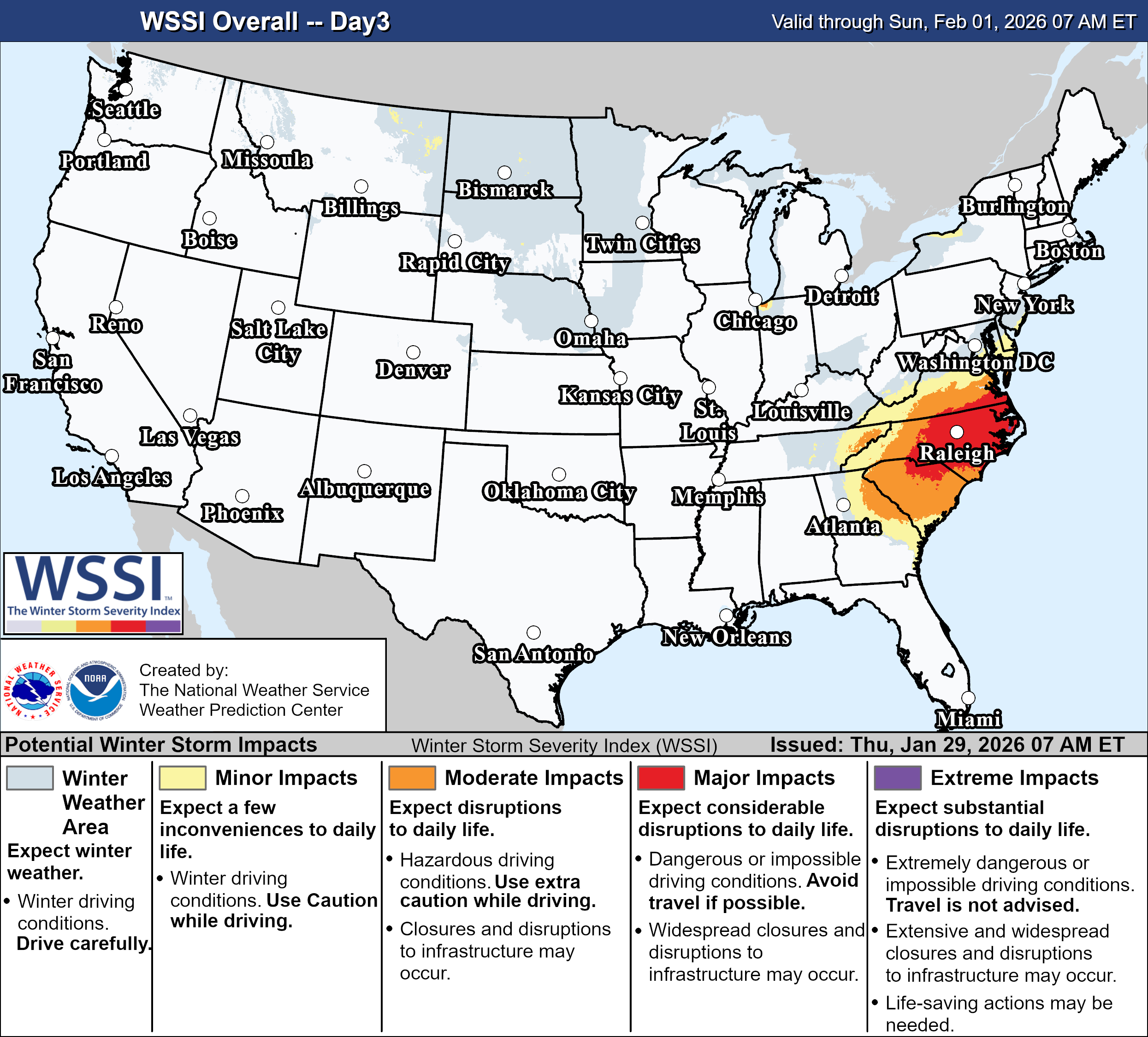
While dangerous winds and waves were threatening mariners at sea, a powerful winter storm was developing over the U.S. The NWS WPC Winter Storm Severity Index (WSSI) highlighted the threat for “Major Impacts” three days in advance across the Southern Mid-Atlantic and Southeast, including parts of SC, NC, and VA. A dot of “Extreme Impacts” can even be seen near the Outer Banks of North Carolina.
On Saturday, 31 January 2026, snow was underway for much of the day across the Carolinas. While precipitation rates were quite light, snowfall ratios were high, for cities like Charlotte. This combination led to very light radar reflectivities, even where snow was falling. The NESDIS Merged Snowfall Rate (mSFR) product was able to capture ongoing snowfall Satruday evening across the higher elevations of western NC, even when MRMS data showed little to no precipitation falling. For example, at ~0240 UTC (940 p.m. Eastern 31 January) 01 February 2026, snow was ongoing in Asheville, which was only picked up after a satellite pass went overhead.
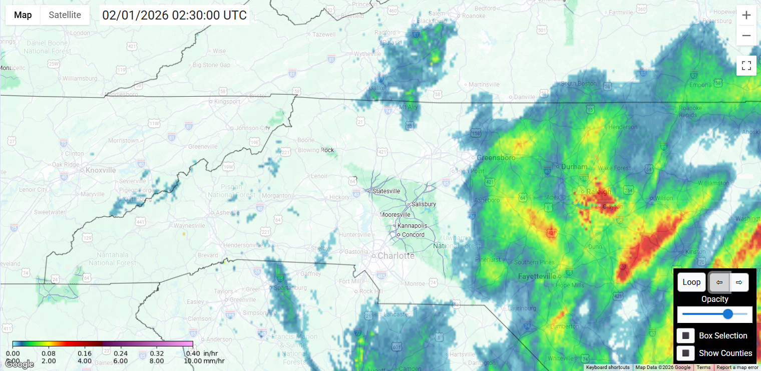
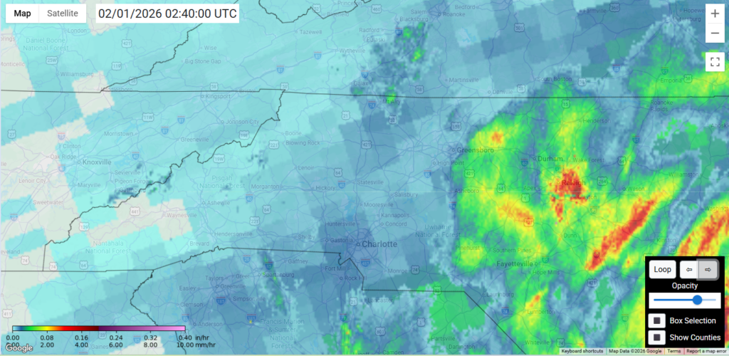
Figure 3: NESDIS mSFR Product output featuring only MRMS data at 0230 UTC (left), and output featuring MRMS & satellite data (right) at 0240 UTC 01 February 2026. From CISESS

The evolution and rapid intensification of the extratropical cyclone is showcased in the GOES-East CONUS Air Mass RGB satellite imagery as the low pressure moved off the Southeast Coast and over the Gulf Stream. Intense convection fired in the northern and western quadrants following an intrusion of stratospheric air rich with potential vorticity (bright oranges and reds) after ~0000 UTC 01 February 2026. From 1200 UTC 31 January to 1200 UTC 01 February 2026, the minimum central pressure of the system dropped 34 hPa in 24 hours, from 1011 hPa to 977 hPa, surpassing the threshold (24 hPa in 24 hours) for ‘rapid intensification’.
Figure 5: GOES-East CONUS Air Mass RGB imagery from ~1200 UTC 31 January to ~1000 UTC 01 February 2026. Credit: NESDIS/STAR
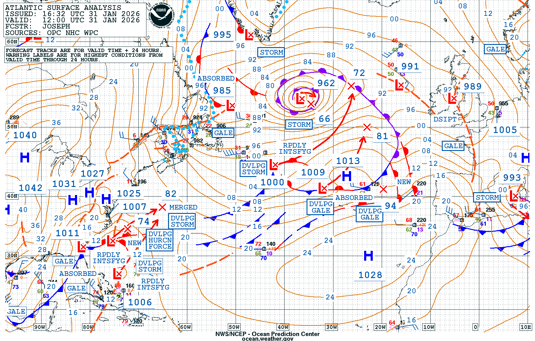
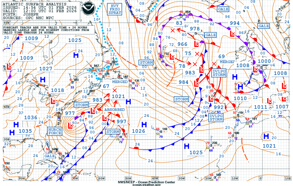
Figure 6: NWS OPC North Atlantic Surface Analysis at 1200 UTC 31 January (left) and 1200 UTC 01 February 2026 (right).
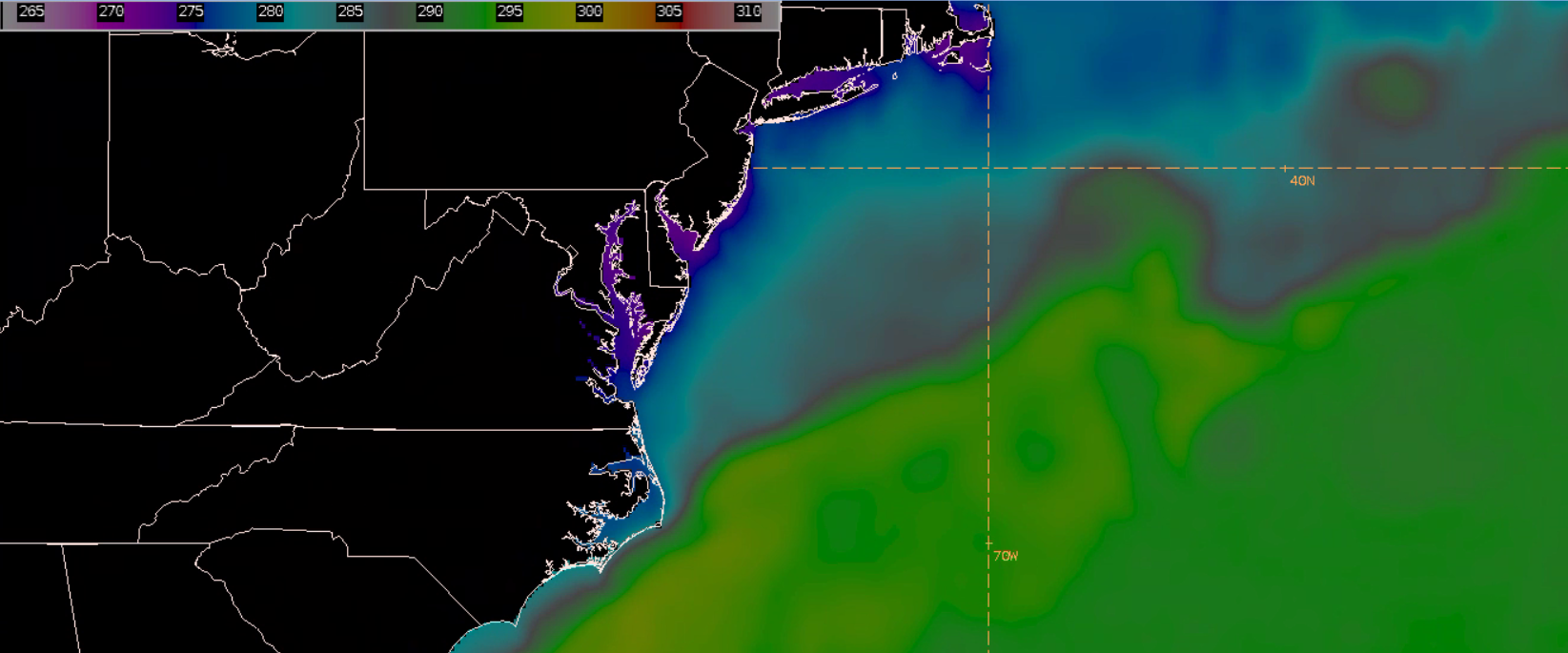
The intensification of the storm system was fueled by the Gulf Stream and tight gradients in sea surface temperature (SST). The NESDIS Geo-Polar Blended Global SST Analysis Product showed SSTs exceeding 295 K (22 degrees Celsius or ~72 degrees F) south of the ‘North Wall’, with much cooler SSTs in the 280-285 K (7-12 degrees Celsius or ~45 to 54 degrees F) to the north. This NESDIS SST Product is at 5-km resolution and combines data from high-temporal resolution geostationary infrared imagers with high-spatial resolution Low Earth Orbit (LEO) satellites. The product is viewable in AWIPS, with dataflow required to be implemented to receive this product on a routine basis.
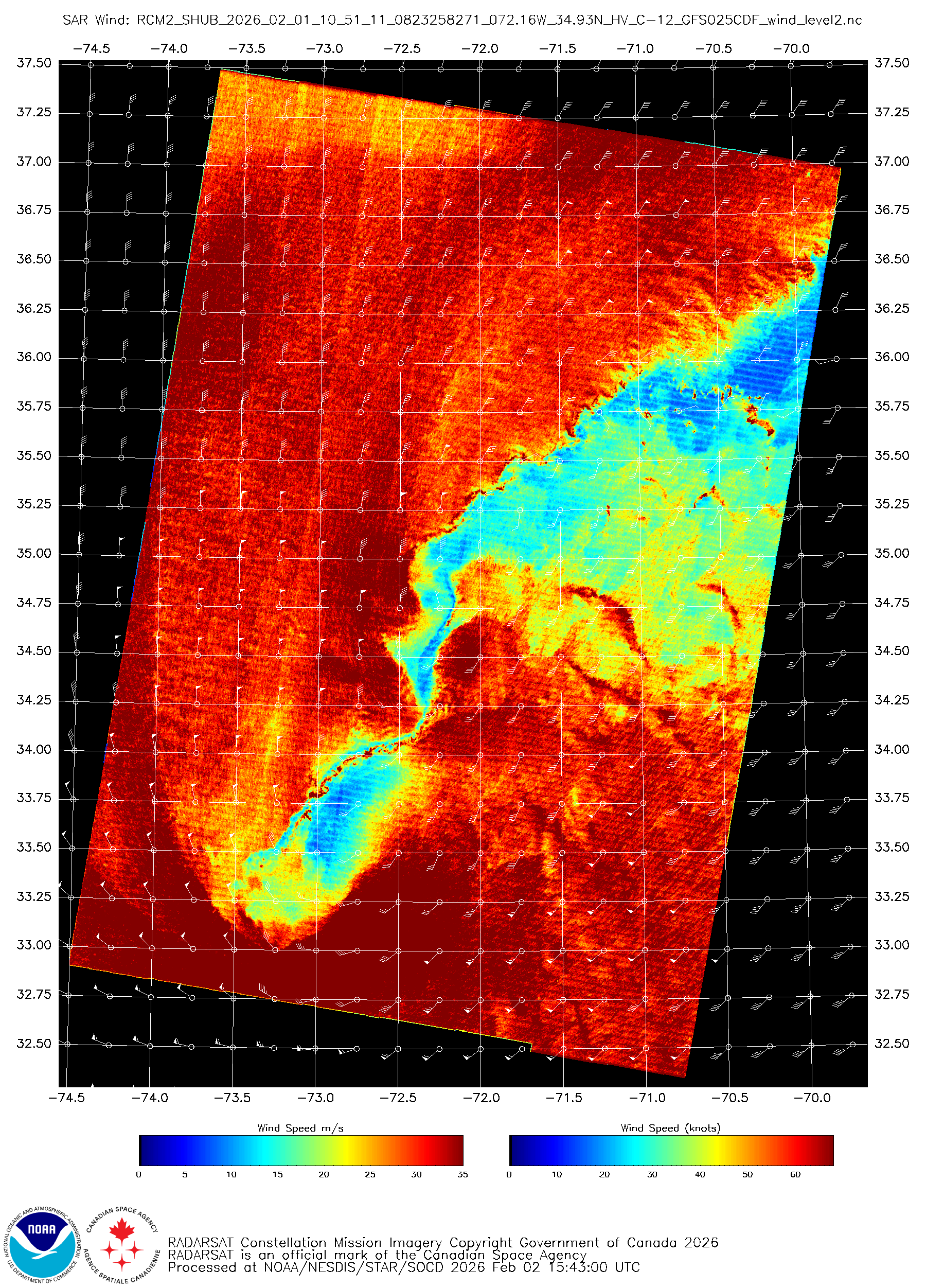
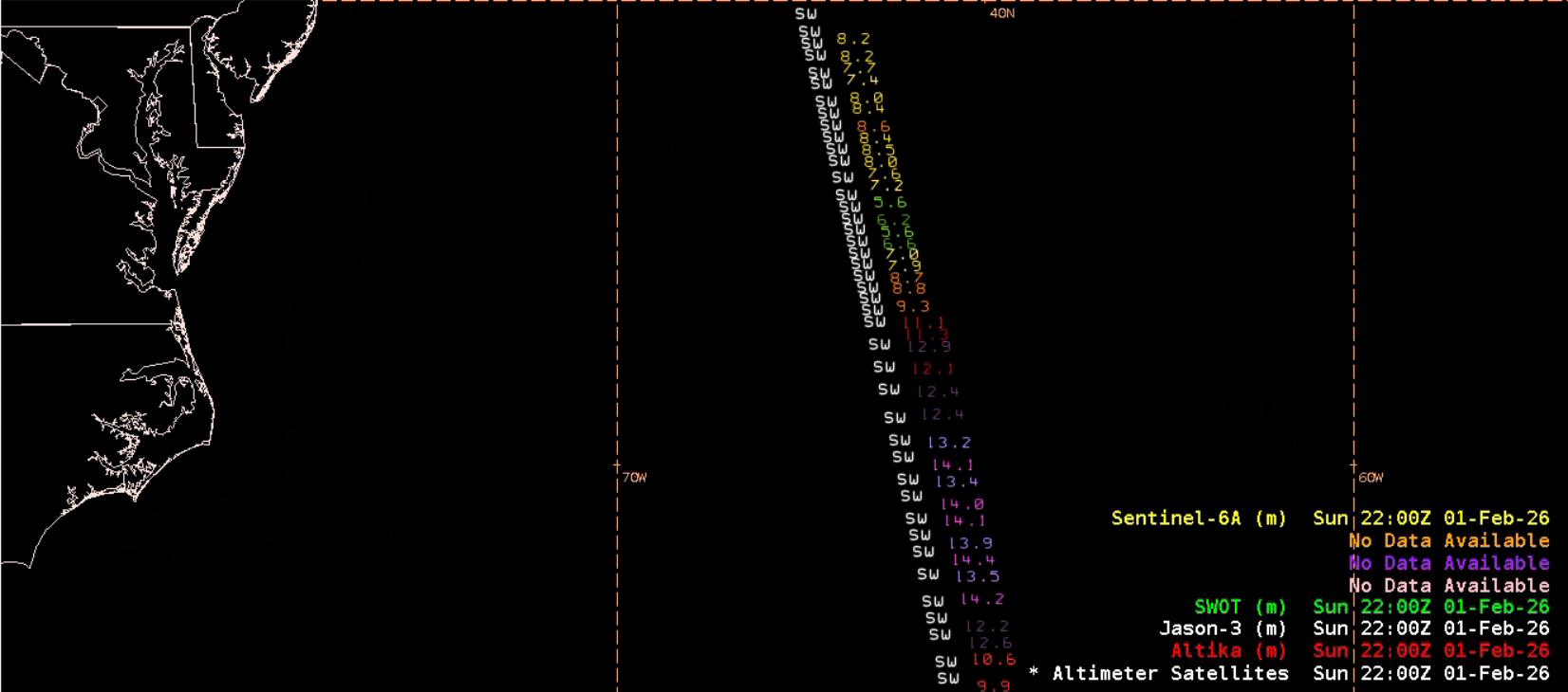
A RadarSat Constellation Mission -2 (RCM-2) SAR pass at ~1050 UTC 01 February 2026, run with the High Winds Algorithm from NESDIS/STAR, captured widespread HF-winds. A large swath of wind speeds over 60 knots surrounded the circulation, strongest in the southeast quadrant in the vicinity of a possible “sting jet”. The high resolution of SAR Winds (500-m) allows the forecaster to also examine the unique structure of the low pressure’s elongated center with much lighter wind speeds. The extremely hazardous waters can also be seen in a SWOT altimeter pass at ~1930 UTC 01 February 2026, with significant wave height observations exceeding 14 meters, or over 45 feet!
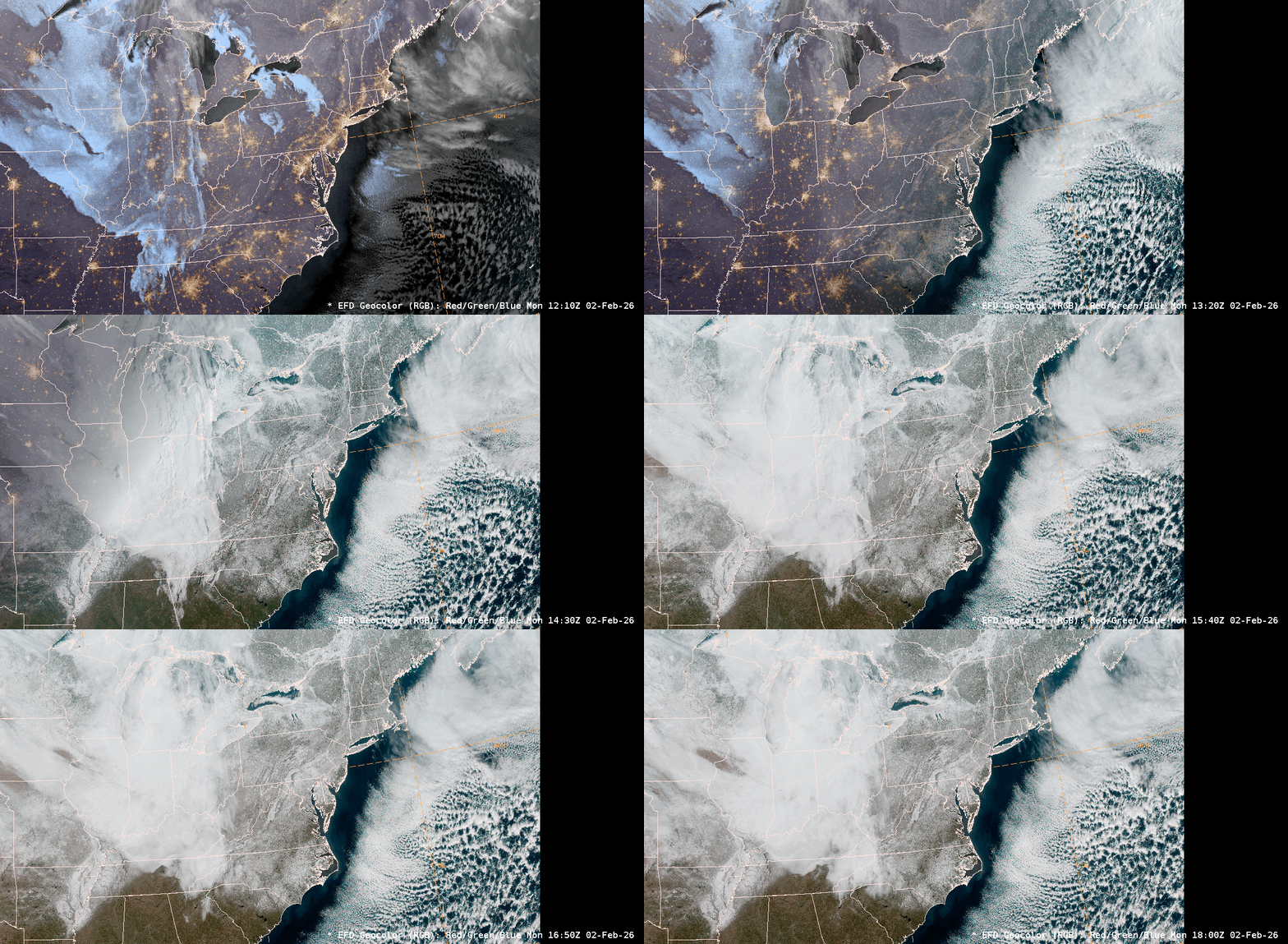
GOES-East Full Disk Geocolor imagery provided a stunning look at the snow blanketing the East Coast from South Caroline to Maine on 02 February 2026. Wind gusts exceeding 60 mph in both NC and MA, with snowfall totals reaching a whopping 19.5 inches in the Tar Heel state.
