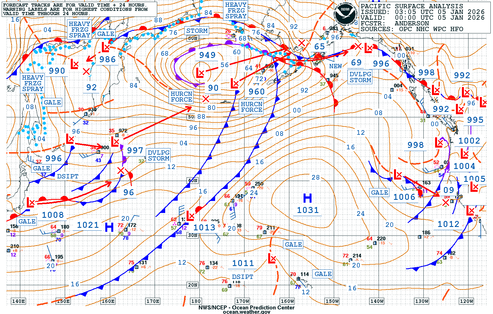
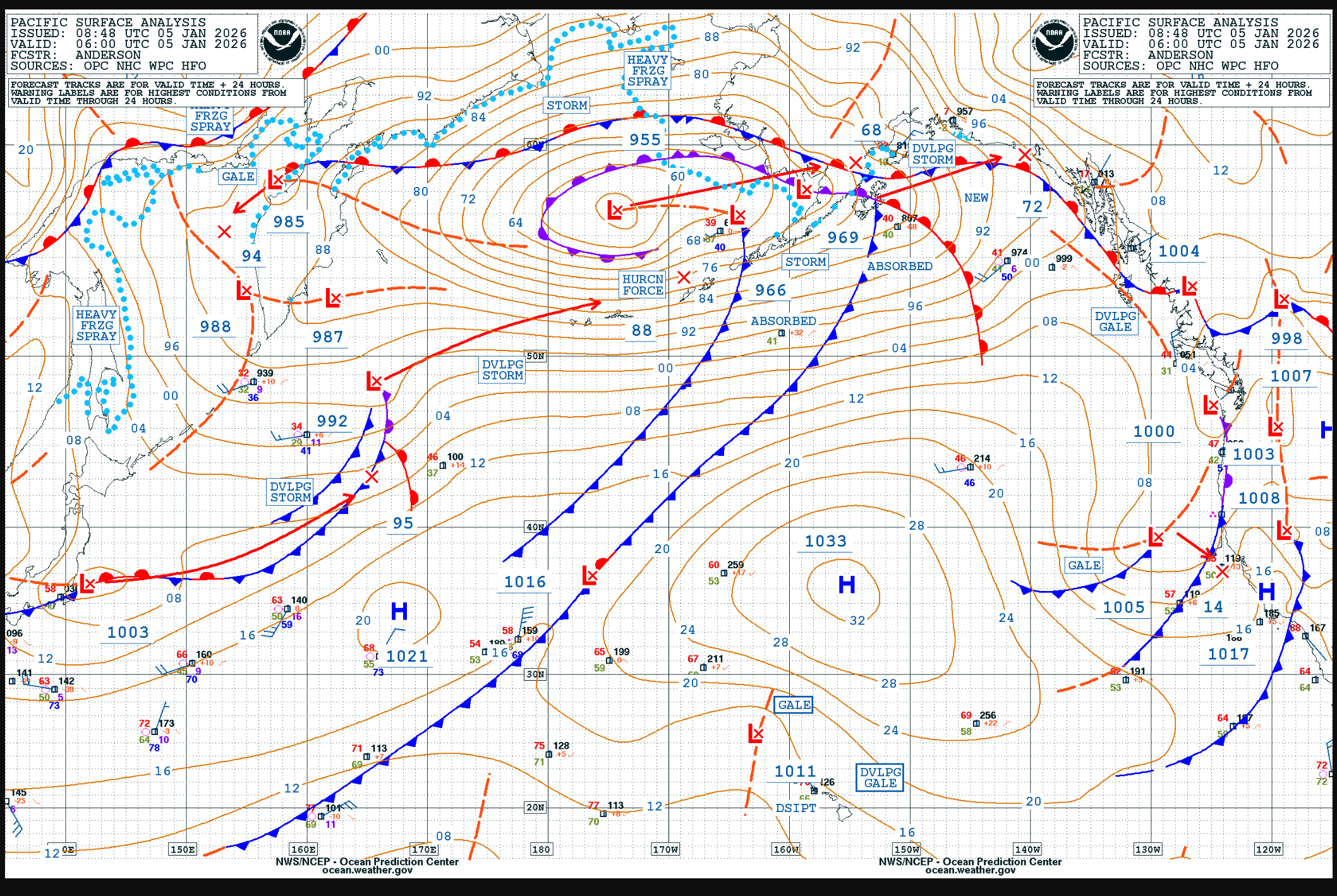
A hurricane-force (HF) low pushed into the Bering Sea for the first weekend of 2026, the second in the North Pacific this year, ending a lull in HF activity across the Basin that started in Mid-December. The NWS Ocean Prediction Center (OPC) forecasted this intense extratropical cyclone to develop in the Western Pacific three days in advance as a 974 hPa HF low by 1200 UTC 03 January 2026. That forecast verified well, with a 975 hPa HF low observed very near the predicted position at that time.
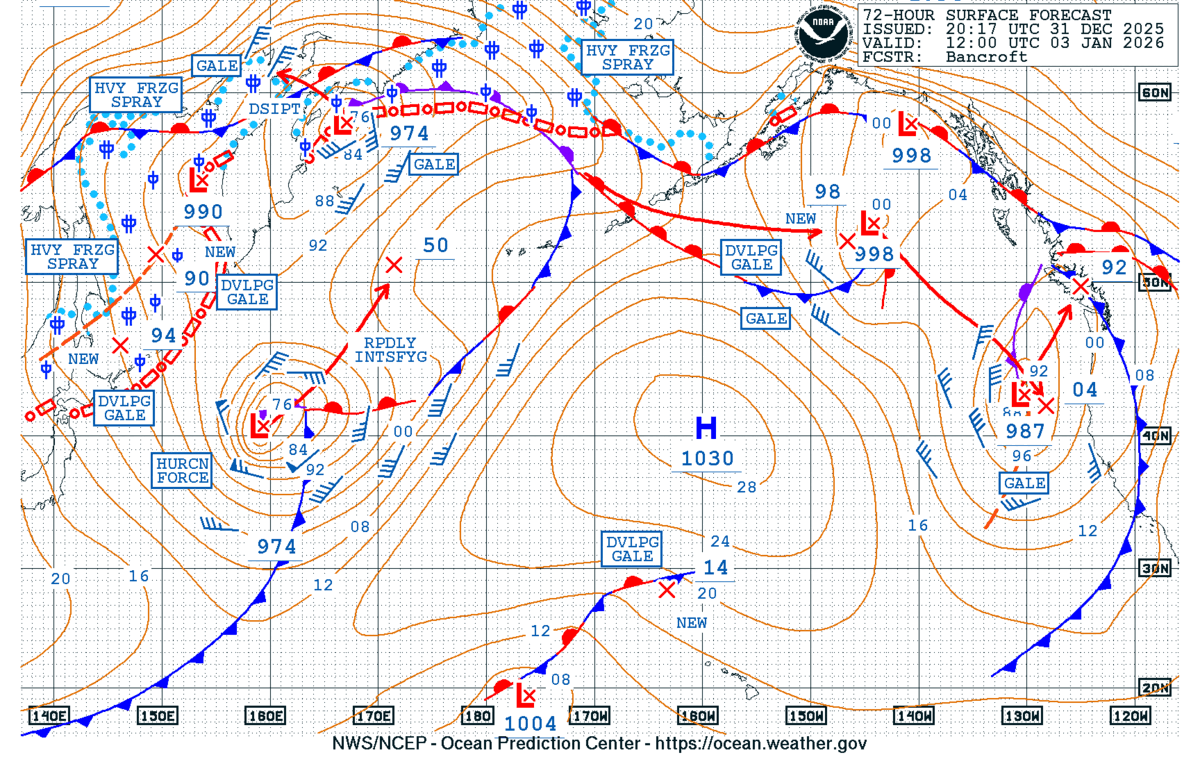

Figure 1: NWS OPC North Pacific 72-Hour Surface Forecast (left) and Surface Analysis (right).
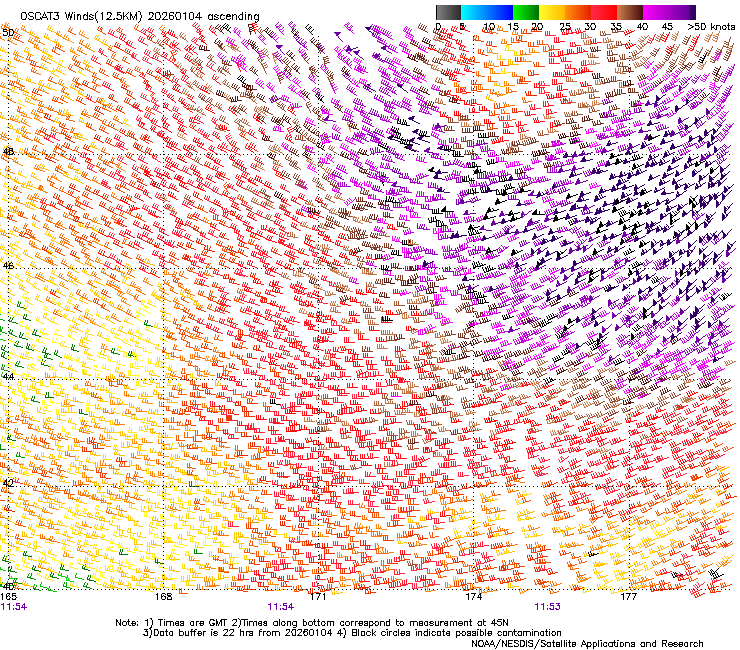
The intense storm system then continued to track northeastward towards the Bering Sea, maintaining HF winds. OSCAT-3 captured the southern quadrant of the extratropical cyclone at ~1200 UTC 04 January 2026, with winds exceeding 60 kts. OSCAT Winds are expected to be implemented in the NESDIS Common Cloud Framework (NCCF) this month, beginning operational delivery.
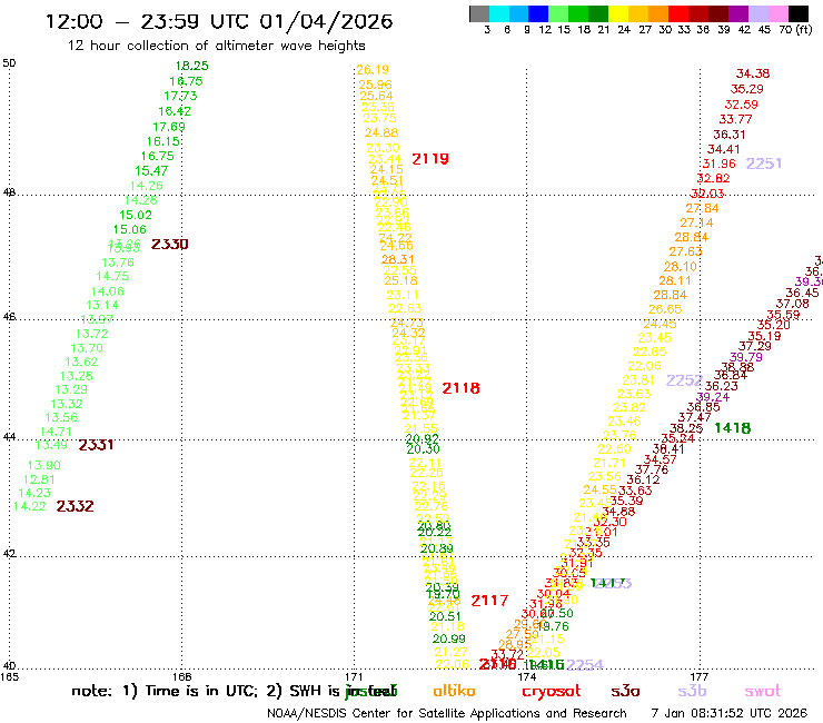
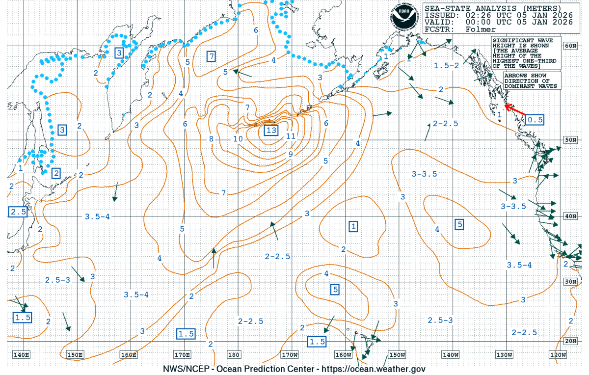
Shortly after, a Jason-3/Poseidon altimeter pass measured significant wave heights approaching a whopping 40 feet. Sentinel-3B also recorded similar significant wave height observations several hours later, with slightly smaller waves to the west as the system tracked eastward. NWS OPC Sea State Analysis at 0000 UTC 05 January 2026 indeed had significant wave heights in excess of 13 meters (~42 feet) south of the Aleutians.
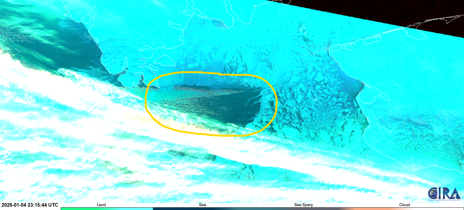
A Heavy Freezing Spray Warning was in effect for the Bering Sea, and the JPSS VIIRS Sea Spray RGB likely observed sea spray at ~2315 UTC 04 January 2025. Sea spray can be seen oriented to the west pushed by strong easterly winds, with a milky gray color and cloud streets downstream of the sea ice (bright light blue color).
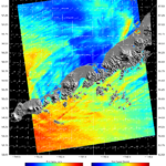
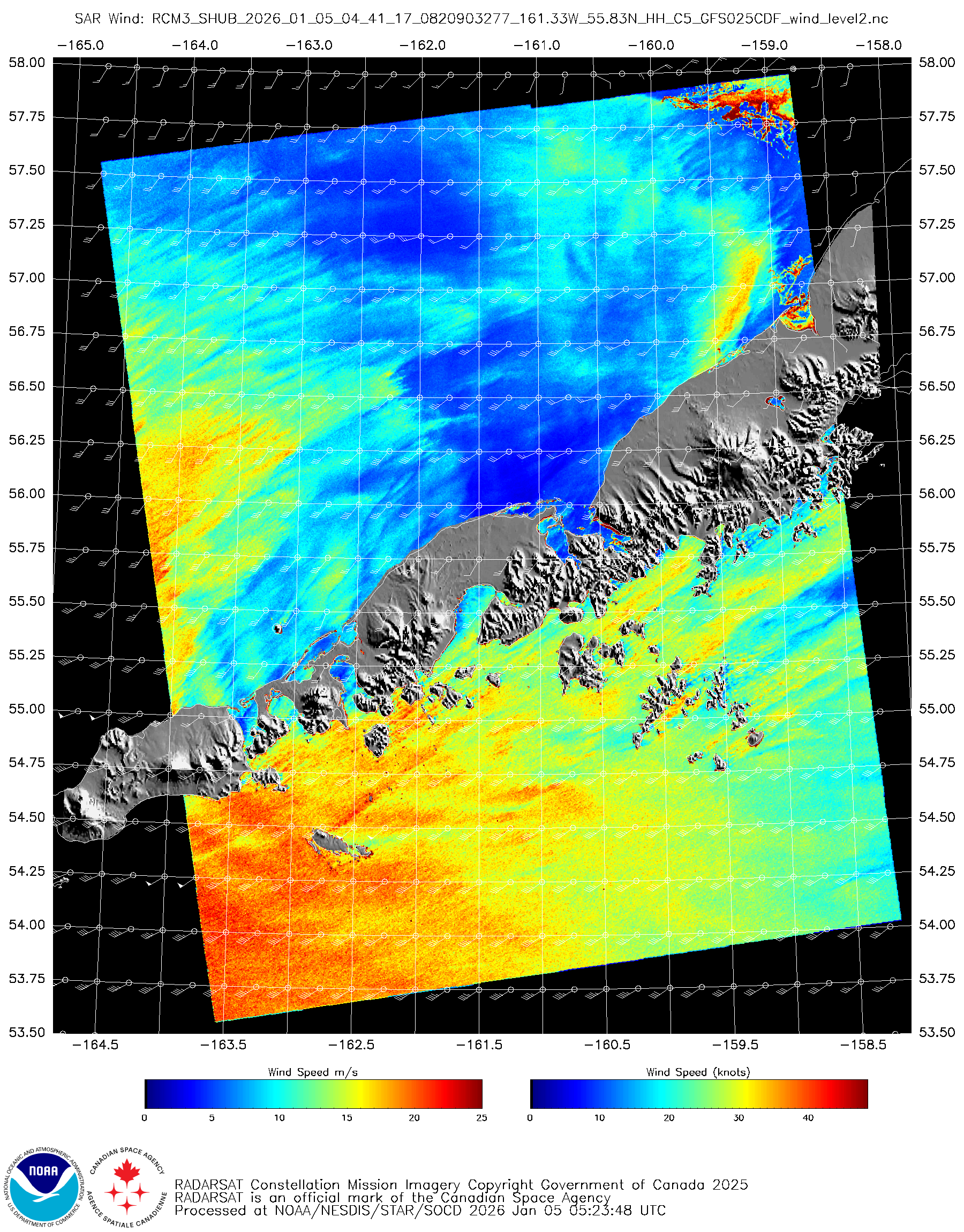
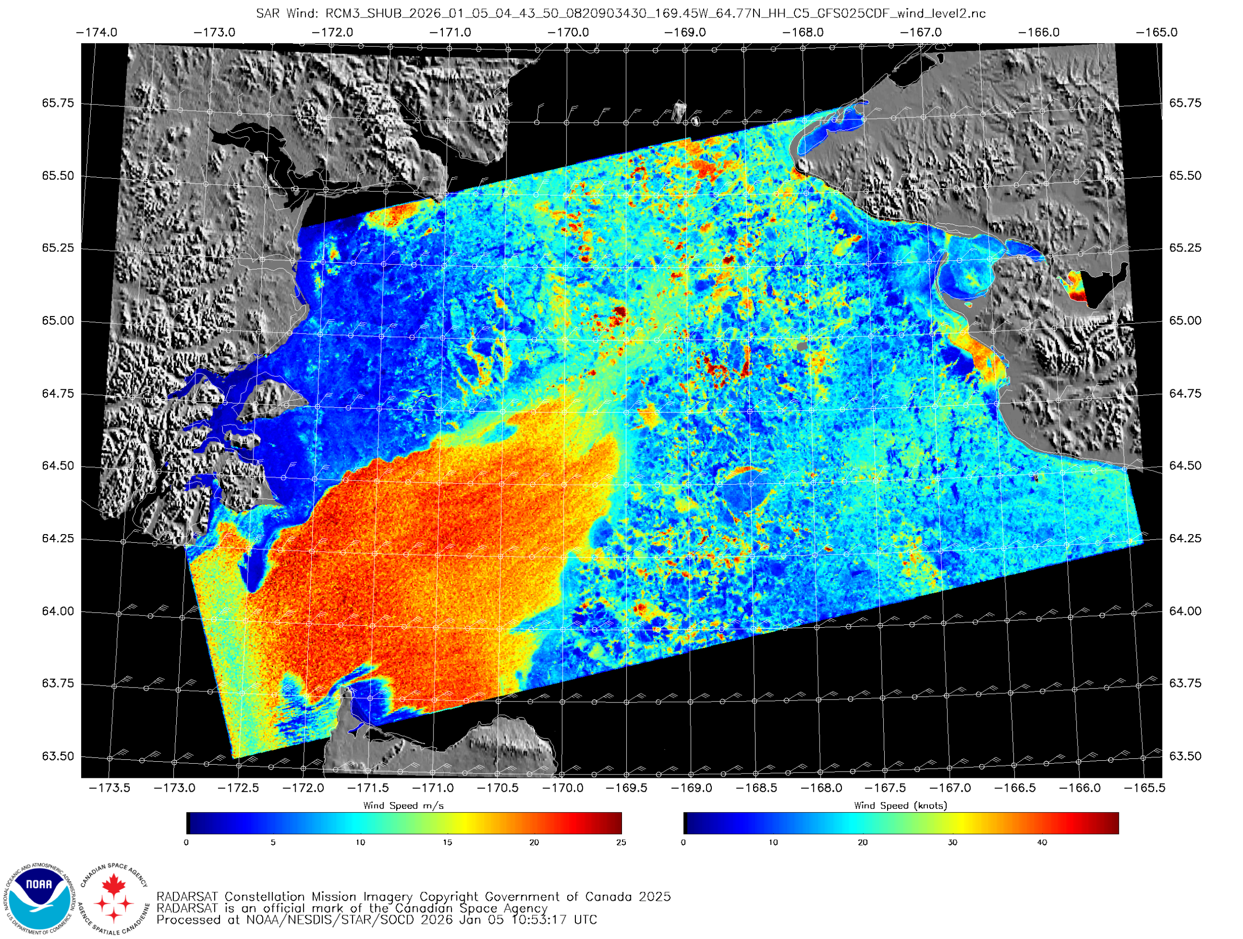
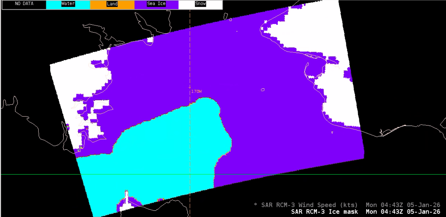
RADARSAT Constellation Mission-3 (RCM-3) Synthetic Aperture Radar (SAR) Winds captured scenes at the periphery of the system during the evening (AK Time) on 04 January 2025. Strong southwesterly winds exceeding 40 knots were observed over waters approaching the south-facing slopes of the Aleutians, with much lighter winds to the north of the islands, clearly depicting the effect of the high terrain. Further north in the Bering Sea, a SAR pass managed to capture both ice-covered and open ocean waters, which are clearly depicted in the Winds imagery. You’ll notice sea ice edges and ice areal extent to the east, where the color interpretation should be avoided, with a solid gradient to the west over open waters. Wind speeds were in the 40-50 kt range where the NWS OPC issued a Heavy Freezing Spray Warning. SAR Winds are now available for AWIPS implementation and there’s a Land-Sea Ice Mask, which helped inform the location of sea ice in the imagery.
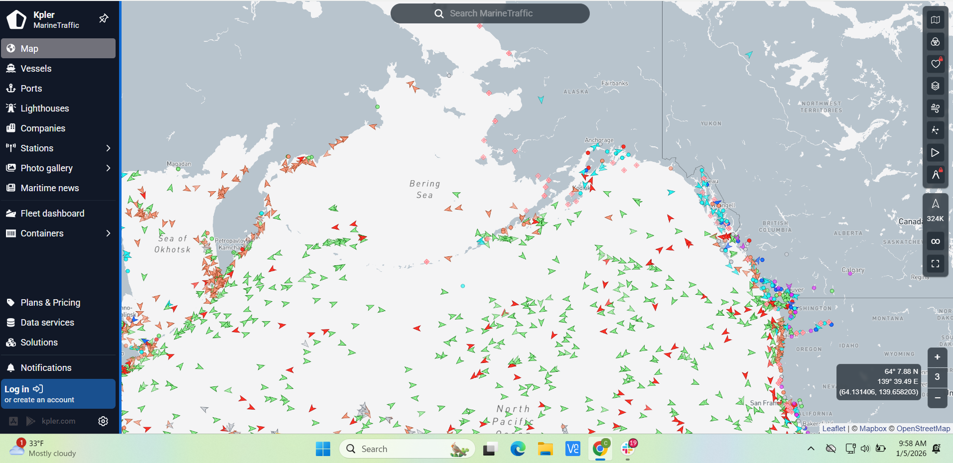
Mariners exercised avoidance plans, with very few ships in the Bering Sea or along northwestern shores of the Aleutians.
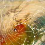
GOES-West Full Disk Air Mass RGB imagery captured the evolution of the extratropical cyclone as the circulation slowly elongated as the low pressure system approached Western AK, before a new storm-force low developed further east in the Gulf of Alaska.
Figure 12: GOES-West Full Disk Air Mass RGB imagery from 1600 UTC 04 January to 1630 UTC 05 January 2026. This imagery was exported from AWIPS, and display files can be shared upon request.


