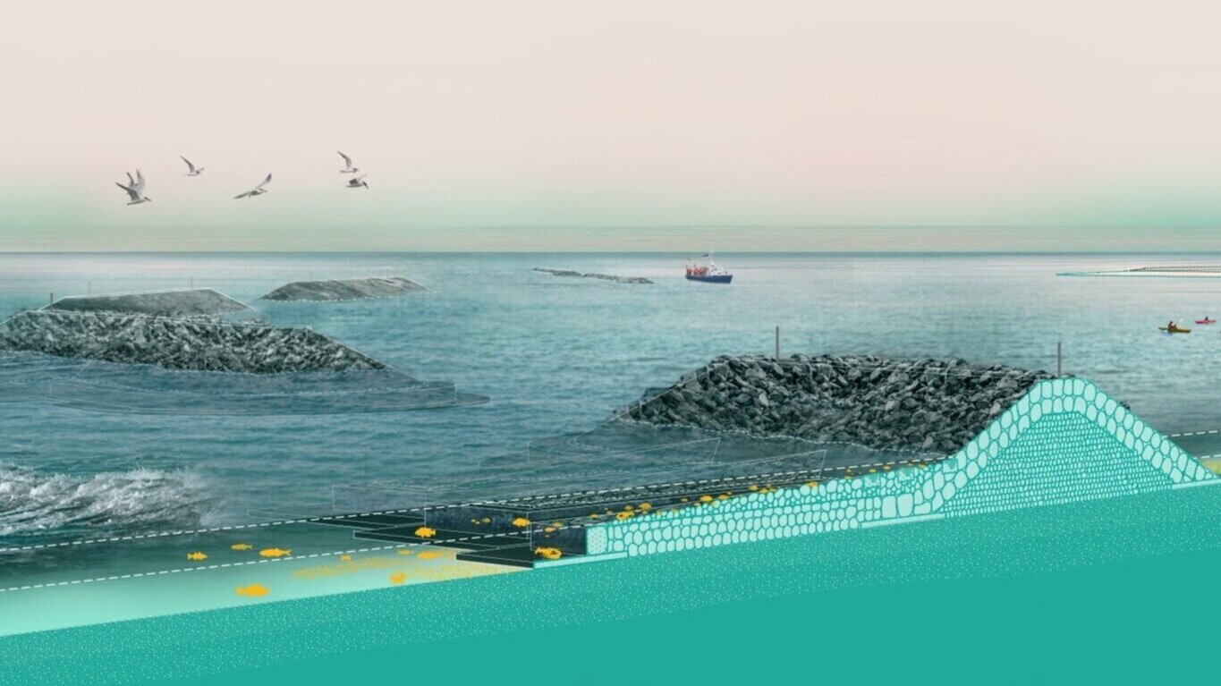
Home » Highlights » Page 21

Category: Highlights

Figure. The 6 × 6 km2 Howland forest area in Maine: (A) the true color image obtained by the EO-1 Hyperion on March 5, 2014 (DOY 64) at a spatial resolution of 30 m; and maps of (B) snow cover fraction (SNOWCF); (C) surface water cover fraction (WaterBodyCF); (D)soil cover fraction (SOILCF); (E) vegetation cover fraction (VGCF); (F) fAPARcanopy; (G) fAPARchl; (H) fAPARnon-chl.

An Evergreen Forest Ecosystem from Satellites

ESSIC/CISESS Scientist Qingyuan Zhang has a new article to be published in International Journal of Applied Earth Observation and Geoinformation that characterizes the seasonally snow-covered Howland boreal forest ecosystem in Maine, USA with satellite images.

Read More »
Isaac Moradi smiles for the camera, wearing a red gridded button-up and a red tie

Moradi is Co-I of NASA Proposal Developing A New Satellite Instrument

Traditional earth-observing microwave instruments utilize heterodyne receivers for measuring the radiance emitted by the earth and its atmosphere. These instruments which indirectly measure atmospheric temperature, water vapor, clouds, as well as surface information, have played an important role in improving the NWP weather forecasts and reanalyses, such as MERRA generated by GMAO. However, because of limitations in current microwave technologies in simultaneously processing an ultra-wide band (20-200 GHz) at high spectral resolutions, the number of channels for the current microwave instruments is very limited (e.g., 22 channels for ATMS and less for most other MW instruments).

Read More »
Figure 1. MiRS NOAA-20/ATMS retrieved TPW (descending and ascending orbits) on 24 October 2021 over the eastern Pacific and West Coast region. The atmospheric river is clearly seen. Locations of the four vertical cross-sections shown in Figure 2 are indicated by the dashed lines.

NOAA’s MiRs Captures Category 5 Rainfall Event in California

On October 24, a powerful Category 5 (the maximum possible) atmospheric river (AR) occurred over the northern and central parts of California. The storm system featured record breaking precipitation, leading to flooding and mudslides in some locations, along with dangerous winds exceeding 70 miles per hour at higher elevations. San Francisco recorded its fourth highest single-day rainfall amount of over 4 inches. Satellite passive microwave measurements are one of the observational tools that allow depiction of these extreme events, since microwaves are less affected by clouds and precipitation.

Read More »
A coral, severely bleached to white

Milestone Report on Coral Reef Health Released Worldwide

ESSIC/CISESS Scientist Jacqueline De La Cour was a contributor and reviewer of The Sixth Status of Coral Reefs of the World: 2020 Report, released by the Global Coral Reef Monitoring Network (GCRMN) on October 5th. This sixth edition is the first since 2008 and the first based on the quantitative analysis of a global dataset, compiled from more than 300 contributors and comprising almost 2 million observations from more than 12,000 sites in 73 countries.

Read More »