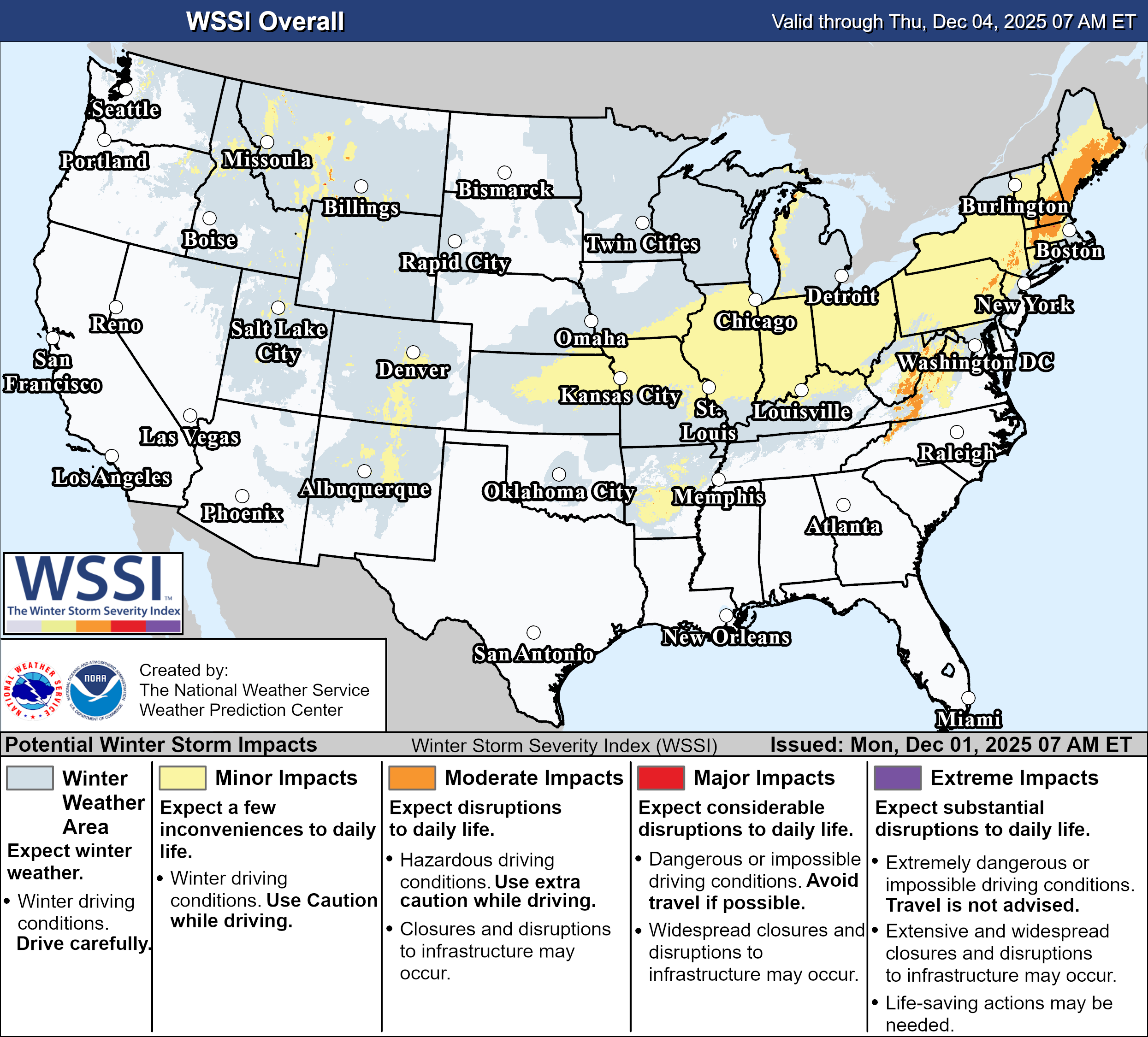
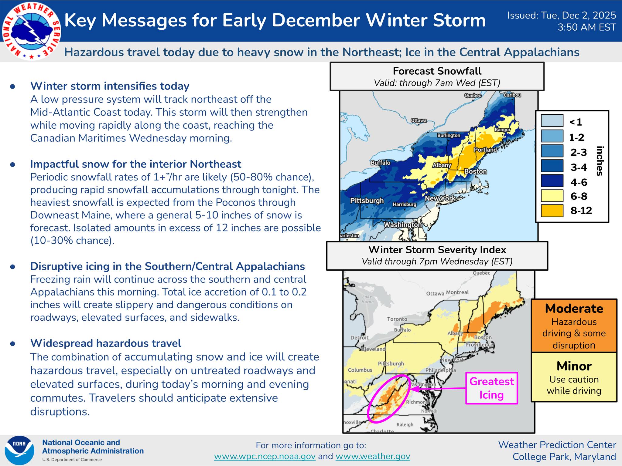
Just as the calendar flipped to December, Old Man Winter dropped a swath of snowfall from the Central to the Eastern U.S. The NWS Weather Prediction Center (WPC) Probabilistic Heavy Snow and Icing Discussion issued at 0804 UTC 01 December 2025, highlighted the threat for “Widespread moderate to heavy snow from the Central Plains to the Northeast”. The NWS WPC Winter Storm Severity Index (WSSI), issued at 1100 UTC 01 December 2025 painted widespread ‘Minor’ potential winter storm impacts from Kansas City to the Northeast, with ‘Moderate’ impacts across the Central Appalachians and eastern portions of northern New England. Additionally, NWS WPC socialized Key Messages to social media, and posted WPC Weekly Weather Updates to YouTube ahead of the event.
Snowfall totals topped out around a half of a foot across the Central U.S., including in Kansas, Missouri, Indiana, and Kentucky, before the storm system began heading towards the Eastern Seaboard and strengthening in the Western Atlantic. GOES-East Clean Longwave Infrared Band 13 captured the evolution of the system as it pushed off the East Coast. You’ll notice cold cloud tops and intense convection fire along the Gulf Stream towards the end of the animation as the extratropical cyclone gained a ‘baroclinic leaf’ appearance and began to strengthen more quickly.
Figure 3: GOES-East CONUS IR Band 13 imagery from 0001 to 2356 UTC 02 December 2025. Credit: NESDIS/STAR
As the system was underway across the Northeast, the NESDIS Radar-Satellite Blended Snowfall Rate product observed general snowfall rates of 0.1-0.15″ in liquid equivalence, with a heavy band of snow depicted northwest of Albany, NY, with rates up to 0.20″ per hour (2″ snow/hour given 10:1 snow-ratio). Snowfall totals reached a foot near towns like Phoenicia, NY.

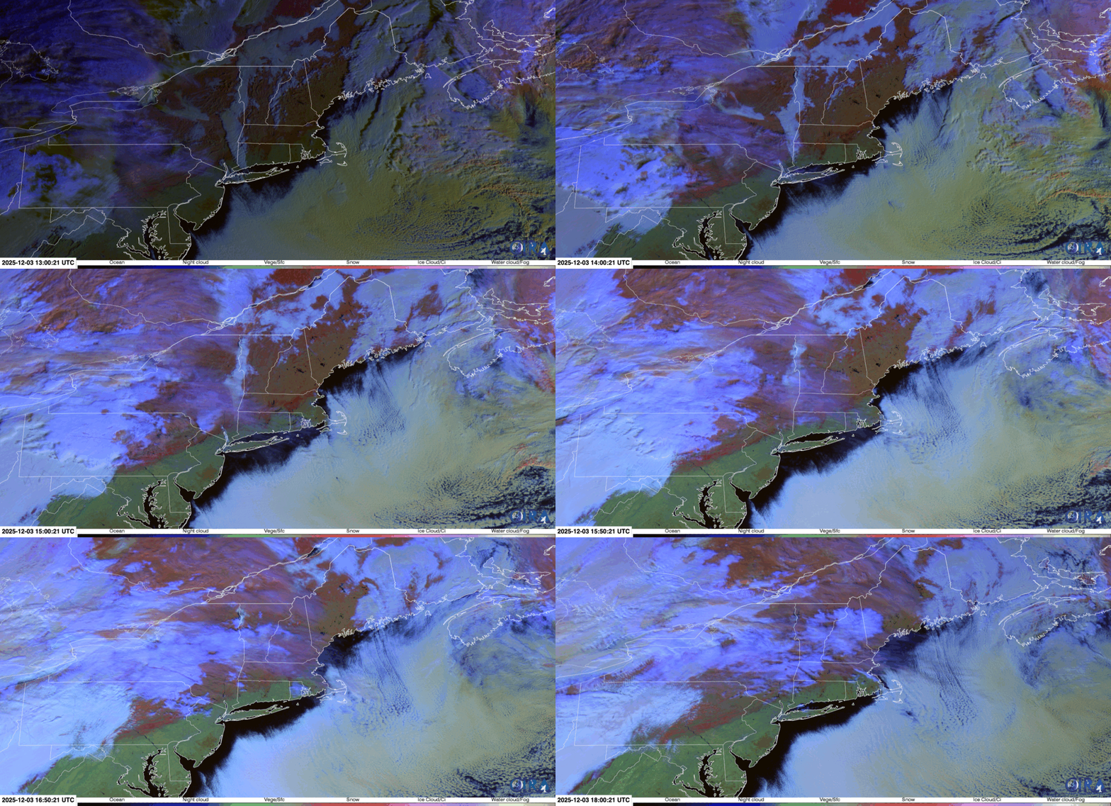
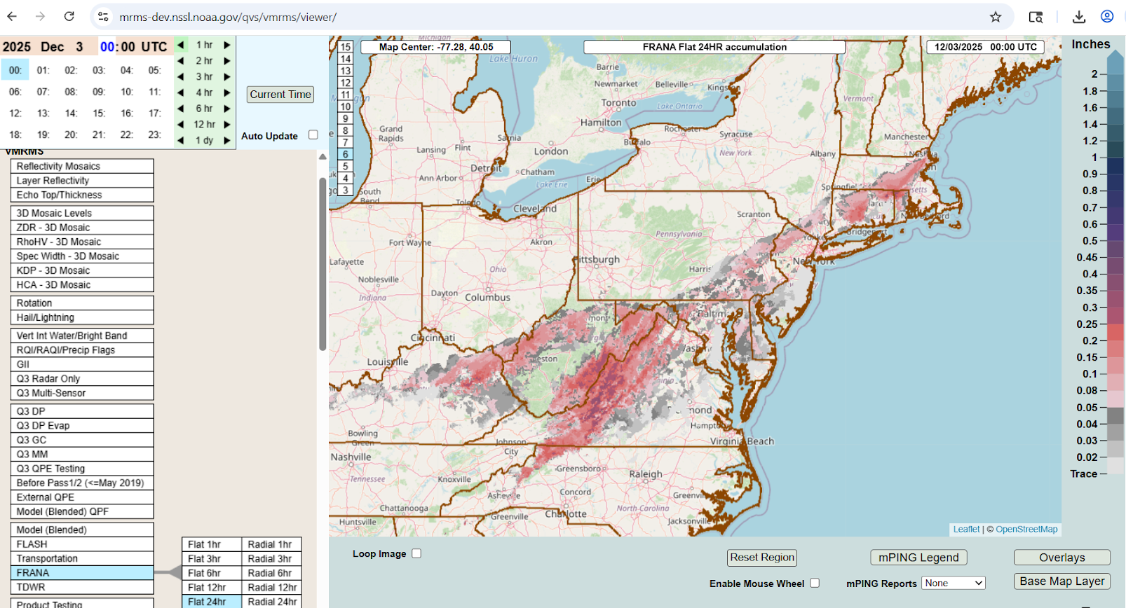
The Day Snow-Fog RGB provided a view of the fresh interior snowfall across the Northeast on 03 December 2025, as seen in the red colors over land. You’ll notice dark reds across Connecticut and Massachusetts near the transition of snow cover to bare ground, where ice from sleet and freezing rain likely occurred. The RGB is useful to differentiate snow cover from clouds moving overhead, as clouds reflect solar radiation in the 0.86 micron “Veggie” Band 3 and the 1.6 micron “Snow/Ice” Band 5. The Experimental MRMS Freezing Rain Accumulation National Analysis (FRANA) depicted freezing rain accumulation across this area, likely confirming the RGB signal.
The low pressure system continued to strengthen over the Northwest Atlantic on 03 December 2025, remaining in the NWS Ocean Prediction Center (OPC) area of responsibility. GOES-East Air Mass RGB imagery tracked the intensifying extratropical cyclone as it pushed past Nova Scotia and towards Newfoundland. Stark changes in the air mass are observed, with dry air following a potent cold front, and the system’s circulation merging with a stratospheric intrusion of potentival vorticity-laden air.
Figure 7: GOES-East Full Disk Air Mass RGB imagery from 0000 to 2350 UTC 03 December 2025. Credit: NESDIS/STAR
By early in the morning on 04 December 2025, the extatropical cyclone reached hurricane-force, with a minimum central pressure of 974 hPa.
