Headlines:
- South Asian monsoon remains strong with flooding in India, Pakistan and Nepal
- Heat wave in Europe enhances drought and wildfire occurrence
- Hurricane Erin charts a long path through the Atlantic without seriously affecting land
- Rainfall pattern looking a little more like La Nina
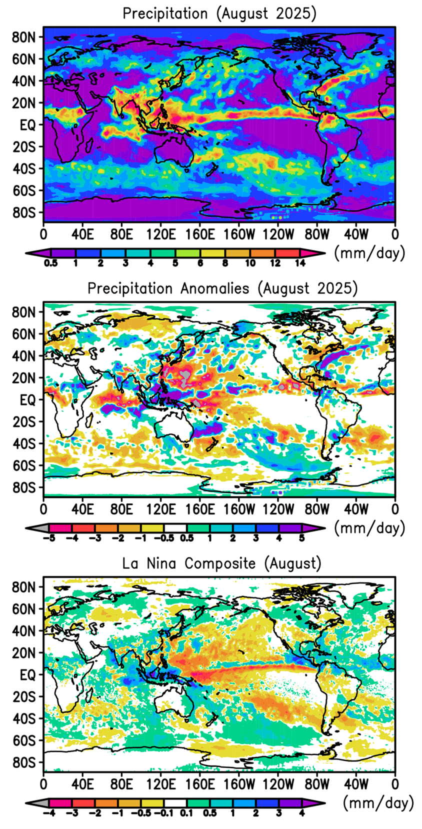
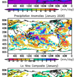
Heavy rain across much of South Asia dominated much of land and ocean areas in August as the monsoon there continued a strong year (Fig. 1). Positive anomalies of rainfall were noted from some regions of India through Indochina and covering most of China (Fig. 1, middle panel). Accompanying floods and landslides killed hundreds in northern India, Pakistan and Nepal. The heavy rainfall also covered the South China Sea and land areas to the south and east, e.g., the Philippines, Borneo and Malaysia. Tropical cyclones traversed the western Pacific and Typhoon Kajiki crossed the South China Sea and flooded northern Vietnam.
The tropical Pacific SST pattern seemed to return a bit toward a La Nina look with the monthly Nino3.4 index dropping slightly to -0.3 (and -0.6K for the relative 3.4 index). This slight shift was reflected somewhat in the rainfall anomaly pattern with distinct negative anomalies in western Pacific east of the Philippines and along and to the south of the Equator, the robust positive anomaly over the Maritime Continent and a weak positive feature over northwest South America. The tropical pattern correlation between this August’s rainfall anomaly pattern and El Nino/La Nina composites (Fig. 1, bottom panel) shows a slight positive correlation (~ +0.2) with the La Nina side of things (see Fig. 2), with the La Nina forecast to strengthen somewhat over the next few months.
Africa in August had a generally wet east and a dry west along its ITCZ over land. The dry west may be related to the relatively weak Atlantic tropical cyclone season, but the wet anomalies to the east were linked to heavy rains and an associated landslide in western Sudan which caused hundreds of deaths among refugees trying to avoid the civil war there.
Europe was mostly dry again, with drought stretching from the UK eastward across France, Germany and into eastern Europe, with an accompanying heat wave. A wildfire was noted on Arthur’s Seat, the famous hill in Edinburgh, Scotland, with a large wildfire in southern France, near Toulouse.
The southwest U.S. remained mainly dry with wildfires in parts of California and western Colorado. To the east a dry anomaly stretched from Missouri to the Mid-Atlantic coast and New England. Washington DC had one of its driest Augusts on record and one of the authors’ home rain gauge in central Maryland compiled just .03 inches for the month. To the north and south of the edges of this dry band, small areas of heavy rain occurrence show up in the monthly totals, with local impacts of flash floods in Milwaukee, WI and Chattanooga, TN.
In the Atlantic there is a very strong rainfall feature and positive anomaly off the east coast of the U.S. that is the result of the track of Hurricane Erin which intensified rapidly east of Puerto Rico. Luckily Erin skirted land on its entire trip as it became a very strong storm before dissipating in the far reaches of the North Atlantic.
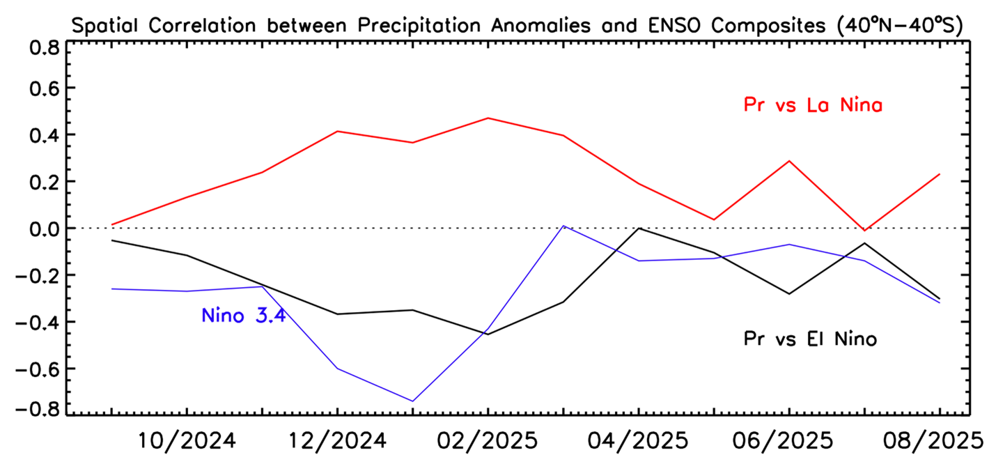
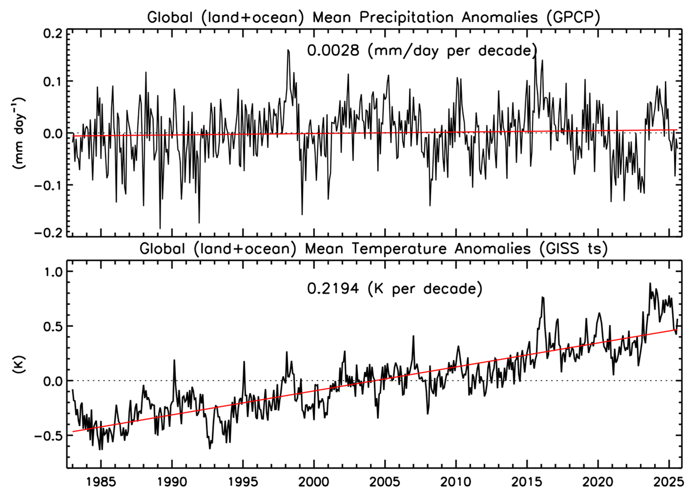
Table 1 has the global totals with for this month with a weak La Nina flavor with the land having a slight positive anomaly and the ocean the opposite. This August was the third warmest in terms of surface temperature (2023 and 2024 were the top two Augusts) and has popped back up above the temperature trend line (see Fig. 3), while the global precipitation number stayed just below the long-term mean.
Table 1 Global precipitation and anomalies in August 2025.
| Mean Precipitation (August 1983-2024) | Precipitation (August 2025) | Precipitation anomaly (August 2025) |
Land+ocean | 2.83 | 2.80 | -0.03 |
Land | 2.44 | 2.53 | +0.09 |
Ocean | 3.00 | 2.92 | -0.08 |
