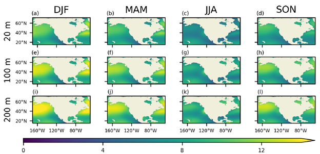
The U.S. offshore wind energy industry is a growing endeavor. As such, stakeholders in this industry need information about winds from the ocean surface up to wind turbine hub heights of ~100m to 200m. Accurate wind speed observations within the rotor layer of wind turbines are scarce, with sparsely spaced coastal meteorological towers, as well as site-specific sodars and lidars, serving the only sources of information.
Leveraging satellite-based products, with their high spatiotemporal coverage, and machine learning methods, offers a way of developing detailed wind speed profile gridded datasets for practical use by stakeholders. In a paper published in the journal Wind Energy Science, ESSIC/CISESS Scientists James Frech, Paige Lavin, and colleagues use random forest regression (RFR), a machine-learning technique, to accurately estimate offshore wind speed profiles on a 0.25° grid at a six-hour resolution from 1987 to the present.

Their methodology is applicable to the coastal regions of the contiguous U.S. and Hawai‘i and uses satellite-derived surface wind speeds from the NOAA NCEI Blended Seawinds version 2.0 product as input. They report that their RFR model has the advantage of requiring fewer input variables and outperforms traditional methods when it comes to estimating wind speeds at wind turbine hub heights in the presence of high vertical wind shear and low-level jets (LLJs). Additionally, previous studies using RFR to estimate wind speeds were limited to smaller areas and thereby of limited utility, while this RFR model is able to perform robustly over a large region.
One important focus of future work will be to predict the wind speed gradient inversion of an LLJ, a current limitation of their model. The final product generated by the model, NOAAOffshoreWindProfiles-USA, will be archived with NCEI for public access.


