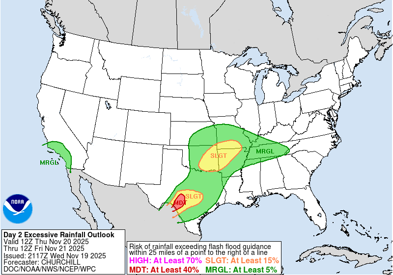
A rainy week across the Lone Star state impacted some of the same locations of the Texas Hill Country that experienced devastating flash flooding this Summer. The threat for heavy rainfall was highlighted five days prior to the event in the NWS Weather Prediction Center (WPC) Extended Forecast Discussion issued at 0757 UTC 15 November 2025: “into mid-later next week downstream system progession and lead moisture and instability return flow genesis into wavy fronts over the central to eastern U.S. and meso-scale features should lead to emergence of a growing area of moderate to heavy rains and some strong thunderstorms from the South-central U.S. eastward.”. A day prior to the event, WPC issued a Moderate Risk Excessive Rainfall Outlook (ERO) for portions of the Texas Hill Country with the Excessive Rainfall Discussion at 1915 UTC 19 November 2025 noting “Given the sensitivity of the Hill Country with the potential for 3″+/hr rainfall rates developing rapidly late tonight, it was decided to introduce the Moderate Risk for the Day 1 period”.
On 20 November 2025, a deep upper-level trough can be seen pushing slowly eastward across the Southwest U.S., with a plume of moisture from the tropical East Pacific funneled into the Southern Plains. Not until the end of the animation later in the day does dry air begin to push into Western and Central TX.
Figure 2: GOES-East CONUS Band 8 Upper-Level Water Vapor Imagery from 0001 to 2316 UTC 20 November 2025. Credit: NESDIS/STAR
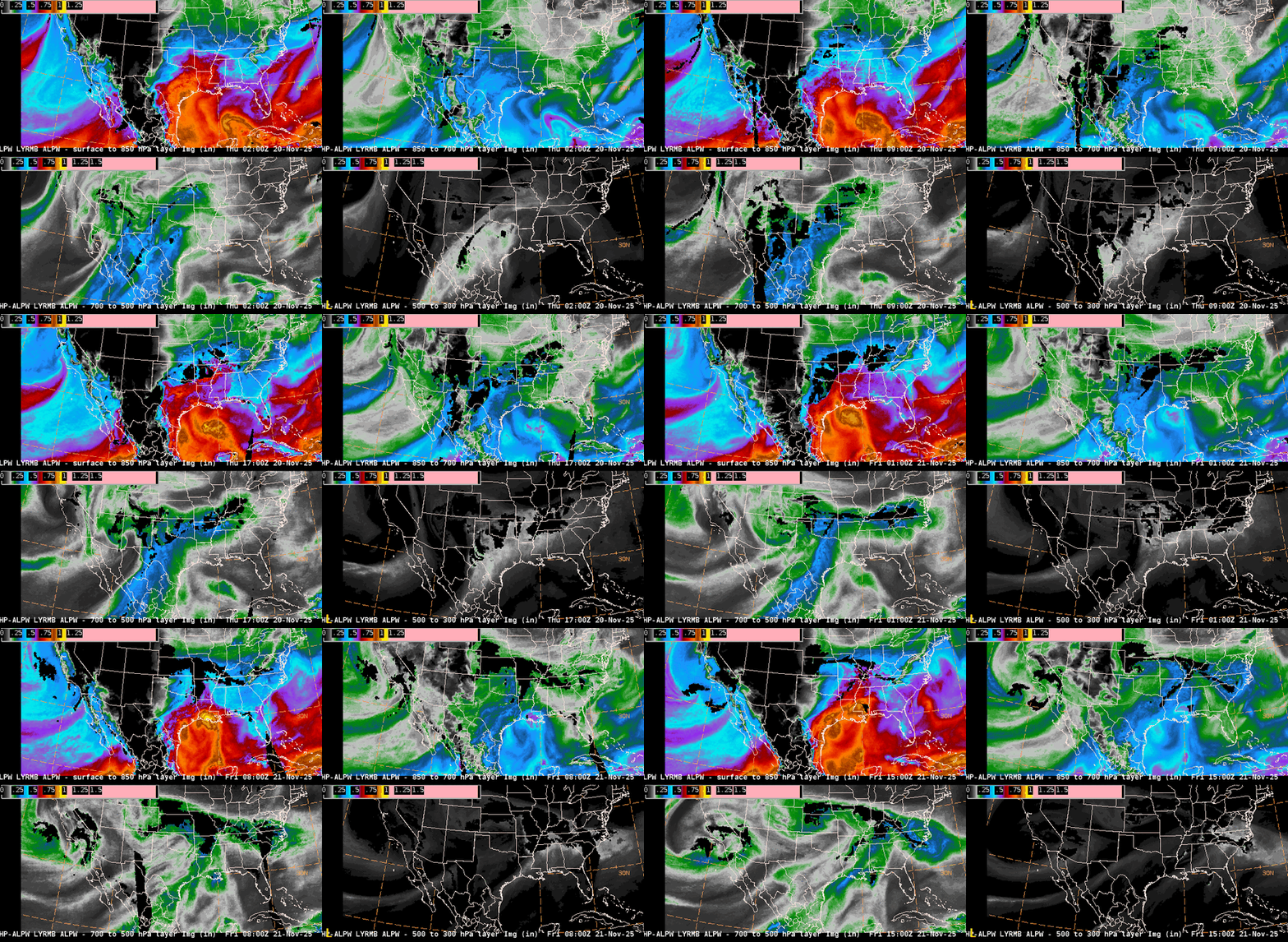
Two converging sources of moisture can be identified in the NESDIS Advected Layered Precipitable Water (ALPW) product, helping to support the heavy rainfall. At lower-levels (Surface-850 hPa & 850-700 hPa layers), high PW values are being transported off of the Gulf, while at upper-levels (700-500 hPa & 500-300 hPa), moisture is streaming northward ahead of the upper-level trough from the tropical East Pacific. PW values approached 2 inches across much of Central and Eastern TX before drier air pushed in behind the upper-level trough after ~0000 UTC 21 November 2025.
On 20 November 2025, WPC issued a Mesoscale Precipitation Discussion (MPD) at 1015 UTC for the Texas Hill Country, stating “Flash flooding likely” due to “areas of training with 1 to 2 inches of rain per hour”. For the next couple of hours, the machine-learning GOES-East LightningCast product continued to expand the footprint of higher probabilities for lightning. The initial storm cell built back towards the TX-Mexico border before exploding into a large complex of storms that slowly drifted northeastward.
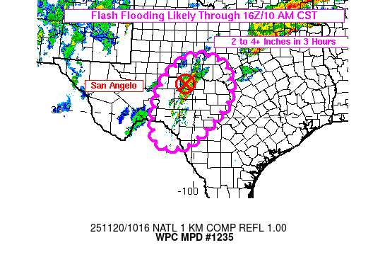
Figure 5: GOES-East Mesosector Band 13 Clean Infrared (IR) imagery overlaid with GLM Flash Extent Density (FED) and LightningCast output from ~0900 to ~1400 UTC 20 November 2025. This video was created from AWIPS, and display files can be shared upon request.
An additional MPD was issued at 1800 UTC 20 November 2025, with “expectations for locally significant flash flooding developing”. The MPD noted “precipitable water values of 1.4-1.7″ (near daily records…)…While a dry line is slowly approaching the region from the west.” Thereafter, a Flash Flood Emergency was issued by the NWS Weather Forecast Office in San Angelo for Menard, TX, where “Between 6 and 9 inches of rain” had fallen. Air Mass RGB imagery made it easy to see when the dry line began to cross the Texas Hill Country a few hours later as the dark green colors, representing a moisture-rich tropical air mass, were replaced by oranges and reds.
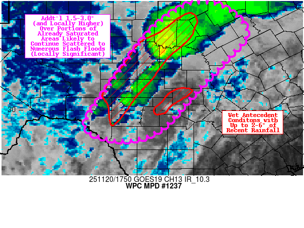
Figure 7: GOES-East Air Mass RGB imagery from 0001 to 2351 UTC 20 November 2025. Credit: NESDIS/STAR
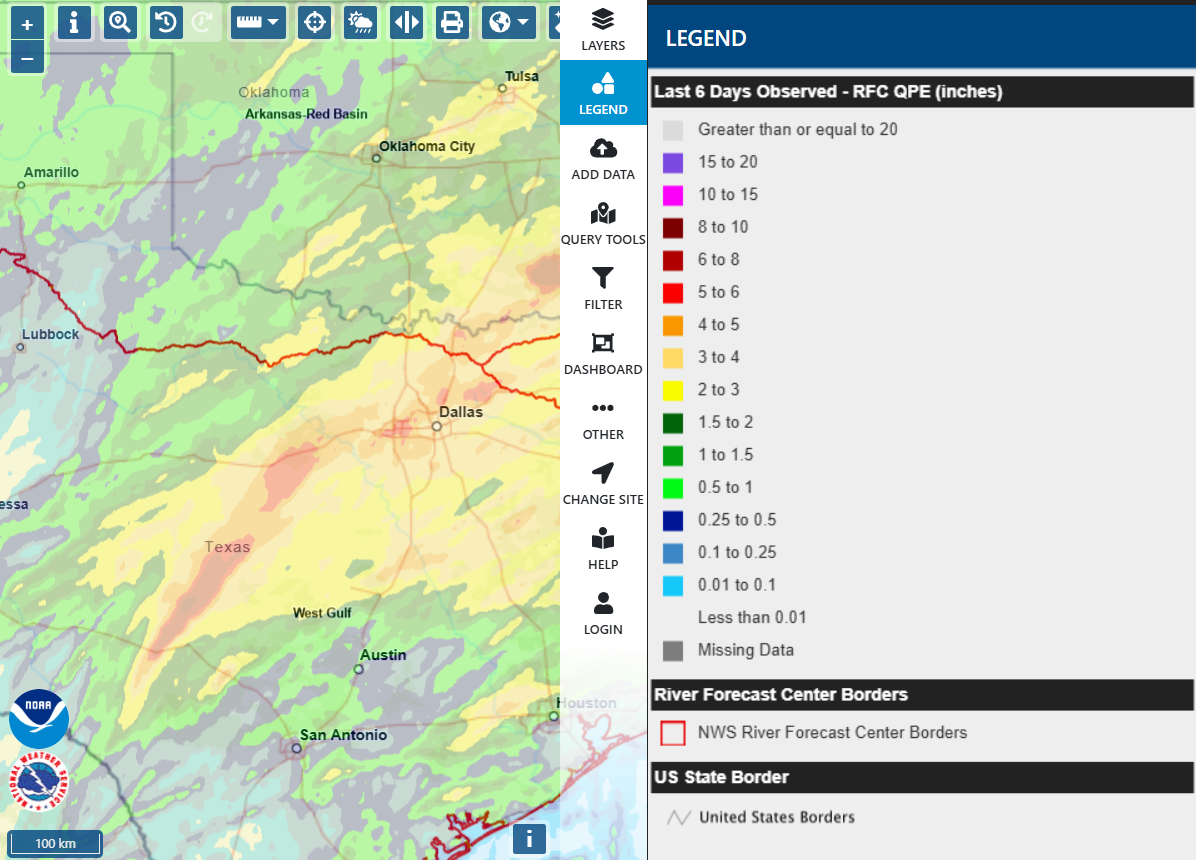
Rounds of rainfall have continued across TX in recent days, resulting in impressive totals over the last six days across central portions of the state, ranging from 2-5 inches with embedded amounts in the 6-10 inch range. Weather should dry out for the next few days, before rain is expected to return this weekend, especially for eastern parts of the state.
