![(a) the cloud-free XCO2 retrievals from the CO2 Sounder lidar for the flight on August 8, 2017. Significant XCO2 enhancements were seen in the flight segment crossing Vancouver Island. The British Columbia wildfires are marked to the north of these enhancements. (b) image of the smoke plumes from the wildfires in Canadian Rockies as seen from DC-8 over Vancouver Island. (c) true color image from Aqua/MODIS showing the smoke and fires on the same day.](https://essic.umd.edu/wp-content/uploads/2021/11/mao_figurea.jpg)
Measuring Atmospheric CO2 Enhancements From Wildfires Using a Lidar
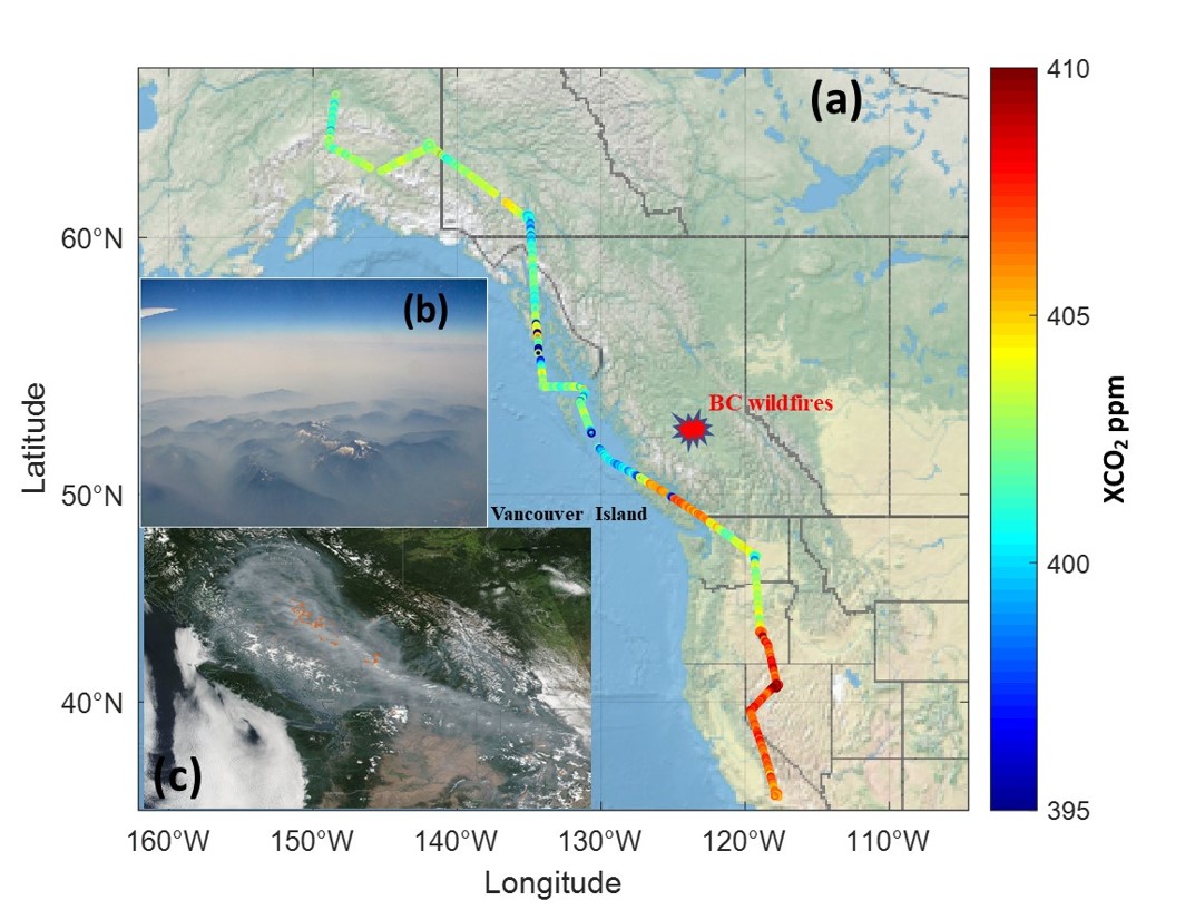
ESSC/CISESS Scientist Jianping Mao is first author on a new paper in Geophysical Research Letters titled “Measuring Atmospheric CO2 Enhancements From the 2017 British Columbia Wildfires Using a Lidar”.