Monitoring California Flooding Using VIIRS and Sentinel-1
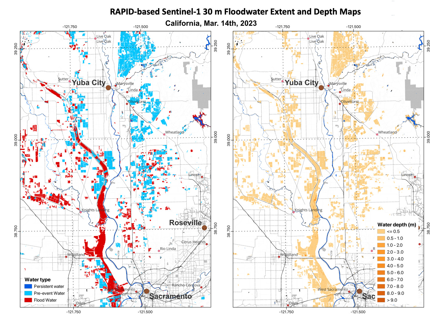
ESSIC Associate Research Scientist Qingyuan Zhang recently used VIIRS daily 375m flood extent products on 3/8/2023, 3/11/2023, 3/13/2023 and 3/15/2023 to monitor flooding in California.

ESSIC Associate Research Scientist Qingyuan Zhang recently used VIIRS daily 375m flood extent products on 3/8/2023, 3/11/2023, 3/13/2023 and 3/15/2023 to monitor flooding in California.

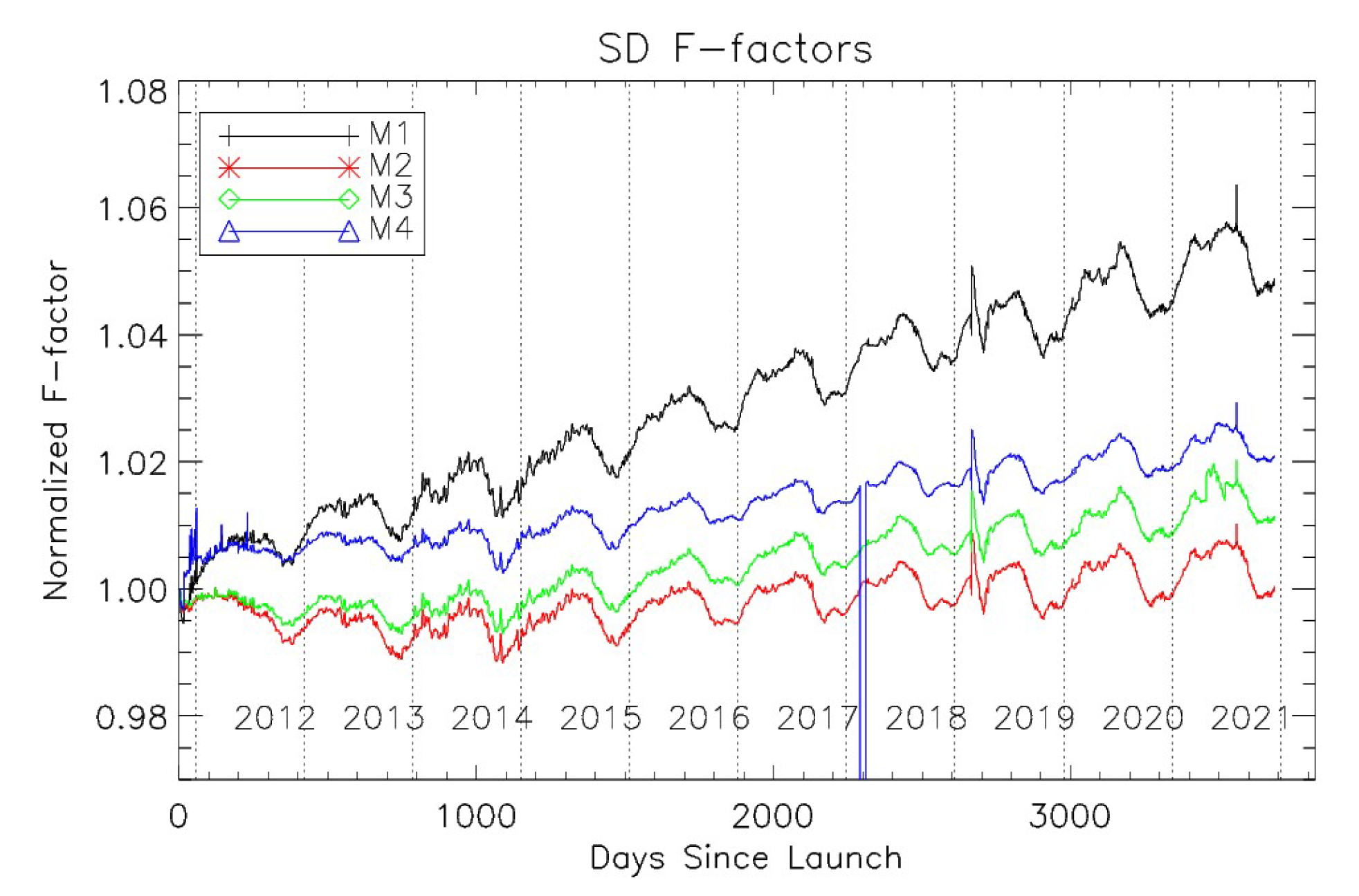
ESSIC/CISESS Scientists Xi Shao and Wenhui Wang co-published an article in Remote Sensing on July 13, 2022 that describes more than a decade of research on S-NPP VIIRS reflective solar bands (RSBs).

Wenhui Wang, ESSIC/CISESS Associate Research Scientist, is first author on a new paper titled “An Improved Method for VIIRS Radiance Limit Verification and Saturation Rollover Flagging” recently published in IEEE Transactions on Geoscience and Remote Sensing. Other ESSIC/CISESS scientists credited on the project include Slawomir Blonski, Bin Zhang, and Sirish Uprety.

ESSIC/CISESS Senior Faculty Specialist Yan Bai is a part of a NOAA Center for Satellite Applications and Research (STAR) project alongside Changyong Cao, STAR/SMCD/SCDA. The scientists found that VIIRS imaging bands can detect shipping containers at ports under clear sky conditions, despite its moderate resolution and the weak signal. This may enable them to monitor the port activities such as shipping container backlog in light of supply-chain challenges as widely discussed in the media. Figure 1 shows that more than 50 ships were found in the port of Los Angeles on October 1, 2021, compared to about a dozen two years ago, which indicates a potential backlog on that day.

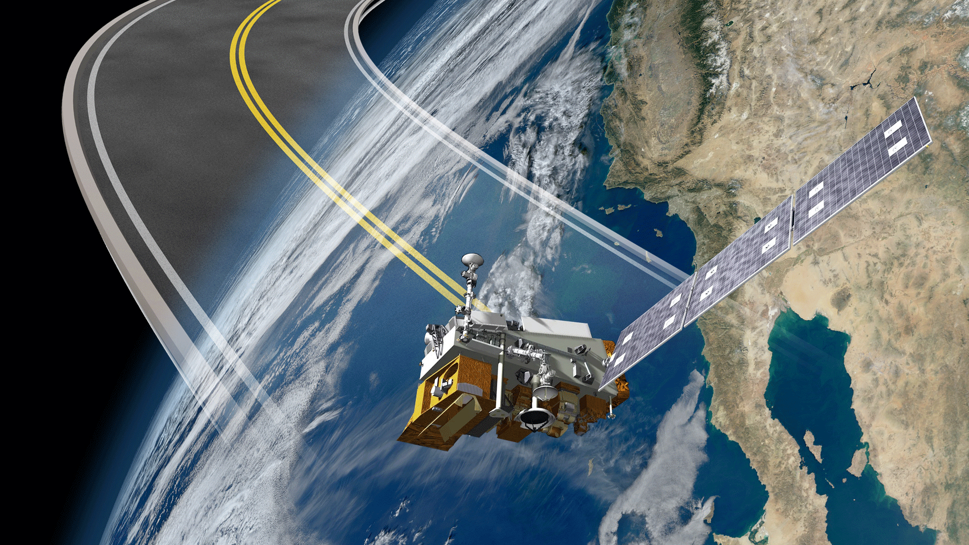
ESSIC/CISESS Senior Faculty Specialist Sirish Uprety and Associate Research Scientist Xi Shao are co-authors on a new paper about radiometric consistency between the Visible Infrared Imaging Radiometer Suite (VIIRS) onboard the Suomi National Polar-orbiting Partnership (S-NPP) and NOAA-20 satellites.