The North Pacific has remained extremely active after ramping up in October, this time with a very strong hurricane-force low farther south and west in the Pacific as the active storm track has shifted slightly upon the arrival of Winter. Just like the November ‘Bomb Cyclone’, highlighted in a previous Satellite Liaison Blog, the hurricane-force low was predicted well in advance by the NWS Ocean Prediction Center (OPC), allowing mariners to have ample time to create and execute avoidance plans. The North Pacific 96 Hour Surface Forecast issued at 1536 UTC 11 December predicted a 940 mb hurricane-force low near ~51 N, 175 E, at 1200 UTC 15 December 2024. Well enough, at 1200 UTC 15 December 2024, there was a 935 mb hurricane-force low at ~51 N, 175 E.


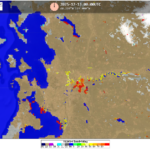
5-minute GOES-West GLM Flash Extent Density (FED) overlaid on 10-minute Full Disk Geocolor imagery from 1301 UTC 14 December to 0256 UTC 15 December 2024 showed the powerful extratropical cyclone as it came into GOES-West Field of View. Widespread amounts of lightning were detected along the strong cold front as it pushed east, southwestward of the Alaskan Aleutian Islands, while the development of the well-defined occlusion can also be seen.

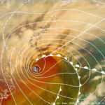
GOES-West AirMass RGB imagery from ~1800 UTC 14 December to ~0300 UTC 15 December 2024 also provided a great look at the environment around the extratropical cyclone, with stark contrasts in the temperature and moisture of the air masses around the system. The dark oranges and reds within the area of the developing occlusion signal a stratospheric intrusion of air with high levels of potential vorticity to fuel the intense low, while dark purples north of the advancing warm front signaled the existing cold air mass in place.

High wind speeds were forecast in the OPC High Seas Text Forecast issued at 2230 UTC 12 December 2024…”..HURRICANE FORCE WIND WARNING….48 HOUR FORECAST LOW 45N166E 945 MB. WITHIN 150 NM SW SEMICIRCLE WINDS 70 TO 100 KT.” Metop-C/ASCAT confirmed ocean surface wind speeds up to 80 knots on the southern side of the low pressure’s circulation in a large footpring of hurricane-force winds within the cold conveyor belt around ~2213 UTC 14 December 2024. You’ll notice erroneous wind directions within the general west-nothwesterly flow, likely due to the extreme winds combined with falling precipitation.

The OceanSat-3/OSCAT scatterometer observed even stronger winds at ~0147 UTC 15 December 2024, with a west-southwest wind at 89 kts. Like with ASCAT, there are erroneous wind directions, with precipitation a likely cause for the shorter, Ku-band, OSCAT errors.

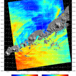
The 96-hour Wind & Wave forecast issued at 1612 UTC 11 December predicted Significant Wave Heights (average height of highest one-third of the waves) up to 7 meters, or nearly 23 feet, near 45 N, 165 E, at 1200 UTC 12 December 2024. A Sentinel-3b altimeter pass at 1000 UTC confirmed the massive waves, with observations up to 8.6 meters, or over 28 feet near 45 N, 165 E.


The North Pacific remains angry, with 10 active warnings on the 1200 UTC 19 December North Pacific Surface Analysis, including a hurricane-force low, 2 storm-force lows (expected to become hurricane-force within the next 24 hours, hence the ‘DVLPG HURCN FORCE’ label), 5 gales, one developing gale, and a Heavy Freezing Spray Warning.


