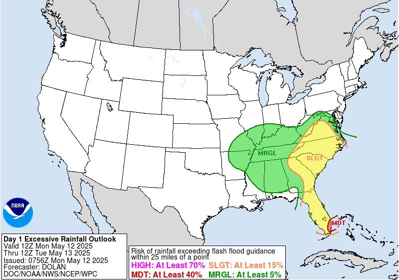
May continues to charge forward in typical fashion, with rounds of storms and heavy rain across the eastern two-thirds of the nation. Last week, the Eastern Seaboard was the target for an atmospheric river delivering beneficial rain, though too much too fast in some areas. Florida was the first state targeted on Monday, 12 May 2025, with urban areas of South Florida under a Moderate Risk of rainfall exceeding flash flood guidance within 25 miles of a point in the National Weather Service (NWS) Weather Prediction Center (WPC) Day 1 Excessive Rainfall Outlook (ERO).
GOES-East CONUS Geocolor imagery overlaid with GLM Flash Extent Density (FED) showed morning thunderstorms followed by a brief lull in activity before a line of strong storms crossed South Florida during the afternoon and evening.
Figure 2: GOES-East CONUS Geocolor imagery overlaid with GLM FED from 0621 to 2326 UTC 12 May 2025. Credit: NESDIS/STAR
NESDIS/OSPO Advected Layered Precipitable Water (ALPW) imagery from 0200 UTC 12 May to 1500 UTC 13 May 2025 provided a look at the plume of moisture circulating an upper-low, with very moist air stretching from Florida to the southern and central Appalachians. GOES-East Full Disk Lower Level Water Vapor Band 10 imagery from 1400 UTC 12 May to 1450 UTC 13 May 2025 tracked the training, slow-moving convection pivoting northeastward across the Eastern U.S.
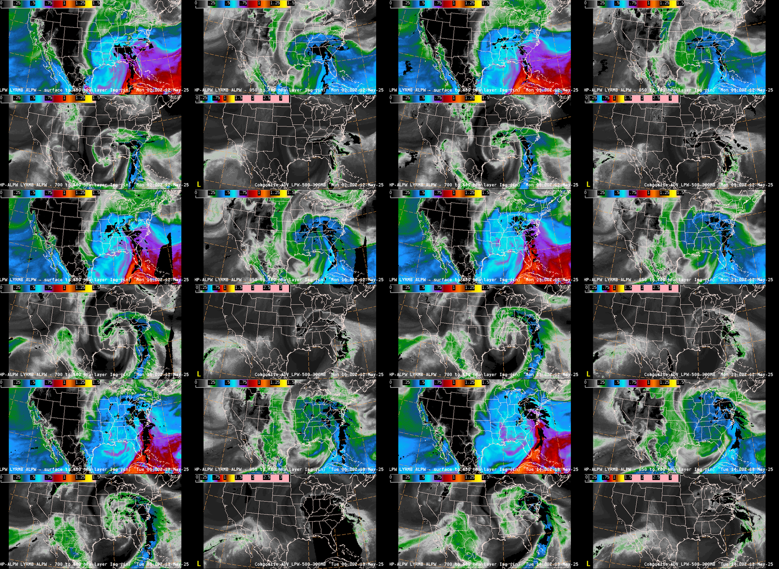
Figure 4: GOES-East Band 10 imagery from 1400 UTC 12 May to 1450 UTC 13 May 2025. This video was created in AWIPS, and display files can be shared upon request.
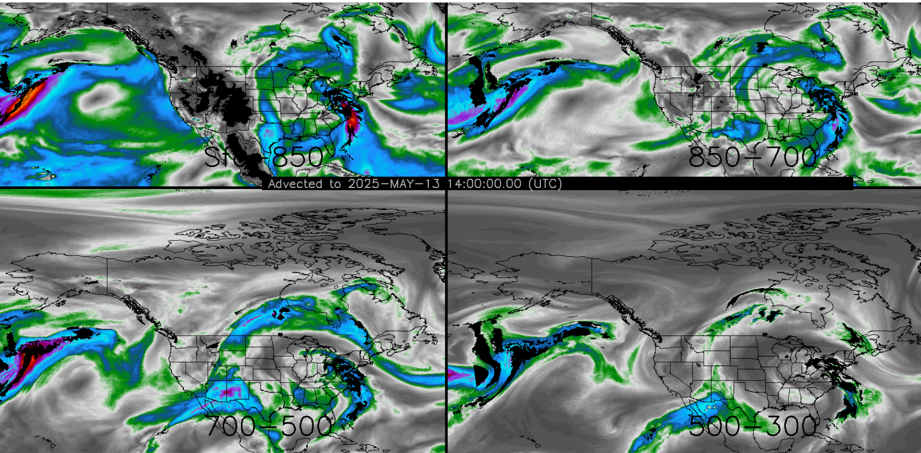
The Cooperative Institute for Research in the Atmosphere (CIRA) Layered Vapor Transport (LVT) Product at 1400 UTC 13 May 2025 identified maximum transport values up to ~600 kg/m/s centered over the Mid-Atlantic. A meteorologist at the NWS WPC noted that the HRRR Integrated Vapor Transport (IVT) was also recently made available, which matched the LVT output quite well. The LVT is different from the ALPW product, as it also accounts for winds from the GFS model. LVT has the same units as IVT, allowing for a direct comparison of model and satellite-derived data.
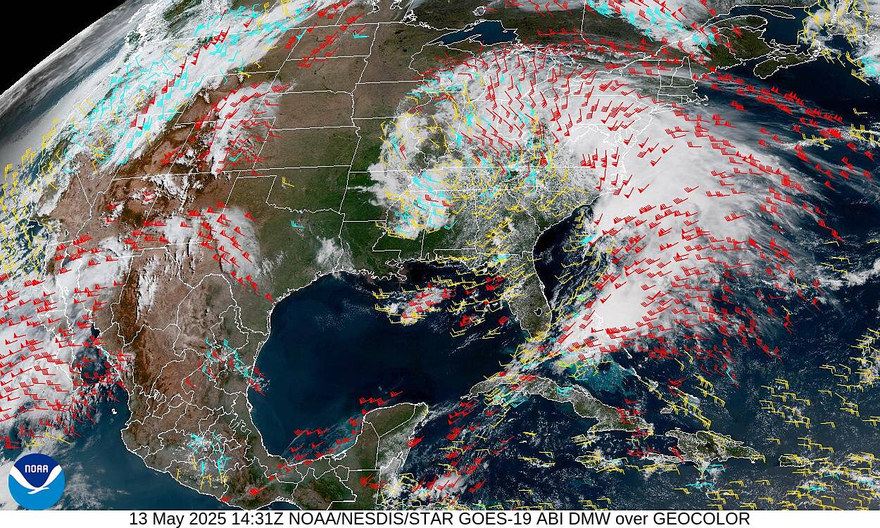
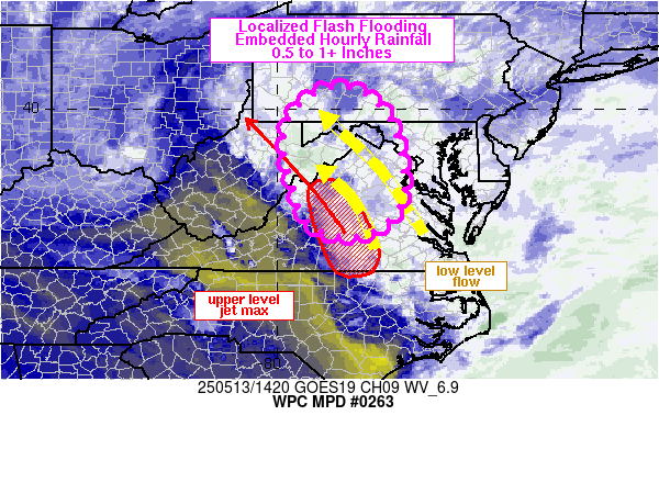
Additionally, GOES-East Derived Motion Winds (DMWs) overlaid on Geocolor imagery at 1431 UTC 13 May 2025 indicated high-level (400-100 hPa – red barbs) winds up to 70 kts across southern VA, which was referenced in a WPC MPD issued at 1441 UTC: “Localized flash flooding may develop across portions of central to western VA into the central Appalachians through 19Z…with a jet streak noted on GOES East DMV (~70 kt) over south-central VA”
Heavy rain fell for several straight hours from Tuesday into Wednesday, causing flash flooding across the Mid-Atlantic. GOES-East Clean Infrared (IR) Window imagery from 1501 UTC 13 May to 0531 14 May 2025 showed repeating rounds of convection slowly pivoting northward before a new round of convection fired and sat over Central Virginia on Tuesday evening. A Flash Flood Emergency was issued by NWS Sterling at 1849 UTC 12 May for Allegany County in MD, with a second issued at 0135 UTC 13 May 2025 for Greene County in VA.
Figure 8: GOES-East Band 13 imagery from 1501 UTC 13 May to 0531 UTC 14 May 2025. This video was created in AWIPS, and display files can be shared upon request.
Leading up to the Memorial Holiday Weekend, more rain is expected across the East, with a Slight Risk ERO forecasted for Tuesday, 20 May 2025, across the Tennessee and Ohio valleys.


