The Chesapeake Bay Stock Assessment Committee held a Blue Crab Data Workshop from Dec 5-7 to review sources of environmental and biological data that may help model the blue crab population for improving the management of this important marine resource and iconic Chesapeake Bay delicacy. Ron Vogel, ESSIC/CISESS senior faculty specialist, participated in the workshop as a subject matter expert on environmental data sources from satellites to be used in the modeling research.
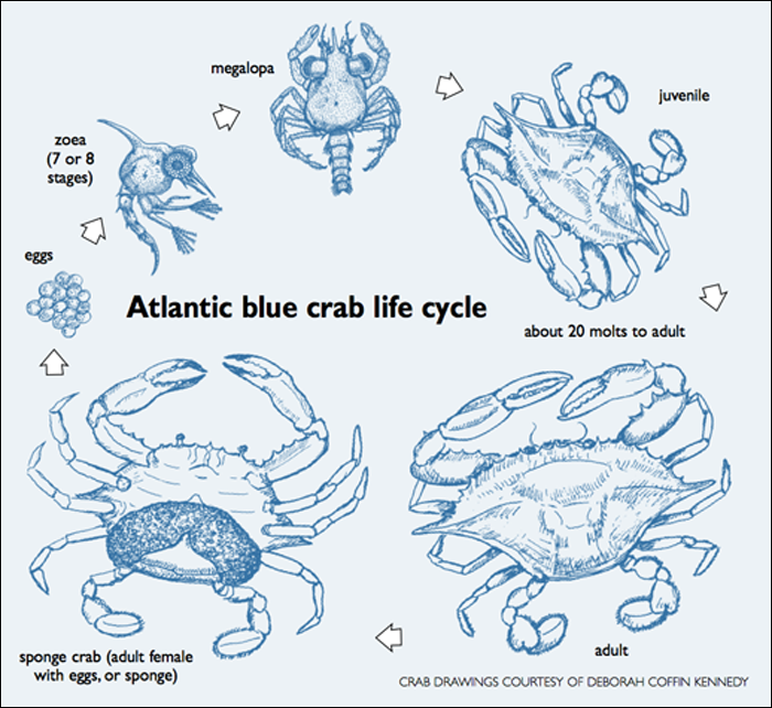
Blue crab numbers are highly variable every year and several population surveys suggest a long-term decline. Re-evaluation of management decisions, such as harvest limits, occurs yearly and have been based solely on stock surveys. Now for the first time, the committee will use environmental data to conduct modeling research to understand the species’ yearly variability. Vogel identified NOAA’s sea surface height anomaly and ocean vector winds as key satellite products for understanding the survivability and distribution of larval crabs while in their off-shore life stages outside of Chesapeake Bay, prior to their re-entry into the Bay. The aim of the modeling is to improve decisions for sustainably managing the species while protecting the livelihoods of local crab fishers.
In his research, Vogel applies earth-observation satellite data to environmental decision-making. He currently develops decision-support tools for water quality, fisheries and climate change in coastal areas. Other interests include ecological modeling with satellite data and vegetation and land surface monitoring by satellite. He has expertise in both visible and infrared satellite remote sensing.


