ESSIC and NOAA scientists addressed an audience of local media and broadcast meteorologists to discuss how new scientific developments can be applied to severe weather forecasting.
ESSIC Director and ConE Chair, Professor Antonio Busalacchi, began the discussion by explaining issues of aging U.S. weather satellites. Based on current predictions, the U.S. stands to retain only a fraction of its current weather-related satellites by the next decade. A decline in observational satellites could result in the loss of weather prediction capability.
According to Busalacchi, any extended gap in our observational coverage capabilities, presents a scenario where our forecasting advances may regress 10 years or more.
Busalacchi believes the U.S. doesn’t have the proper strategies in-place to accommodate current and future budgetary issues.
“The present strategies we’re on are not sustainable, so we need to find new and more affordable ways to get the same information,” Busalacchi said. Some of his solutions involve launching a mix of large multi-sensor craft with smaller more task-specific satellites, investing in the private sector, and strengthening international partnerships.
New Cooperative Institute for Climate and Satellites (CICS) Executive Director and Professor, Fernando Miralles-Wilhelm, commented that people often question investments made in space research, not realizing the importance of funding satellite observations. “These things really help us deal with massive amounts of loss prevention here on earth,” Miralles-Wilhelm said.
NOAA’s Dr. Scott Rudlosky, an ESSIC visiting assistant scientist, discussed how his current work with ground-based lightning mapping array (LMA) sensor networks , may serve to prepare users for the GOES-R era class of satellites.
The LMA, which detects high frequency waves emitted by lightning, has demonstrated capabilities to monitor and predict severe weather. GOES-R will offer similar lightning observation capabilities. According to Rudlosky, the data derived from this technology can be utilized by weather broadcasters to increase public safety.
“Although it’s not obvious to where you are, these flashes (lighting) can come to ground just about anywhere,” Rudlosky said. “This is the type of information you really need to show the public to drive that point home,” he furthered, in reference to the LMA sensor data.
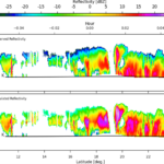
The LMA technology has proven useful in severe conditions where weather patterns are unpredictable. Rudolsky noted how high concentrations of lightning observed by the D.C. LMA network during a severe weather event on June 13, 2013, actually preceded the formation of two separate tornados in the D.C. area. The event was visually illustrated by Rudlosky and ESSIC Faculty Research Assistant, Patrick Myers, in an “It’s Severe” blog post on the ESSIC web-site.
Rudlosky later appeared that day and was mentioned in both an NBC4 on-air segment and web-site post, presented and authored by workshop attendee, NBC4 meteorologist Amelia Segal. He was also featured in an article published the following day in ClimateWire, written by workshop participant, Elizabeth Harball.
ESSIC / AOSC Professor Raghu Murtugudde, concluded the workshop by discussing recent unpredictability in the jet stream pattern, which often leads to severe weather. He predicted that in five to 10 years, the earth may settle into a new, more stable weather system, but that current patterns warrant a need for advanced monitoring systems.
Participating in the workshop were on-air meteorologists from local Washington, D.C. and Baltimore television stations, NBC4 and WBAL11, along with reporters from ClimateWire and CBS Radio. (UMD Associate Director of Communications, Lee Tune and UMD CMNS Science Writer, Heather Dewar were also in attendance.)
“All of this will help us,” said participant, NBC4 chief meteorologist Doug Kammerer. “The more we are informed, the better.”


