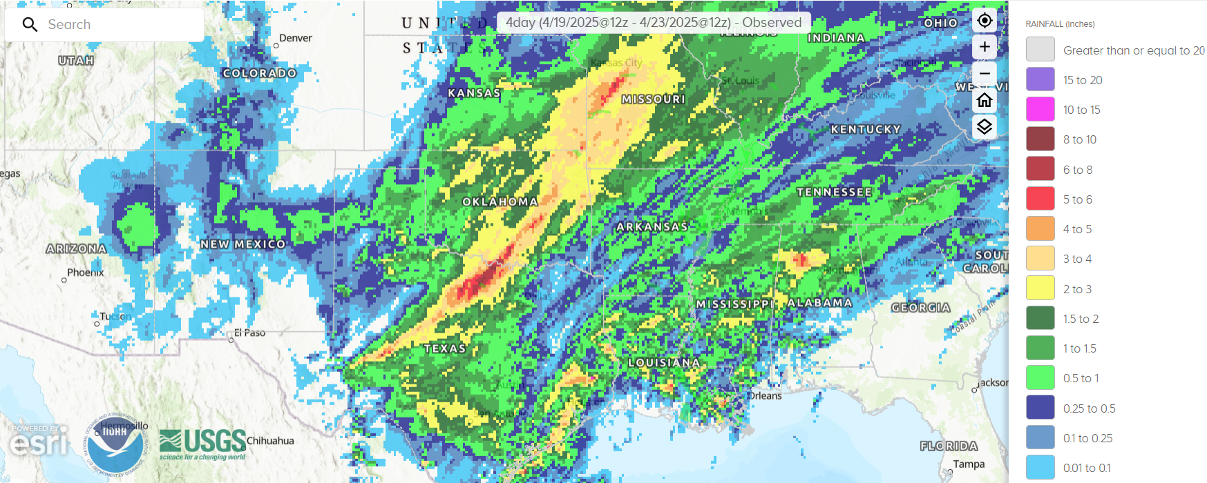
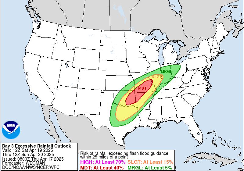
The Southern Plains and Middle Mississippi Valley were the latest target for repeating rounds of storms that brought flooding over the Easter weekend. The National Weather Service (NWS) Weather Prediction Center (WPC) highlighted the elevated flash flooding risk in the Day 3 Excessive Rainfall Outlook (ERO) valid for 1200 UTC 19 April to 1200 UTC 20 April 2025, with a Moderate Risk, or at least a 40 percent risk of rainfall exceeding flash flood guidance within 25 miles of a point.
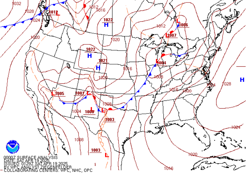
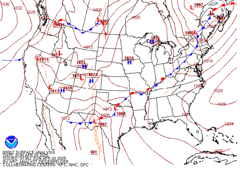
By 0000 UTC 19 April 2025, there was a dry line positioned across West-Central Texas and a cold front pushing into the Southern Plains. A day later at 0000 UTC 20 April 2025, WPC’s Surface Analysis looked strikingly similar, with the dry line just slightly further west in Texas, and the cold front stalling to become a stationary front. The stage was set for heavy rain and storms to develop along the slow-moving boundaries. GOES-East Band 13 Clean-Infrared (IR) Longwave Window imagery from ~0000 UTC 19 April to ~1200 UTC 20 April 2025 captured the repeating rounds of convection moving from Central Texas into eastern Oklahoma and the Middle Mississippi Valley.
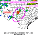
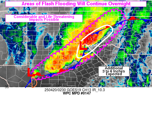
Multiple Mesoscale Precipitation Discussions (MPDs) were issued by WPC to highlight the flash flooding threat during this time period. The MPD issued at ~0240 UTC 20 April 2025 noted that ‘Considerable flash flooding with life-threatening impacts will be possible…from areas of northern TX into southeastern OK’, after several inches of rain had already fallen, with storms ongoing.
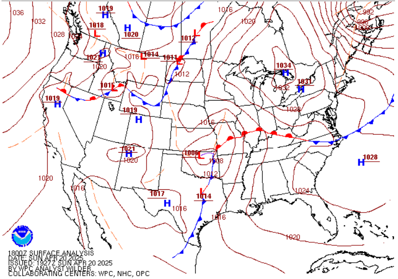
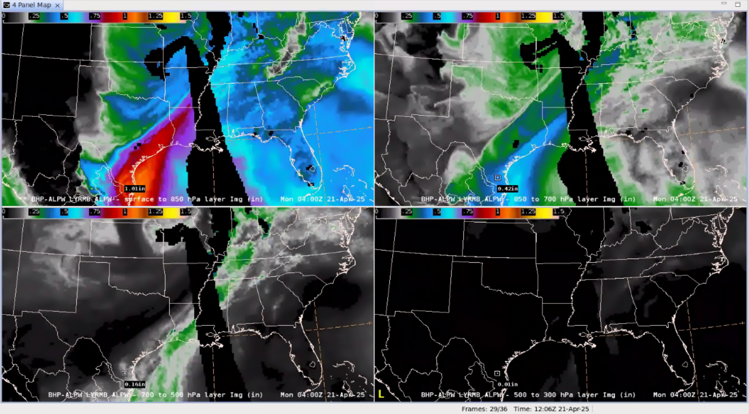
By 1800 UTC 20 April 2025, a surface low was beginning to strengthen and move northeast across Oklahoma. The low pressure’s spin is visible in the newly operational Advected Layered Precipitable Water (ALPW) Product from NESDIS/OSPO, while waves of moisture continued to move ashore from the Gulf, especially along the Texas Coast. Rounds of heavy rain continued in Southeast Texas, with an MPD issued at ~0425 UTC 21 April 2025 noting an “airmass characterized by 1.5-1.8 inch PW values”. The ALPW product at 0400 UTC 21 April 2025 confirmed that the Precipitable Water (PW) values, when adding up all four layers, reached 1.6″ in parts of southern Texas.
Storms continued to expand in coverage while pushing towards the Texas Coast. The machine-learning (ML) GOES-East LightningCast product picked up on the Geostationary Lightning Mapper (GLM) detecting lightning in far South Texas by at least 40 minutes in advance. Intense convection can be seen farther northeast, with very high values of GLM Flash Extent Density (FED) detected.
From the morning of 19 April to 21 April 2025, 41 Flash Flood Warnings were issued from Texas to the Middle Mississippi Valley and up to 10 inches of rain fell across parts of northern Texas.
