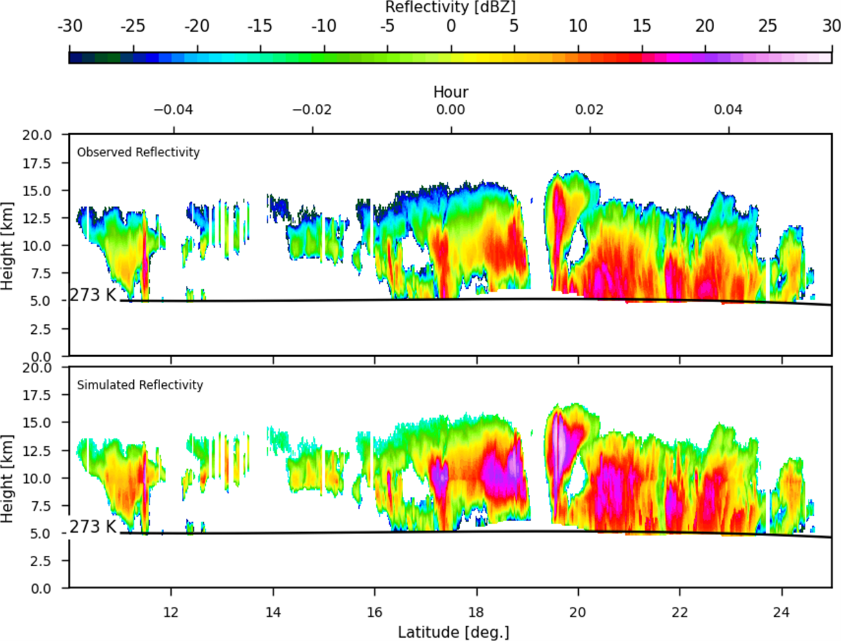
Chris Smith, ESSIC/CISESS Faculty Assistant, has been posting updates on hurricane activity on the Satellite Liaison Blog, a blog for scientists to demonstrate how satellite data were used (or could have been used) by National Weather Service (NWS) forecasters and other users to address specific forecast challenges. Smith has posted to the Satellite Liaison Blog over 15 times in the past year to engage the satellite user community on the science and tools two of the national centers are using in their forecasts and decision making.
Recently, he posted reviews of Hurricane Helene and Hurricane Milton, two powerful hurricanes that recently hit the southeast United States. Smith’s most recent post follows Hurricane Milton from inception to landfall, focusing on the satellite imagery that NWS used as they responded to the emergency.
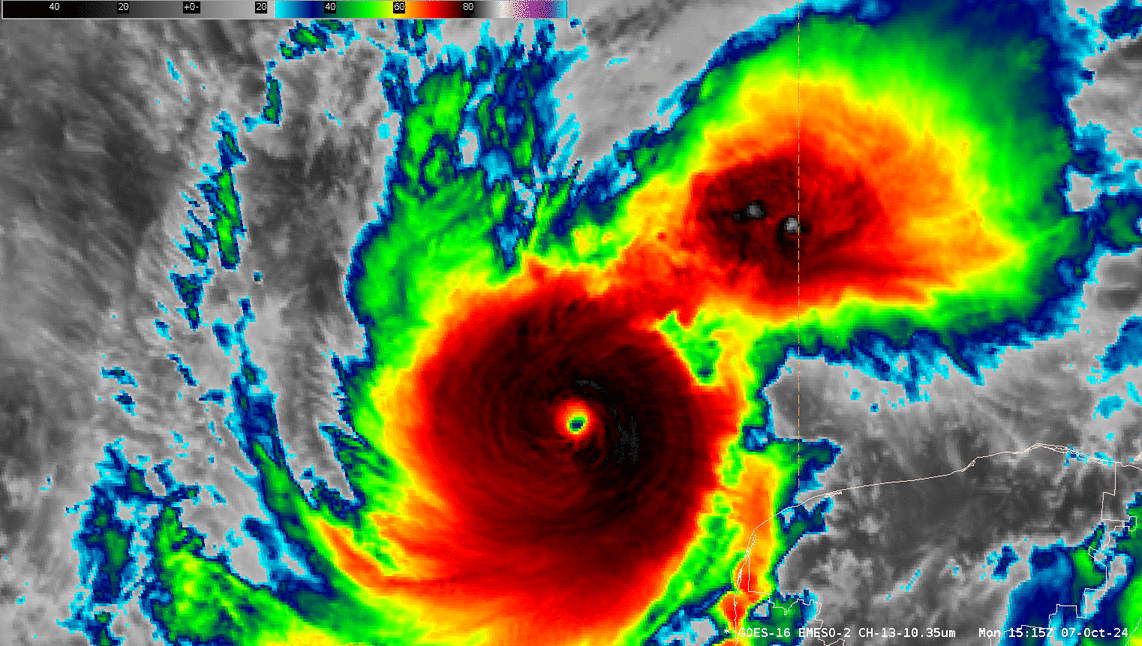
GOES-East 1-minute mesosector Clean IR Longwave Window Band 13 imagery from ~1515 to ~1615 UTC 07 October 2024. This animation was created in AWIPS, and display files can be shared upon request.
Smith’s imagery, derived from the Geostationary Operational Environmental Satellite R-series and Joint Polar Satellite System (JPSS) programs, demonstrates the lightning, rainfall, and tornados brought on by Hurricane Milton.
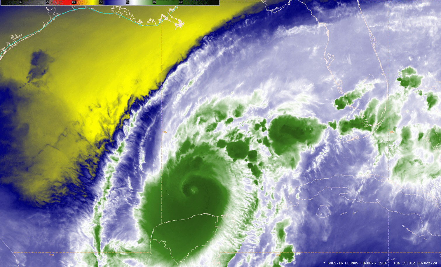
GOES-East upper-level water vapor Band 8 from ~1500 to ~1730 UTC 08 October 2024. This animation was created in AWIPS, and display files can be shared upon request.
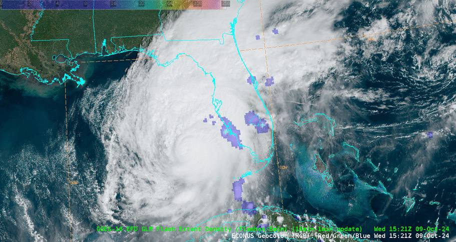
GOES-East GLM FED overlaid with a transparency filter on Geocolor imagery from ~1530 to ~1820 UTC 09 October 2024. This animation was created in AWIPS, and display files can be shared upon request.
The Satellite Liaison Blog serves as an outlet for liaisons to share publicly the science and satellite tools making their way into NWS operations, gathering feedback for maximizing operational capabilities of satellite products. Smith has posted to the Satellite Liaison Blog over 15 times in the past year to engage the satellite user community on the science and tools that the national centers are using in their forecasts and decision making.
Christopher Smith joined ESSIC/CISESS, University of Maryland in 2023 and is the GOES-R Satellite Liaison for the NWS Weather and Ocean Prediction Centers. Smith works to interpret experimental satellite imagery and products, and make such products available to forecasters and the NWS for a route to operations. He trains forecasters how to use satellite imagery in weather forecasting, while also delivering forecaster feedback to satellite developers to maximize meteorological satellite capabilities. Smith is an alumni of the UMD Atmospheric & Oceanic Science (AOSC) Department, and his long-term interests include infusing AI-Satellite Products to increase lead time in decision making for forecasters.
")