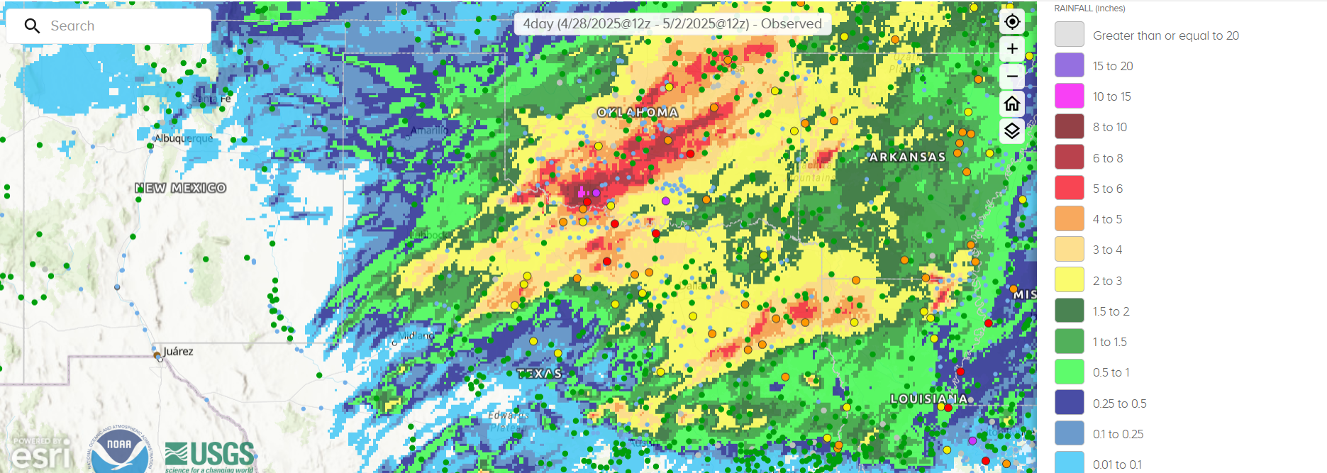
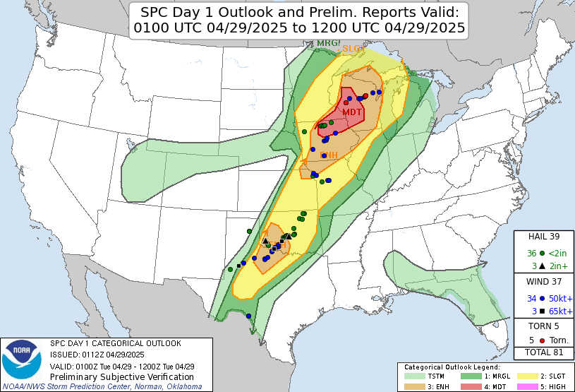
The Southern Plains were once again the target for rounds of heavy rain and thunderstorms as the month of April came to an end and May began. A Mesoscale Convective System (MCS) set the stage for a wet week starting on 29 April 2025, first developing in the Texas Panhandle before tracking northeastward to southern Missouri. GOES-East Band 13 Clean-Infrared (IR) Longwave Window imagery from 0311 to 1531 UTC showed the initial explosion of convection before a large area of storms maintained itself while racing across multiple states. The National Weather Service (NWS) Storm Prediction Center (SPC) issued a Day 1 Convective Outlook highlighting the Slight to Enhanced Risk of severe storm coverage from 0100 to 1200 UTC 29 April 2025, with storm reports indeed showing several wind reports with speeds over 50 kts along with large hail across northern TX and OK.
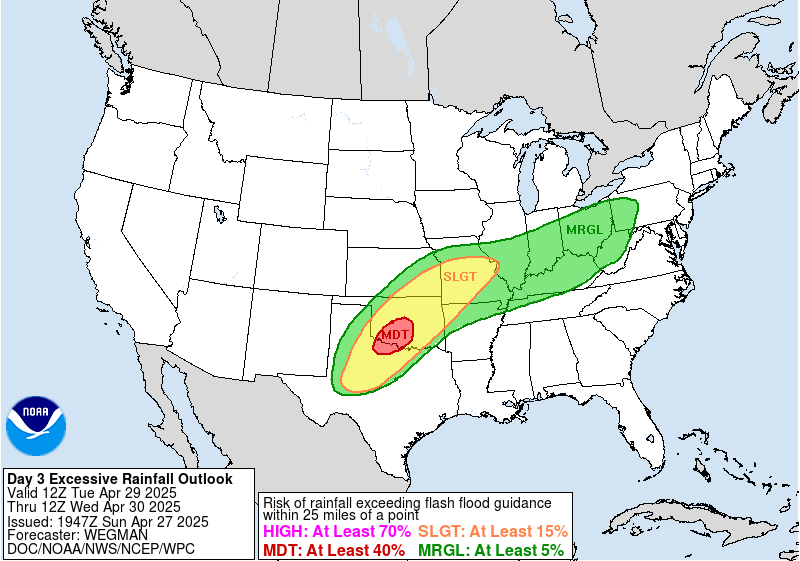
Further rounds of heavy rain and storms were expected to develop as the week progressed. A Day 3 Moderate Risk Excessive Rainfall Outlook was released by the NWS Weather Prediction Center (WPC), with north-central TX and south-central OK in the crosshairs from 12 UTC 29 April to 12 UTC 30 April 2025.
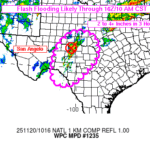
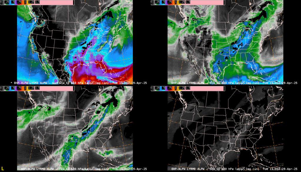
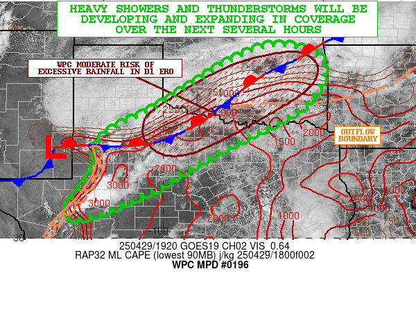
The operational National Environmental Satellite, Data, and Information Service (NESDIS) Office of Satellite and Product Operations (OSPO) Advected Layered Precipitable Water imagery indicated a low-level moisture feed from the Gulf, with a mid-to-upper level (700-500 hPa, 500-300 hPa layers) connection of moisture to the tropical East Pacific. The combination of moisture plumes indeed led to flash flooding, and WPC issued several Mesoscale Precipitation Discussions (MPDs) highlighting the risk of flash flooding over geographic areas up to six hours in advance. The MPD issued at 1935 UTC 29 April 2025 noted ‘PWs should increase to near or above 1.5 inches and this will be running a solid 2 standard deviations above normal’, matching the 1.5″+ PW values seen (once adding up all four layers) in the ALPW across northern TX.
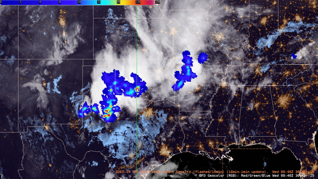
Just over 12 hours later, a new round of storms was pushing east across the TX-OK border, dumping more rain on already saturated areas. GOES-East GeoColor imagery overlaid with the GLM Flash Extent Density (FED) indicated a wide footprint of lightning as the convection crawled eastward.
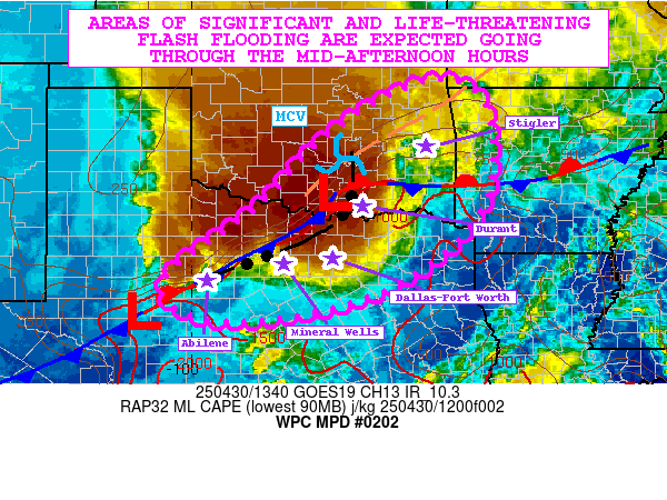
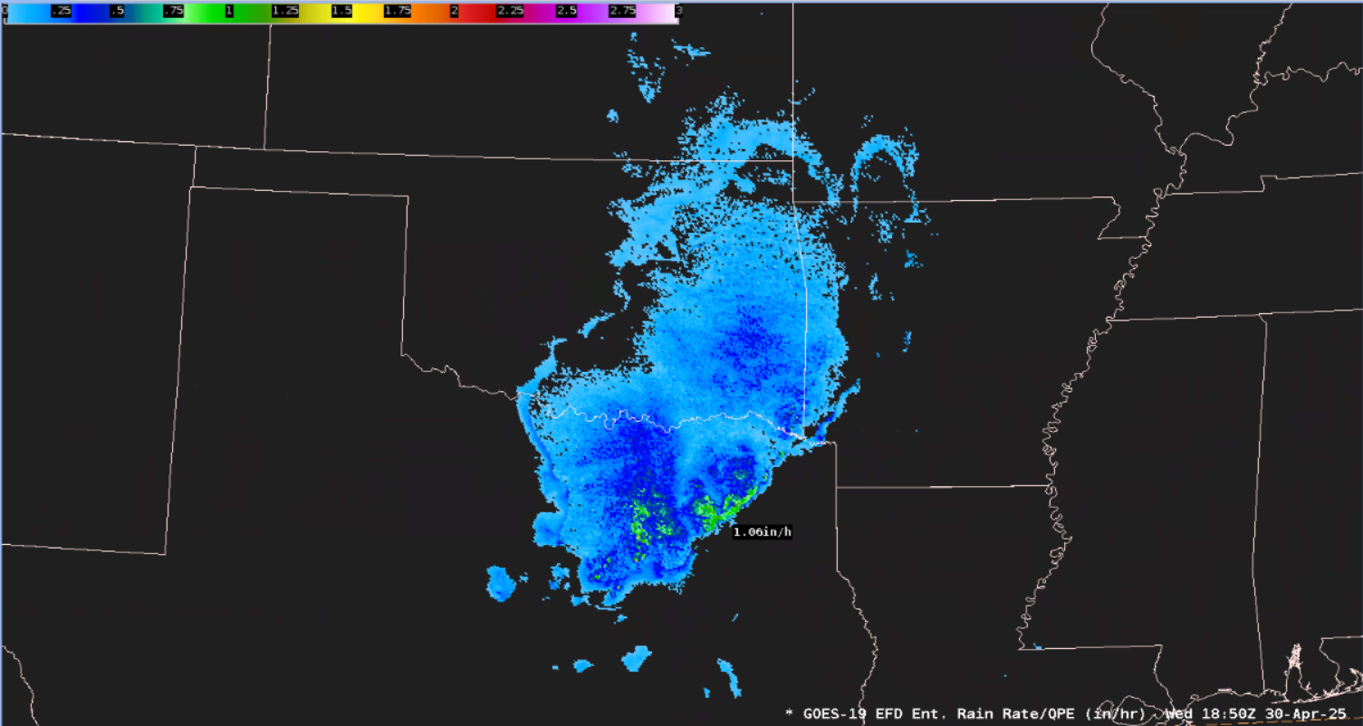
WPC’s MPD issued at 1400 UTC 30 April 2025 stated ‘significant and life-threatening flash flooding are expected which will include a notable urban flash flood threat to multiple metropolitan areas including Dallas-Fort Worth’. GOES-East 1-minute Mesoscale Visible Band 02 imagery from ~1530 to 1845 UTC tracked the slow-moving thunderstorms across the Dallas-Forth Worth Metro. Southerly flow from the Gulf can be seen feeding the explosive line of storms. Additionally, the newly available GOES-East Enterprise Rain Rate product in AWIPS detected rain rates in excess of 1″/hour in Northeast TX at 1850 UTC 30 April 2025. The GOES Enterprise Rain Rate product is meant to supplement radar and gauge measurements, and is most useful in areas without adequate observations.
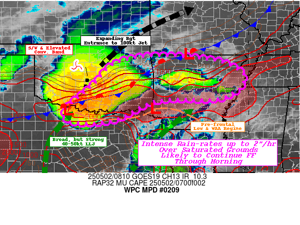
Like a broken-record, a new round of storms fired this morning along the TX-OK border. In GOES-East Proxyvis imagery, low clouds streaming north from an earlier complex of storms in Texas helped boost convection in Oklahoma around ~0600 UTC 02 May 2025. A WPC MPD issued at 0830 UTC 02 May 2025 mentioned ‘saturated ground conditions likely to continue scattered flash flooding incidents through early morning.’
Several rivers as of this morning were in Moderate or Major Flood Stage across northern TX and southern OK after up to 10″ of rain fell over the past four days.
