![Figure. Example of a mapped data product: seasonal means of dissolved inorganic carbon [CT(RFR-LME)] in the Northern Hemisphere (a) winter (December-January-February), (b) spring (March-April-May), (c) summer (June-July-August), and (d) fall (September-October-November) over the period 1998–2022 within each U.S. LME.](https://essic.umd.edu/wp-content/uploads/2024/08/jiang-1.jpg)
Introducing a New Set of Ocean Acidification Indicators
(Click to enlarge) Comparisons between pCO2 from selected moored buoy observations, RFR-LME and RFR-LME-NM maps, and other mapped surface products. (a) Mapped long-term mean pCO2(RFR-LME)
![Figure. Example of a mapped data product: seasonal means of dissolved inorganic carbon [CT(RFR-LME)] in the Northern Hemisphere (a) winter (December-January-February), (b) spring (March-April-May), (c) summer (June-July-August), and (d) fall (September-October-November) over the period 1998–2022 within each U.S. LME.](https://essic.umd.edu/wp-content/uploads/2024/08/jiang-1.jpg)
(Click to enlarge) Comparisons between pCO2 from selected moored buoy observations, RFR-LME and RFR-LME-NM maps, and other mapped surface products. (a) Mapped long-term mean pCO2(RFR-LME)

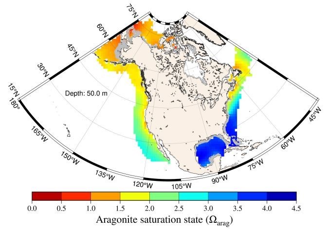
Figure. Example of a map of one of the OA indicators, namely, the aragonite saturation state at a depth of 50 m on the North

ESSIC scientists Li-Qing Jiang, Paige Lavin, and Hyelim Yoo are a part of a team of scientists that have developed detailed maps that track ocean acidification indicators from 1998 to 2022 for eleven large marine ecosystems (LMEs) in the U.S. The study was just published in Nature – Scientific Data for this work.

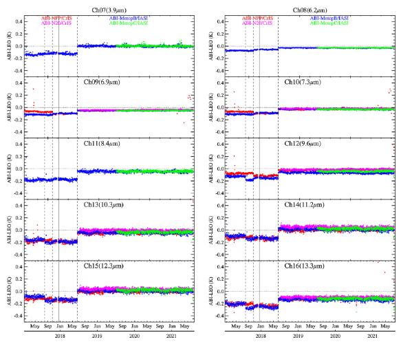
ESSIC/CISESS Scientist Fangfang Yu (STAR/SMCD/SCDAB) has a new article in the Journal of Applied Remote Sensing, co-written with Hyelim Yoo, Haifeng Qian, and Xi Shao. The paper describes the radiometric calibration of the Advanced Baseline Imager (ABI) Infrared (IR) channels on GOES-16.

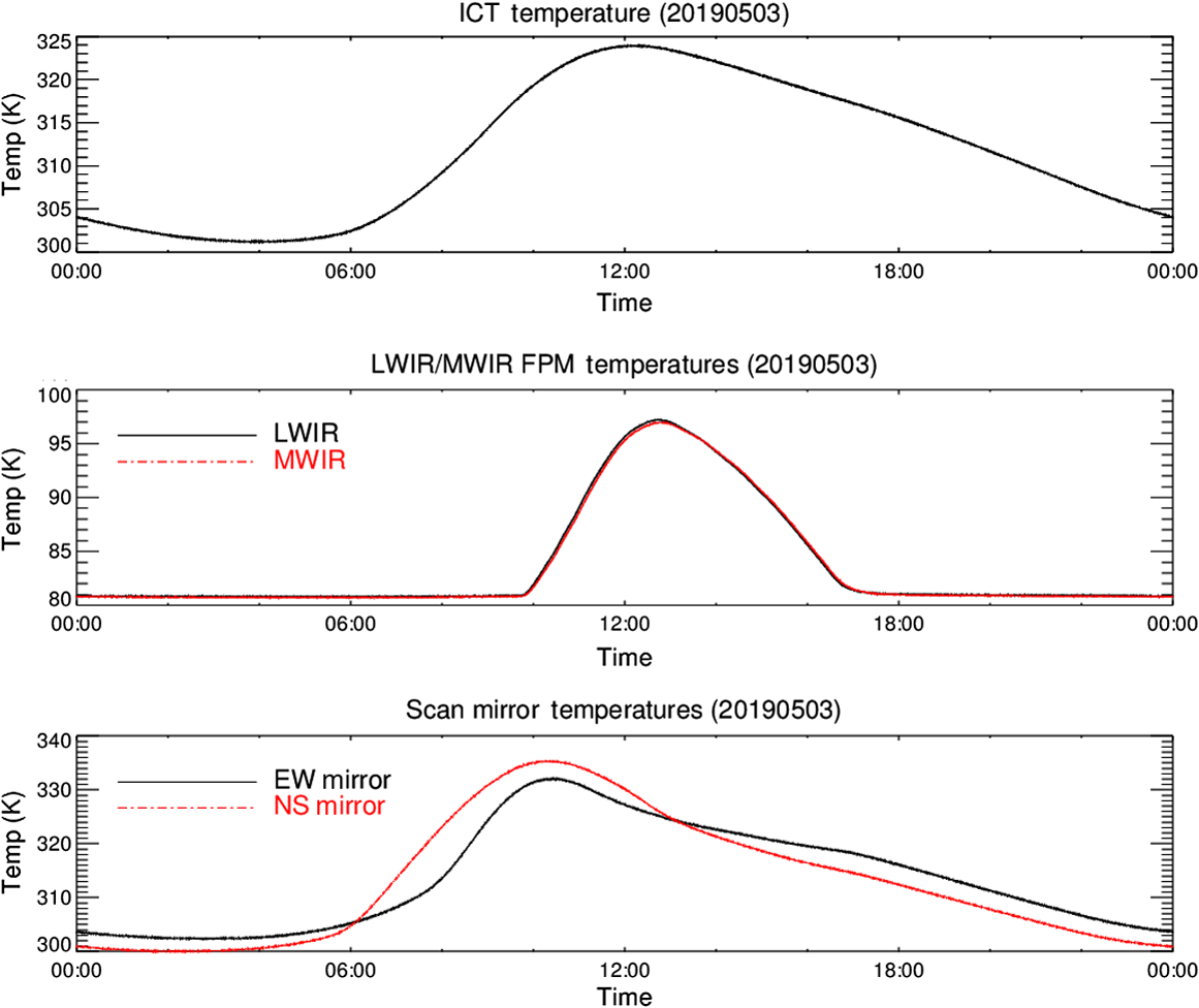
ESSIC/CISESS Scientists Zhipeng Wang, Fangfang Yu, Hyelim Yoo, Haifeng Qian and Xi Shao have been honored with a SPIE Journal of Applied Remote Sensing 2020 Best Papers Award for their article, “On-orbit calibration and characterization of GOES-17 ABI IR bands under dynamic thermal conditions”.