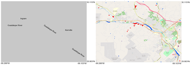
Mapping the Extent of the Devastating July 4 Texas Flash Flood Event
The July 2025 flood event in Texas Hill Country, fueled by remnants of Tropical Storm Barry, resulted in, to date, 135 fatalities, including 28 children
")
The July 2025 flood event in Texas Hill Country, fueled by remnants of Tropical Storm Barry, resulted in, to date, 135 fatalities, including 28 children
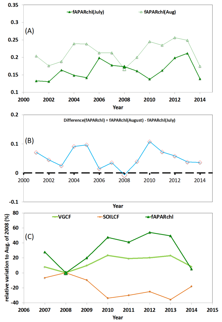
ESSIC/CISESS Scientist Qingyuan Zhang has published a paper entitled “Impacts of abiotic and biotic factors on tundra productivity near Utqiaġvik, Alaska” in Environmental Research Letters.
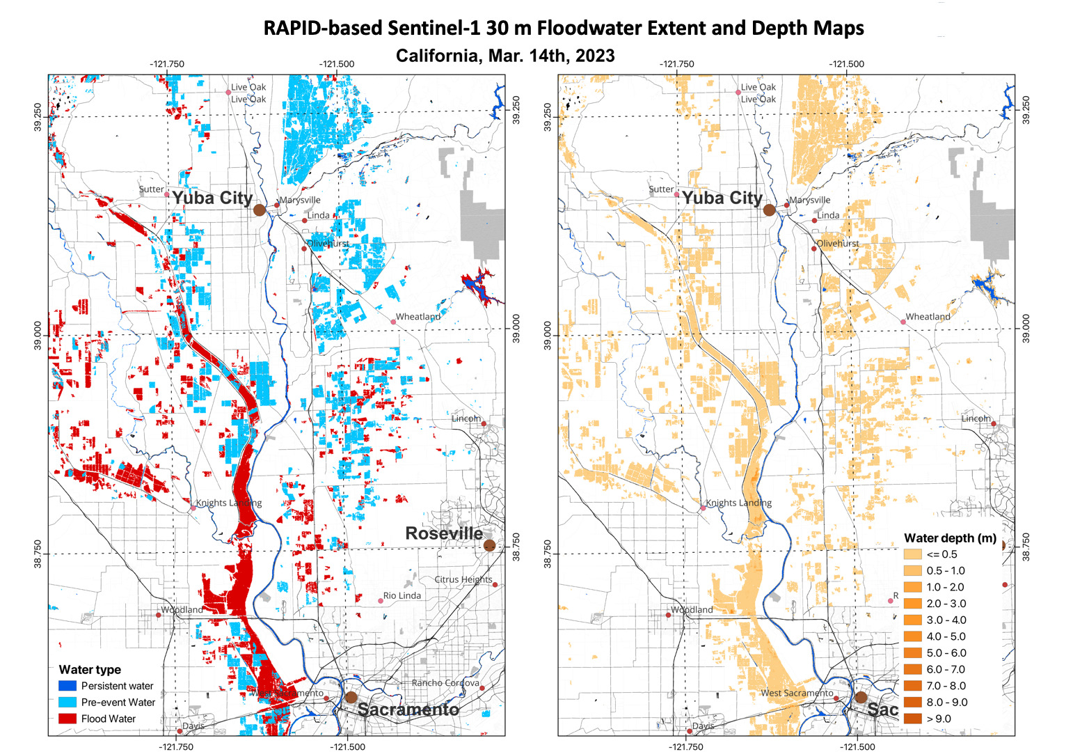
ESSIC Associate Research Scientist Qingyuan Zhang recently used VIIRS daily 375m flood extent products on 3/8/2023, 3/11/2023, 3/13/2023 and 3/15/2023 to monitor flooding in California.
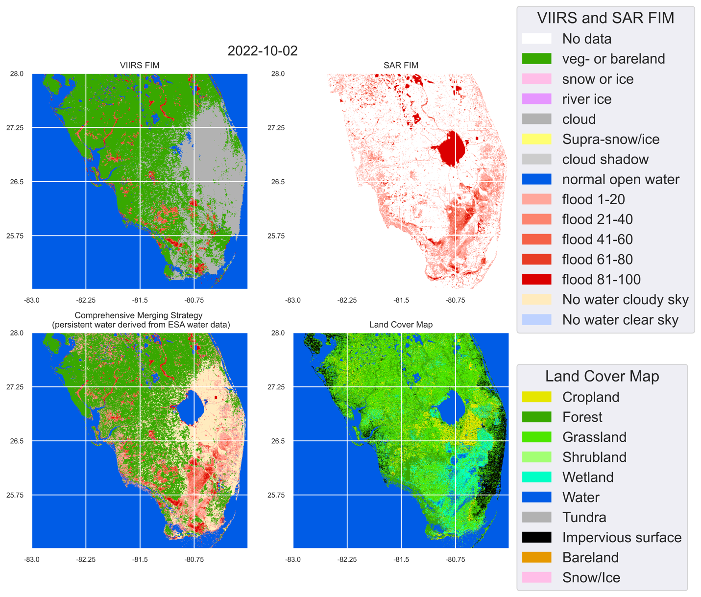
Hurricane Ian made landfall in Florida on the afternoon of 9/28/2022 as a massive Category 4 storm and brought record-setting winds. As of 10/4/2022, at least 105 people have been reported as casualties of Hurricane Ian, 55 of which in Lee County, Florida. Even more people are without power or their home. The NOAA STAR Flood team has produced VIIRS Flood maps, Sentinel-1 SAR Flood maps, and blended Flood maps to report the flood extent due to Hurricane Ian.
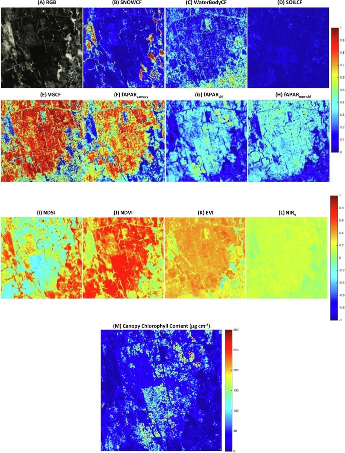
ESSIC/CISESS Scientist Qingyuan Zhang has a new article to be published in International Journal of Applied Earth Observation and Geoinformation that characterizes the seasonally snow-covered Howland boreal forest ecosystem in Maine, USA with satellite images.
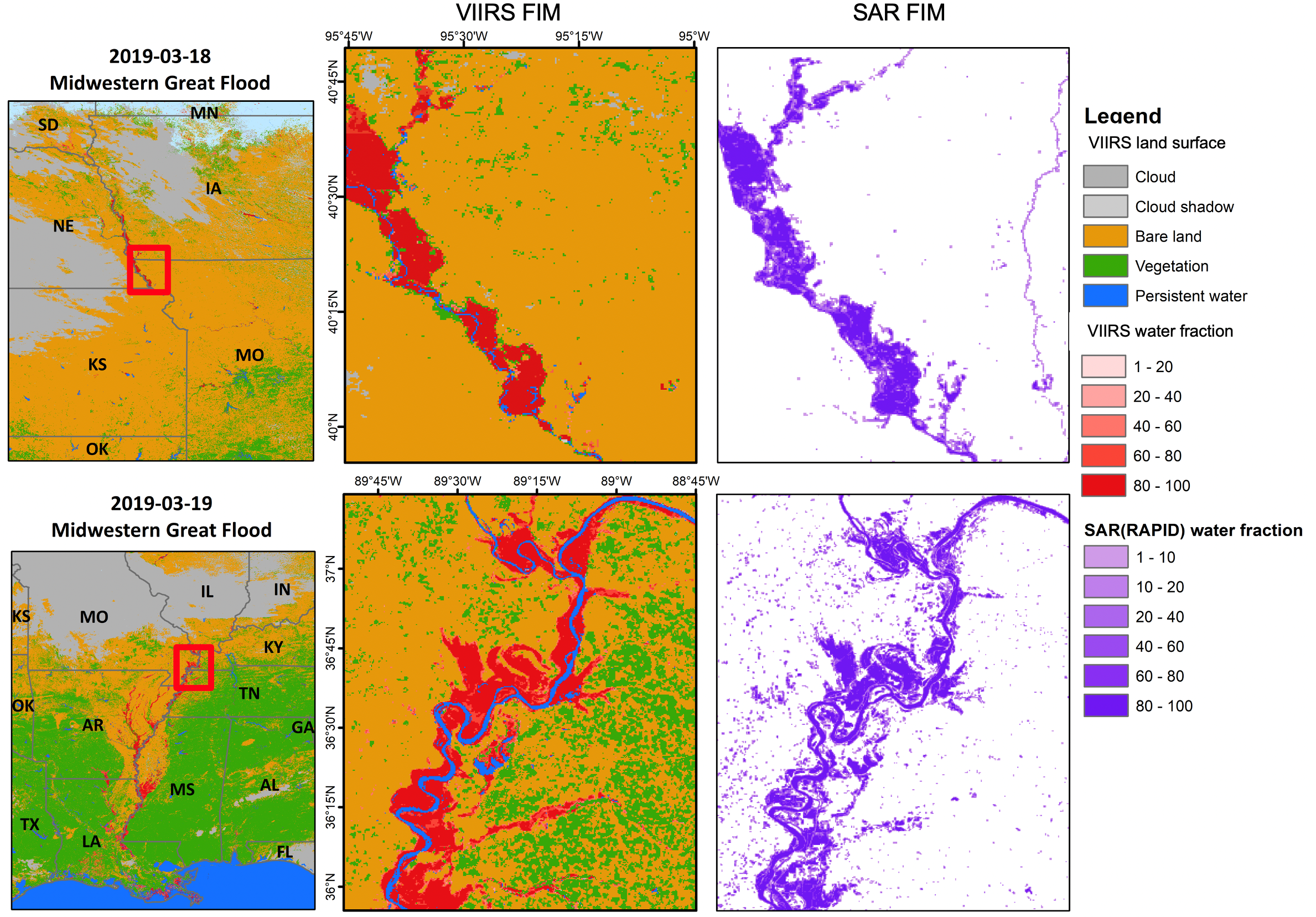
ESSIC/CISESS Scientist Qingyuan Zhang and their colleagues have developed a framework to compare Visible/Infrared Imager Radiometer Suite (VIIRS) Flood Inundation Maps (FIM) with Sentinel-1 synthetic aperture radar (SAR) FIM.