Home » Cazzy Medley » Page 10

Author: Cazzy Medley

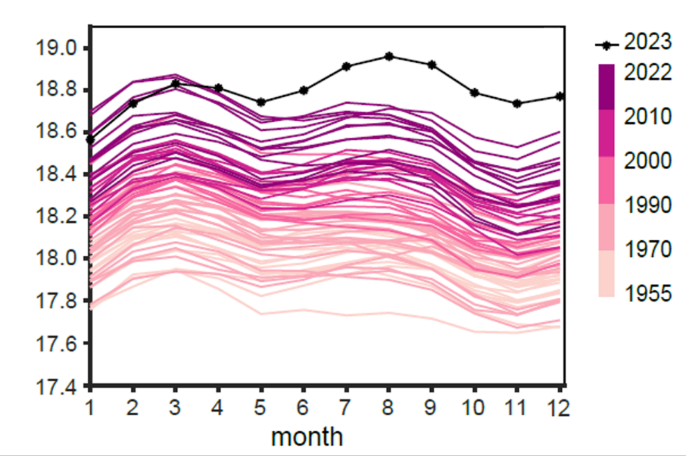
Summer 2023 water temperature anomaly map for Chesapeake Bay shows a 1 degree C decrease in temperature compared to a 2007-2022 baseline, indicating favorable conditions for several key fish species, according to the seasonal fishery impacts report released by the NOAA Chesapeake Bay Office and containing data generated by UMD/ESSIC/CISESS.

Chesapeake Bay has ‘favorable’ summer, finds ESSIC-supported NOAA report

The Virginian-Pilot featured a news article on November 5 highlighting a NOAA report containing an operational satellite data product from ESSIC/CISESS Senior Faculty Specialist Ron Vogel. The report, Synthesis of Environmental Impacts on Key Fishery Resources in the Chesapeake Bay, is released seasonally by the NOAA Chesapeake Bay Office and is used by regional fishery managers to help guide management decisions.

Read More »
English: A top view scene of someone doing some research and going through the pages of a book and using a magnifying glass on it. The scene happens on a wooden background. There are also some other research related items in the scene, such as: sticky notes, pencil, ruler or notebook

ESSIC Scientists Earn NASA HBG Peer Awards

NASA recently announced the selections for the 2023 Hydrosphere, Biosphere, and Geophysics (HBG) Annual Peer Awards. Several ESSIC scientists were awarded for scientific achievement and scientific/technical support. The ceremony commemorating these awards was held on Thursday, October 26, 2023 at 2:00pm.

Read More »
Figure: The International Space Station Lightning Imaging Sensors 128 X 128-pixel array of (a) event count, (b) total event energy density, (c) mean event energy density, (d) pixel minimum energy density, (e) pixel maximum energy density, and (f) pixelwise 95% quantile energy density during March 2017–September 2020, computed separately for each pixel, indexed by CCD pixel numbers.

Evaluating Lightning Observations from Space

ESSIC/CISESS Scientists Daile Zhang, Scott Rudlosky (NOAA), and colleagues published a study that uses the well-documented Tropical Rainfall Measuring Mission (TRMM) Lightning Imaging Sensors (LIS) performance to determine if the International Space Station (ISS) LIS performs well enough to bridge the gap between TRMM LIS and the new generation of Geostationary Lightning Mappers (GLMs).

Read More »
The image on the left is from satellite imagery in a CA Sierra Nevada watershed. The image on the right is the same image with snow (blue pixels) identified using the approach discussed below. CREDIT: Justin Pflug

Estimating Forest Snow Resources Using Commercial Satellite Observations

1.2 billion people around the world rely on seasonal snow for their water supply. However, no snow-focused satellite currently exists. The satellites that do attempt to look at the spatial coverage and temperature of snow often struggle to retrieve information about snow in forested regions, which accounts for nearly half of Earth’s snow cover. The forest canopy blocks a lot of satellite remote sensing retrievals, forcing scientists to rely on models. However, processes that control how snow accumulates and melts are pretty different in forested and exposed locations. For example, warmer forests like in the US Pacific Northwest have larger amounts of snow intercepted by the forest canopy and winter snowmelt. This typically makes snow last longer in clearings than in the forest. The opposite is true in colder climates, where snow tends to last longer in the forest.

Read More »