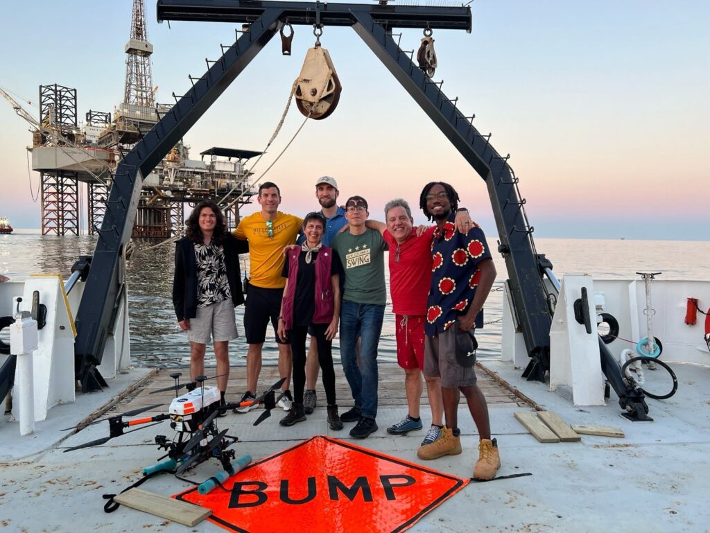
Caption: Scientific crew on board of the Research Vessel (R/V) Point Sur. From left to right: Jonathan Gallegos (SciGlob), Ryan Stauffer (NASA Goddard), Anne Thompson (NASA Goddard Emeritus/UMBC), Niko Fedkin (NASA Goddard/NPP), Nikolay Balashov (UMD ESSIC/NASA Goddard), Martin Cadirola (EcoTronics), and Joshua Richards (UMBC).
In June, several scientists embarked on a research voyage in the Gulf of Mexico to investigate dozens of oil and gas platforms for nitrogen dioxide (NO2) and methane (CH4) emissions. The researchers, which included Earth System Science Interdisciplinary Center’s Nikolay Balashov, were part of the second Satellite Coastal and Oceanic Atmospheric Pollution Experiment (SCOPE-II), a NASA mission funded by the U.S. Department of the Interior’s Bureau of Ocean Energy Management (BOEM).
Every few years, BOEM inventories emissions of criteria pollutants and greenhouse gasses (GHGs) generated by oil and gas operators in the federal waters of the Gulf of Mexico. These inventories are produced based on the operators’ processing techniques, but they require independent verification to ensure their accuracy. The SCOAPE mission began in 2019 partly to verify BOEM’s inventory by making such independent estimations primarily with boat and satellite measurements, initially focusing mainly on air quality.
This year, SCOAPE-II expanded its focus to methane, a powerful greenhouse gas warming the Earth’s atmosphere. Methane can be emitted both due to human activities (such as natural gas extraction) as well as naturally. Nitrogen dioxide is an air pollutant, which can harm humans’ respiratory system and serve as an indicator for other airborne pollutants.
“We urgently need greenhouse gasses to be quantified in our Earth’s atmosphere,” said Nikolay Balashov, Assistant Research Scientist at UMD’s Earth System Science Interdisciplinary Center and NASA, “Improved understanding of anthropogenic methane sources allows humans to better regulate their contribution of methane into the atmosphere.”
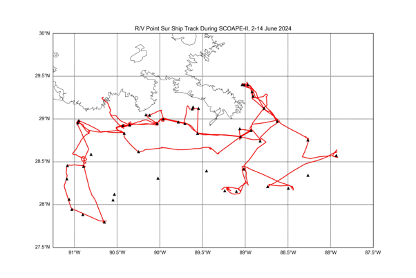
The researchers sailed on the scientific ship R/V Point Sur (pictured above) to oil rigs located in areas that BOEM’s inventories identified as possibly having high emissions. Specifically, a particular oil rig could potentially be leaking significant methane concentrations due to their type of extraction equipment and corresponding processes. Over the course of 11 days, the team visited over 50 sites.
A map of the route and platforms that the team visited.
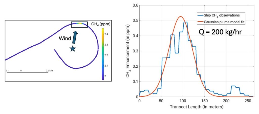
Once they reached the oil rigs, the team measured methane and nitrogen dioxide downwind of the platforms. They were then able to approximate methane emissions with a Gaussian plume model, a mathematical approach used to estimate the concentration of pollutants dispersed in the atmosphere from a single source.
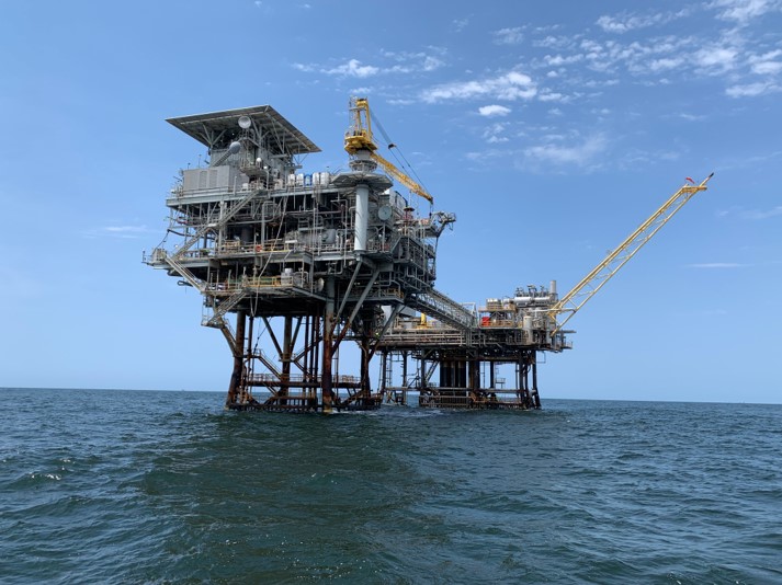
One of the platforms the team visited.
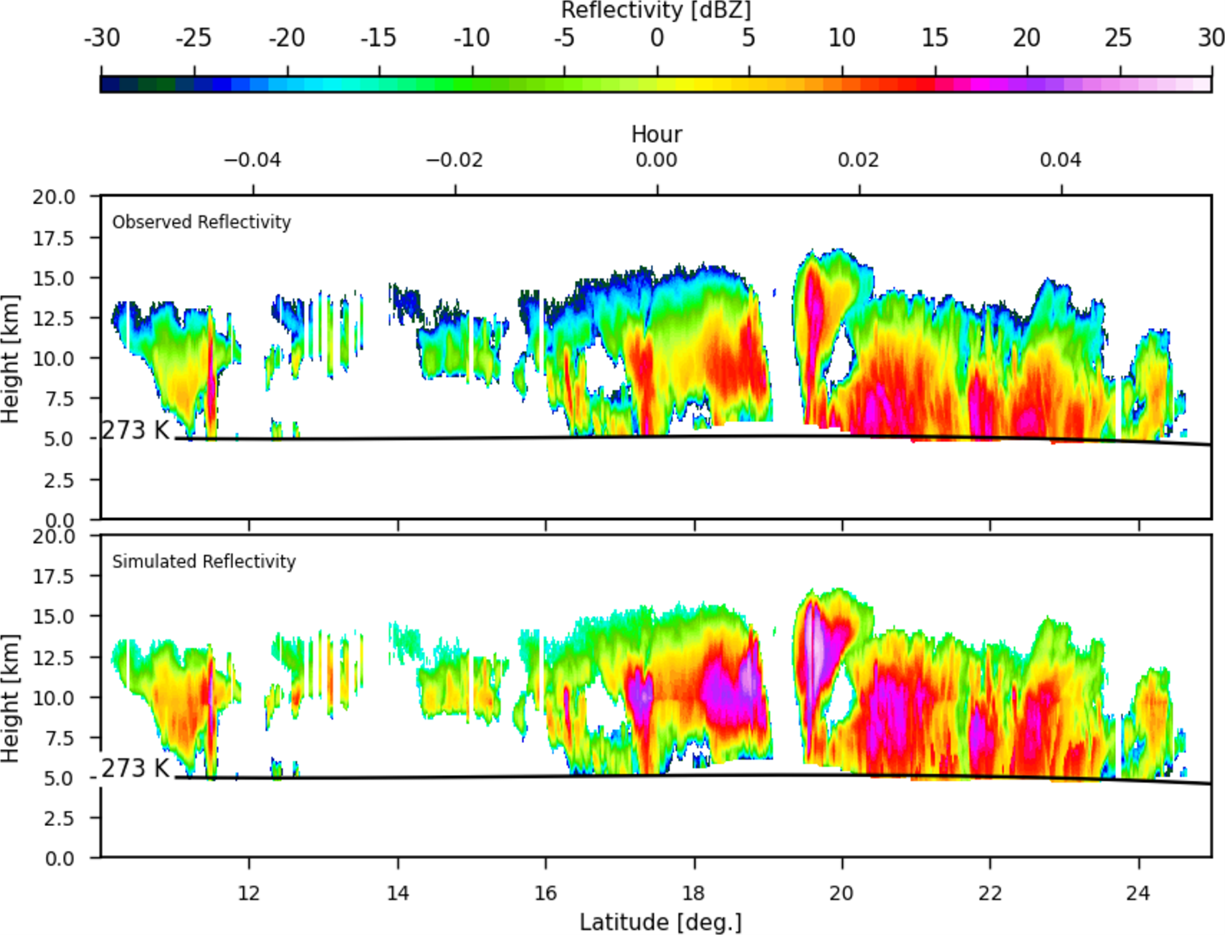
Left: An example of a transect of the oil rig pictured above;
Right: The Gaussian plume model fitting in with estimation of CH4 emissions “Q” equaling 200 kg/hr. Note: all the data shown in this highlight is still a draft version of the data.
Though results are still preliminary, the researchers found that emissions inventories suggest that platforms located in shallow water are mainly responsible for methane emissions, while deep-water platforms primarily emit nitrogen dioxide and carbon dioxide (CO2). A much more detailed analysis of the whole cruise will be published soon.
The recent campaign was supported with the Airborne Visible/Infrared Imaging Spectrometer 3 (AVIRIS-3) manned by scientific crew from NASA Jet Propulsion Laboratory (JPL) as well as by a few satellite products from GHGSat, a recently established Montreal-based private company that specializes in localized CH4 emissions detection from space.
The other scientists on board included the lead Ryan Stauffer (NASA Goddard), Anne Thompson (NASA Goddard Emeritus/UMBC), Niko Fedkin (NASA Goddard), Martin Cadirola (EcoTronics), Joshua Richards (UMBC), and Jonathan Gallegos (SciGlob). Additionally, Debra Kollonige (NASA Goddard/SSAI) supported the group by providing daily weather and chemistry forecasts.
")