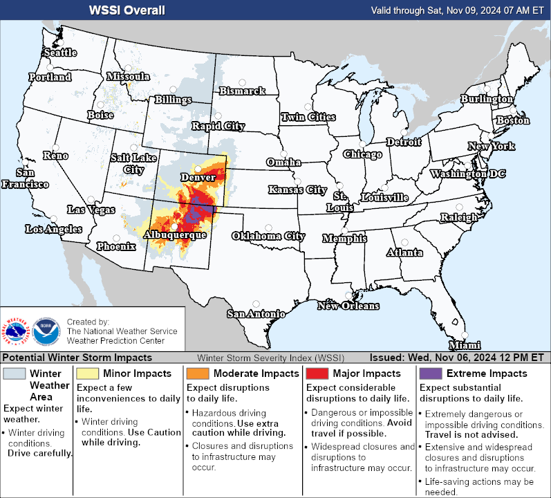
The central and southern Rockies were met with a taste of Winter last week, including a dumping of snow. The NWS Weather Prediction Center (WPC) Day 3 Winter Storm Severity Index (WSSI) on 06 November 2024 highlighted ‘Extreme Impacts’ for parts of northern New Mexico and southern Colorado, ending 1200 UTC 09 November 2024. Winter Storm Watches were posted for cities like Denver by early in the morning of 07 November for the potential of ‘Total snow accumulations up to 10 inches’.
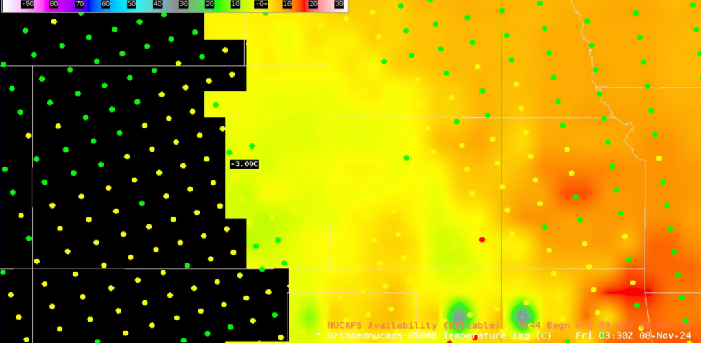
Late in the evening of 07 November 2024, gridded NUCAPS confirmed that 850 mb temperatures were indeed cold enough for snow, with temperatures a few degrees below 0 degrees Celsius. NUCAPS Sounding Availability was overlaid to show the quality of the data, with good-quality data (green dots) available across eastern Colorado.
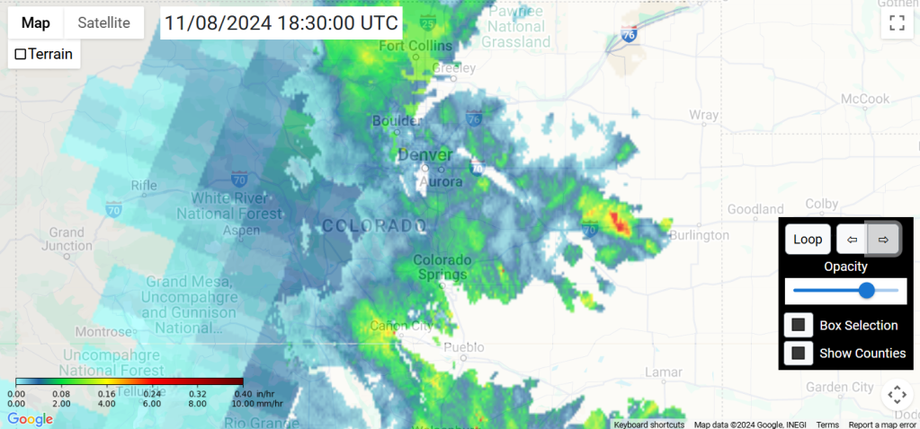
By late morning on 08 November 2024, snow had overspread much of the Colorado Front Range and Rockies, as shown by the Merged Snowfall Rate (mSFR) product. Multi Radar Multi Sensor (MRMS) data showed widespread liquid-equivalent snowfall rates around 0.10″/hour across easetern Colorado, with passive-microwave satellite providing slightly light snowfall rates over the higher elevations to the west. The Rockies were expected to receive slightly less snow than the Front Range from this Winter storm, with places like Breckenridge under a Winter Weather Advisory.
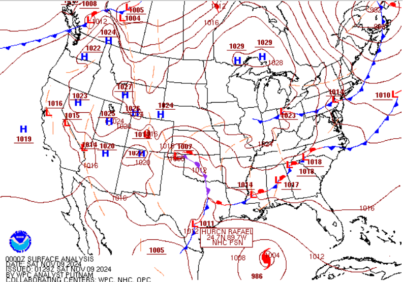
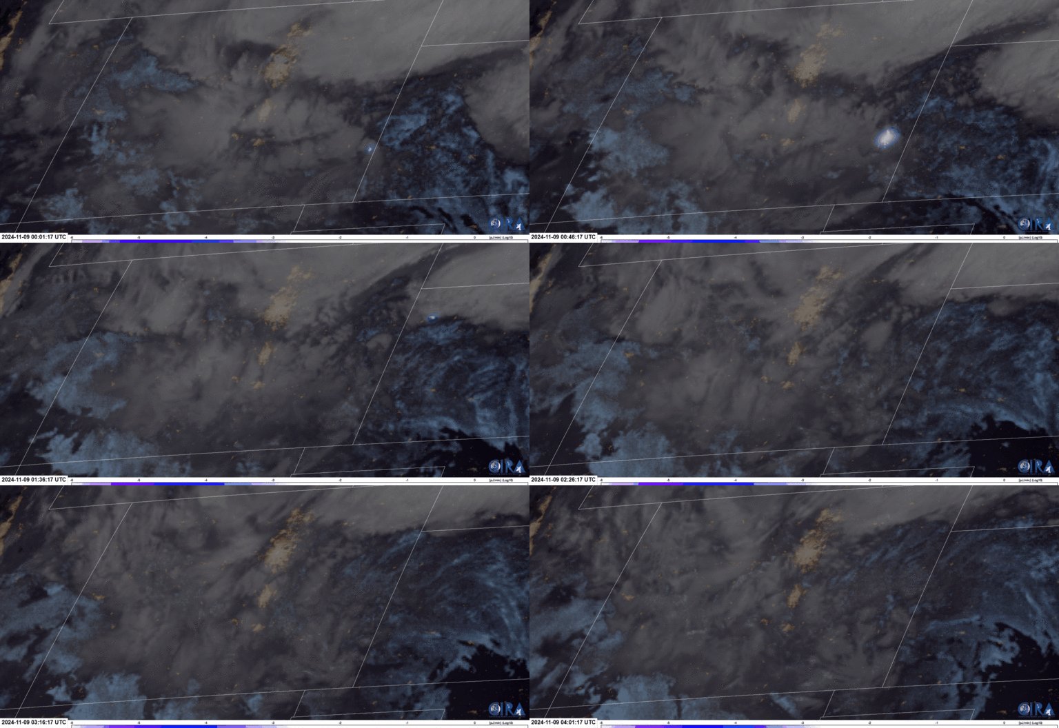
WPC’s Probabilistic Heavy Snow and Icing Discussion in the AM of 08 November, highlighted the dynamic setup, with ‘surface low development over Texas’ leading to ‘the potential for upright convection’ Friday afternoon and evening across far northeastern NM into eastern CO. Well enough, at 0000 UTC 09 November 2024, WPC Surface Analysis had a 1007 mb low pressure over the Texas Panhandle, and GOES-East GeoColor imagery overlaid with GLM Group Energy Density from ~0000 UTC to ~0400 UTC 09 November 2024, confirmed thundersnow was ongoing across parts of Colorado.
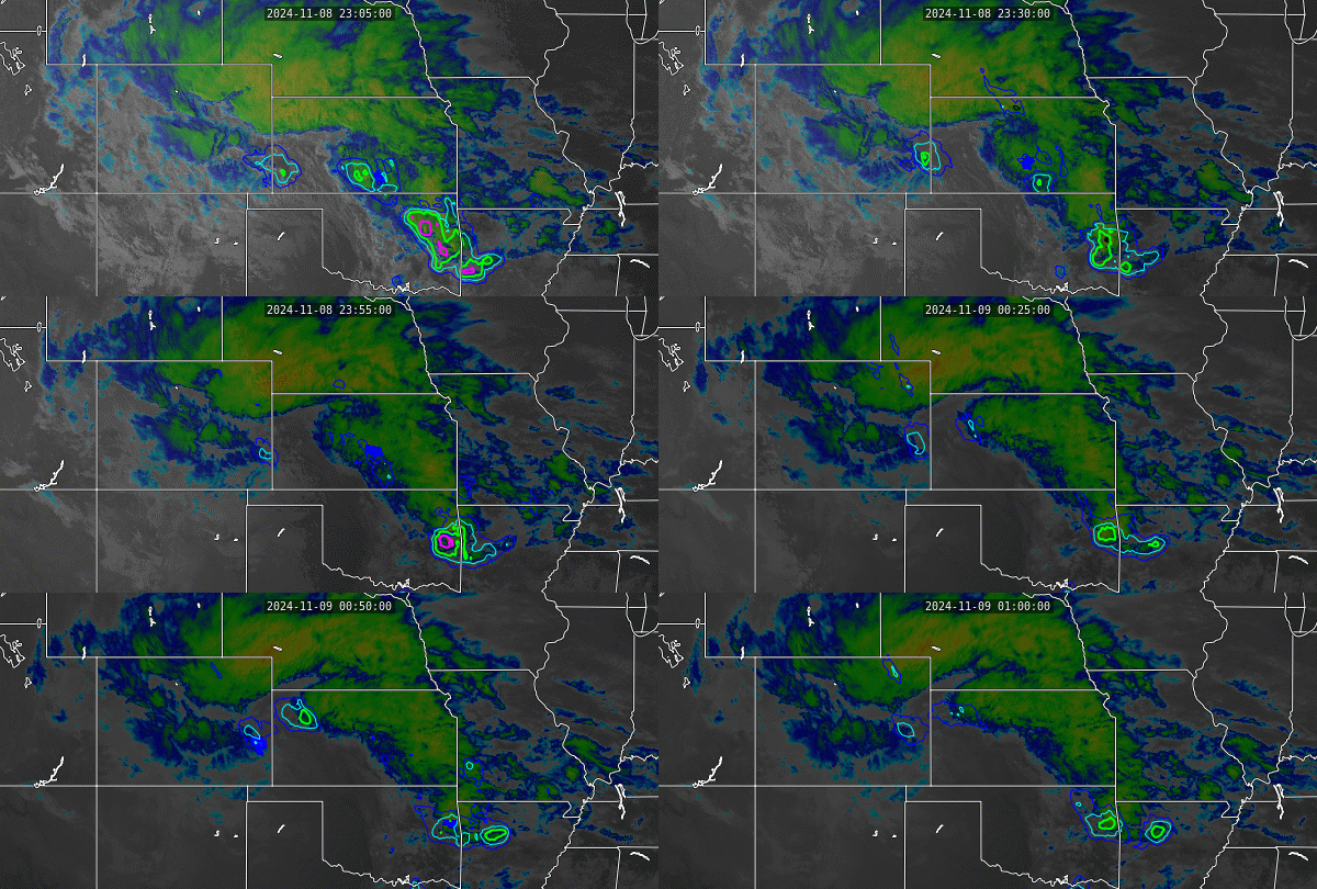
From ~2305 UTC 08 November to ~0100 UTC 09 November 2024, LightningCast had 25 to 50 percent contours leading up to the GLM FED signal in southeast CO, accurately predicting the threat for lightning. The product struggled a bit further north underneath thick, cold clouds, with low probabilities yielding no lightning, though LightningCast is known to have more limitations in these cold-season scenarios.
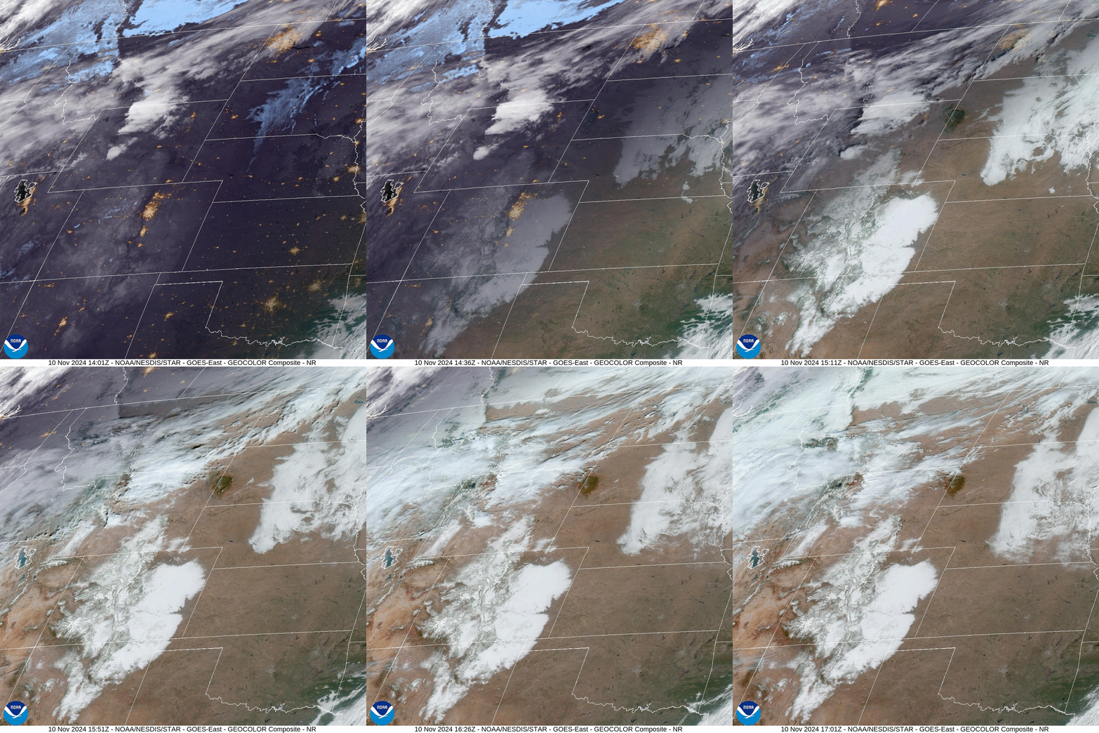
During the morning of 10 November 2024, GOES-East Geocolor imagery captured the fresh snowpack from New Mexico to south-central Wyoming, with clear skies overhead.
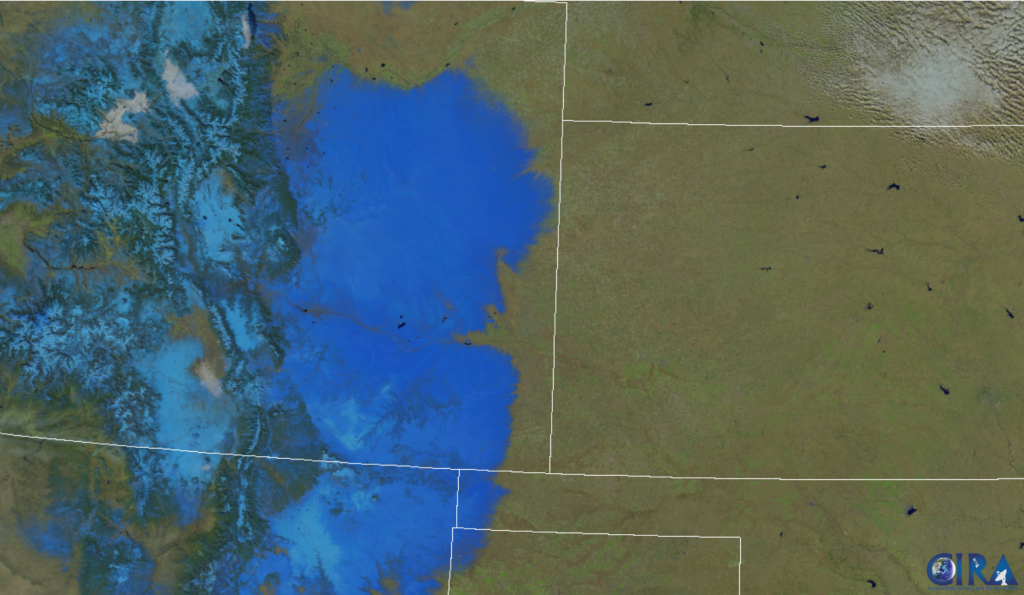
The VIIRS Snowmelt RGB heavily relies on the 1.24 um, Cloud Particle Size band, with fresh snow offering more solar reflectance. In the RGB, dark blues represent wet, more compact snow, whereas light blues represent fresher snow. Dark blues are seen across the CO Front Range, where temperatures spiked into the upper 40s, leading to melting snow, whereas temperatures in the Rockies were colder in the 30s.
