The Famine Early Warning Systems Network (FEWS NET) is teaming up with ReliefWeb to share its latest analyses, data, and resources related to the world’s most pressing food emergencies. FEWS NET’s latest reporting on global food security is available via ReliefWeb updates.
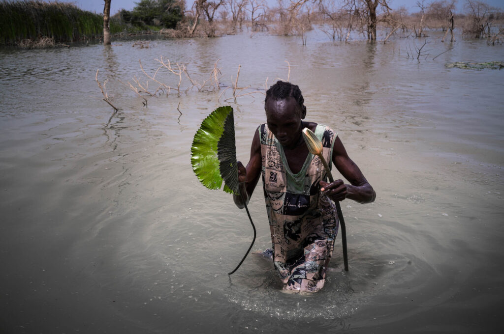
Extreme seasonal flooding in South Sudan is expected to persist through November, leaving devastation in its wake. While floods pose great threats to people’s lives and livelihoods, early warning systems can help communities prepare while activating humanitarian response plans before the worst impacts are realized.
South Sudan’s central wetlands typically experience seasonal fluctuations. However, recent years have seen above-average rainfall and rising lake levels, leading to more extensive flooding. Ongoing conflict, complex flow patterns in low-lying areas, and limited hydrological data have made typical flood forecasting methods difficult to implement.
The Famine Early Warning Systems Network (FEWS NET), which monitors extreme climate and weather events in its monthly food security analyses, recently curated a set of established technologies to overcome these obstacles and provide accurate flood forecasts for South Sudan.
FEWS NET scientists with the United States Geological Survey (USGS) and NASA Goddard Space Flight Center (GSFC) developed a novel approach to forecast floods three to six months in advance.
In May 2024, FEWS NET warned of severe flooding in South Sudan from June through November, driven by expected above-average La Niña rainfall and exacerbated by the outflow of large volumes of water from Lake Victoria beginning in early May.
“In the middle of a cropping season, a flood can suddenly come and destroy everything,” USGS Geographer Dr. Shahriar Pervez said. “Farmers lose a source of income that they were counting on.”
Despite the anticipated La Niña not yet emerging, these flood forecasts became a grim reality as a sharp rise in flooding occurred from August to September in central and northern regions of South Sudan.
In a September Alert, FEWS NET reported that over 65,000 people across South Sudan were displaced by extreme flooding that caused widespread damage to homes, critical infrastructure, crop fields, and livelihoods. The disruption of essential health services also increased the risk of disease outbreaks in flood-prone areas.
According to the latest United Nations Office for the Coordination of Humanitarian Affairs (UNOCHA) field assessments, an estimated 1.3 million people were affected by flooding in October, and 327,000 people were displaced. By the end of October 2024, the Food and Agriculture Organization of the United Nations (FAO) estimated that 75,000 hectares of cropland had been impacted by flooding, with an associated crop loss of 72,500 tons.
Satellite imagery shows that the current flood extent is similar to the same period in 2022, and FEWS NET scientists anticipate the floods to persist into November, although at a diminishing level.
Because of technological advancements, including more available satellites, FEWS NET scientists expect to enhance already robust flood monitoring and analysis efforts and improve flood prediction models.
“This is a very data-sparse part of the world,” University of Maryland/NASA Associate Research Scientist Dr. Kimberly Slinski said. “So satellite data is crucial to our analysis. As the technology evolves and new satellite datasets become available, we’ll be able to improve the skill of our predictions.”
FEWS NET scientists assess flood conditions using cutting-edge tools to map where flood impacts are likely to occur and estimate the number of people who will be affected. This work involves reviewing rainfall conditions recorded over 30 years and assessing forecasts for the next six months. The data are then plugged into computer models to estimate the extent of water expected to spread across the landscape.
Next, scientists review historical flood maps and use NASA satellites, including the Visible Infrared Imaging Radiometer Suite (VIIRS) and Landsat, to see where the water might go. These satellites provide a snapshot of flood conditions, with VIIRS offering broader ground coverage and Landsat capturing finer details. USGS scientists use these satellite images to create a history of monthly maps showing flood conditions to analyze the frequency of flooding throughout the region.
NASA scientists use statistical models, like the Least Absolute Shrinkage and Selection Operator (LASSO), to analyze a range of variables, including rainfall and runoff conditions, to produce skillful forecasts of flood severity over the next six months.
USGS then incorporates these flood calculations into a geographic data model to forecast the extent of flooded areas based on the past frequency of flooding, current conditions, and those regions most at risk.
“The frequency map is crucial to the analysis because when combined with maps of population centers, cropland, and infrastructure, it can help identify critical areas at high risk of flooding,” Slinski explained.
FEWS NET scientists share their analyses of flood impacts with the South Sudan Floods Hydrological Forecast Technical Working Group (TWG). This group includes organizations such as UNOCHA, the World Food Programme (WFP) Earth Observations and Climate team, and the USAID mission in South Sudan.
The TWG, in turn, provides critical insights to the South Sudan Flood Task Force. Led by the Ministry of Humanitarian Assistance and OCHA, this task force comprises members from the UN and various non-governmental organizations who coordinate and implement life-saving flood response efforts in South Sudan.
“That’s the main goal at the end of the day,” Pervez said. “We need to save people’s livelihoods on the ground and determine how we can do that in an improved and timely manner.”
FEWS NET will continue to monitor floods in South Sudan. Subscribe to FEWS NET updates to receive agroclimatology and food security forecasts directly in your inbox, and follow FEWS NET on X, Facebook, and LinkedIn for the latest updates.


