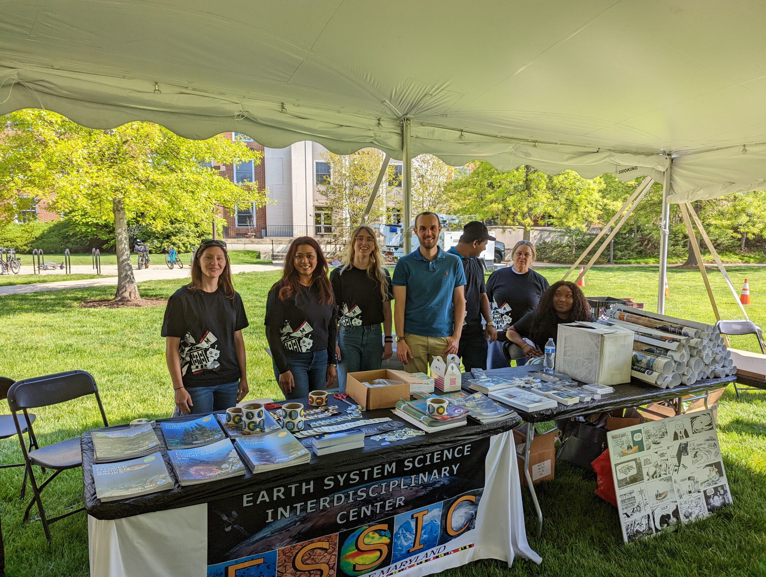
ESSIC Celebrates Maryland Day 2022
On Saturday, April 30, ESSIC faculty and staff gathered to celebrate Maryland Day, the University of Maryland’s largest community outreach event! This was the first
")
On Saturday, April 30, ESSIC faculty and staff gathered to celebrate Maryland Day, the University of Maryland’s largest community outreach event! This was the first
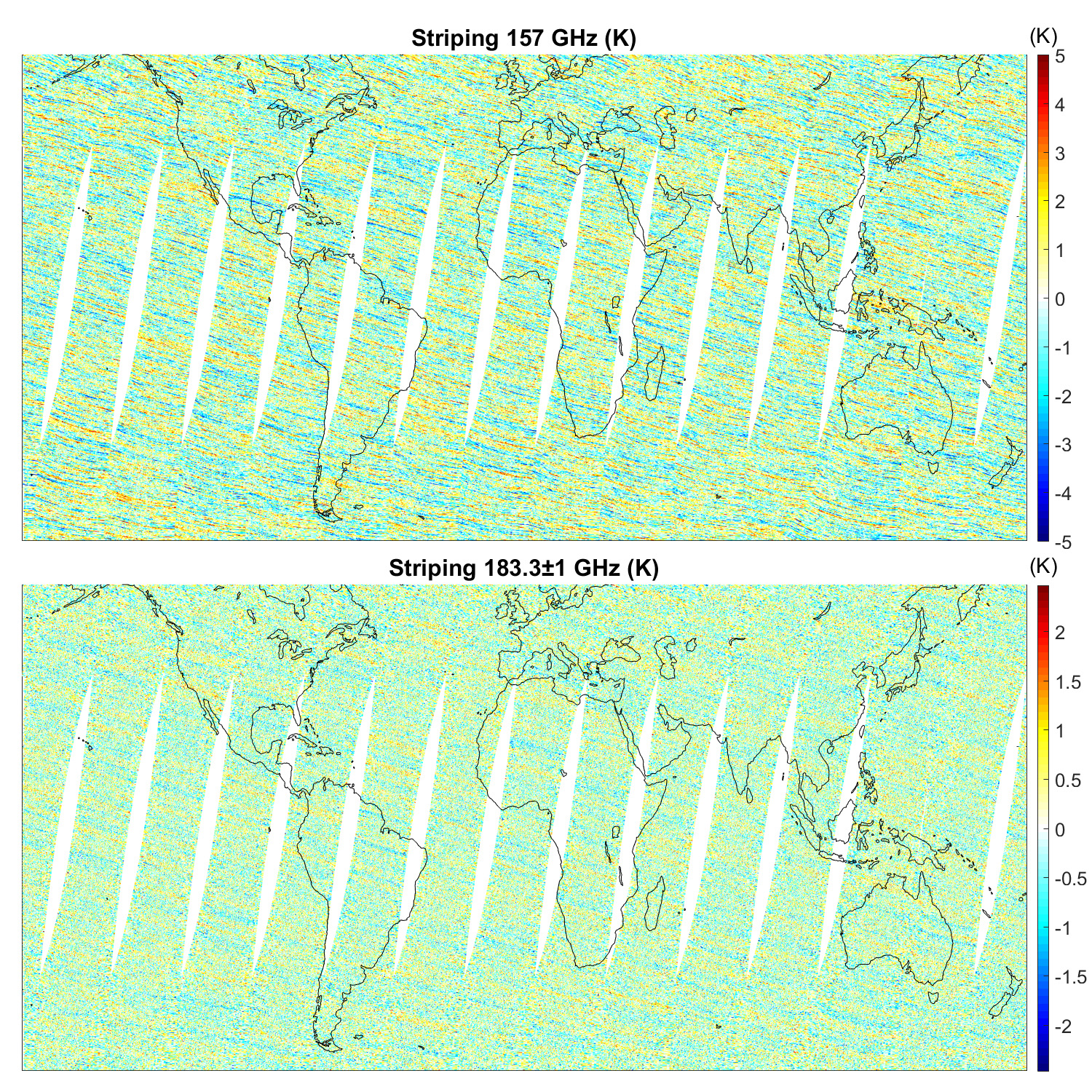
ESSIC/CISESS scientists John Xun Yang, Yalei You, and Rachael Kroodsma are co-authors on a new paper in IEEE Transactions on Geoscience and Remote Sensing alongside Sidharth Misra from NASA Jet Propulsion Laboratory and William Blackwell from MIT Lincoln Laboratory. Blackwell is also a two-time speaker for the ESSIC Seminar Series, the most recent of which can be viewed here.
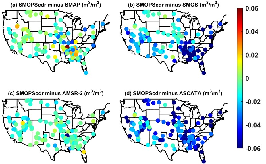
ESSIC/CISESS Scientists Jifu Yin, Jicheng Liu and Ralph Ferraro published a new article last month that discussed their work with NOAA’s Soil Moisture Operational Product System (SMOPS). SMOPS is developed by National Oceanic and Atmospheric Administration (NOAA) to provide the real time blended soil moisture (SM) for Numeric Weather Prediction and National Water Model applications.
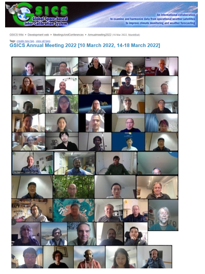
The 2022 Annual Global Space-based Inter-Calibration System (GSICS) meeting was successfully held online on 10 March 2022 and 14 – 18 March 2022. Dr. Fangfang Yu, ESSIC/CISESS Associate Research Scientist and new presiding chair of the GSICS Research Working Group (GRWG), led the effort to organize the meeting with the help of the GSICS Coordination Center (GCC) and GRWG members.
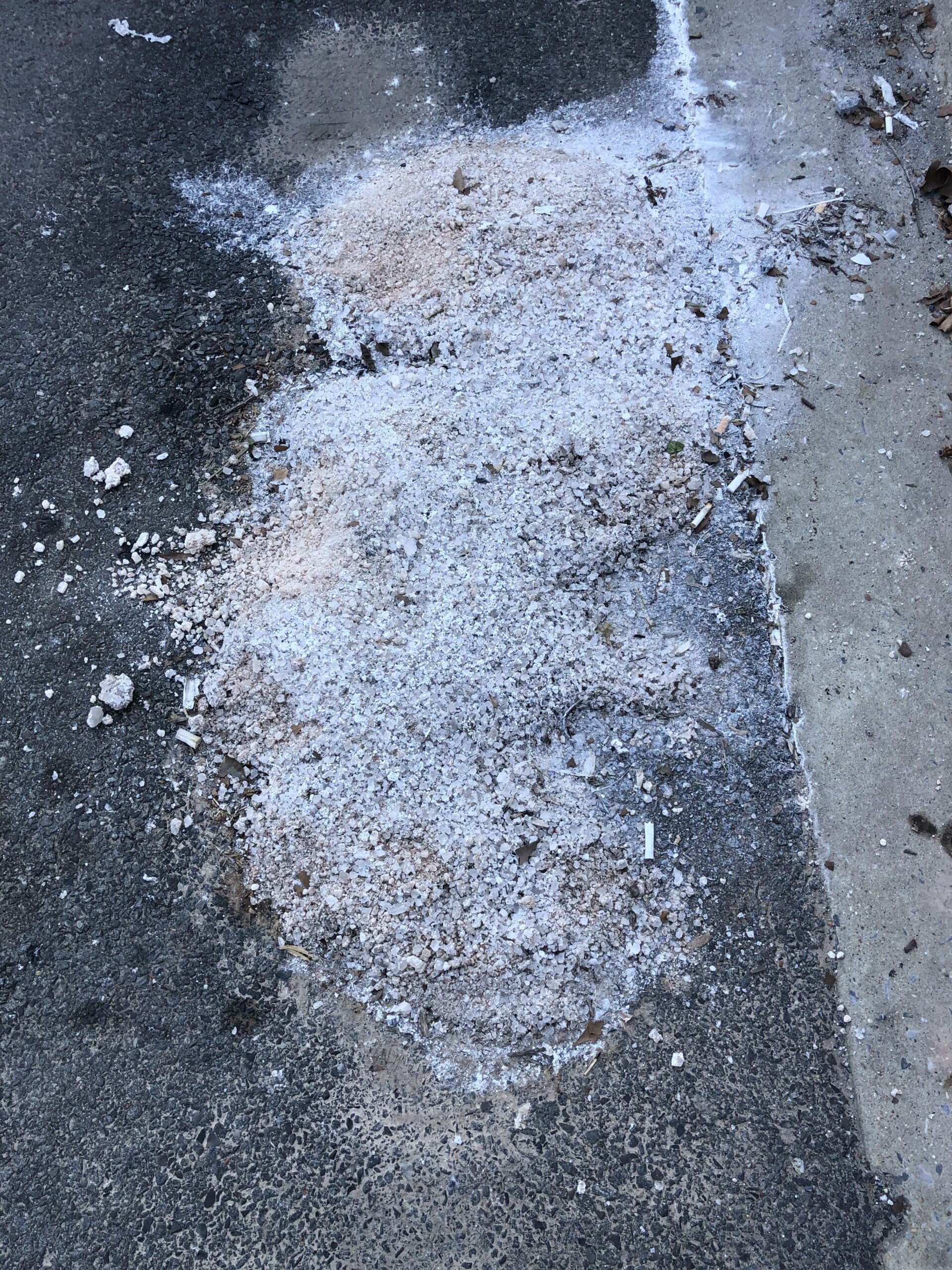
The road salt that makes your drive to work easier on snowy days may be damaging the water quality in local rivers and streams long after winter is over.
ESSIC/CISESS Post-doctoral Associate Daile Zhang has written an article on the legacy of lightning and thunder gods in Chinese history that is featured in this month’s issue of Weatherwise.
The Microwave Integrated Retrieval System (MiRS) Science Team has published a paper in IEEE Journal on Selected Topics in Applied Earth Observations and Remote Sensing (JSTARS) titled “Improvement of MiRS Sea Surface Temperature Retrievals Using a Machine Learning Approach”.
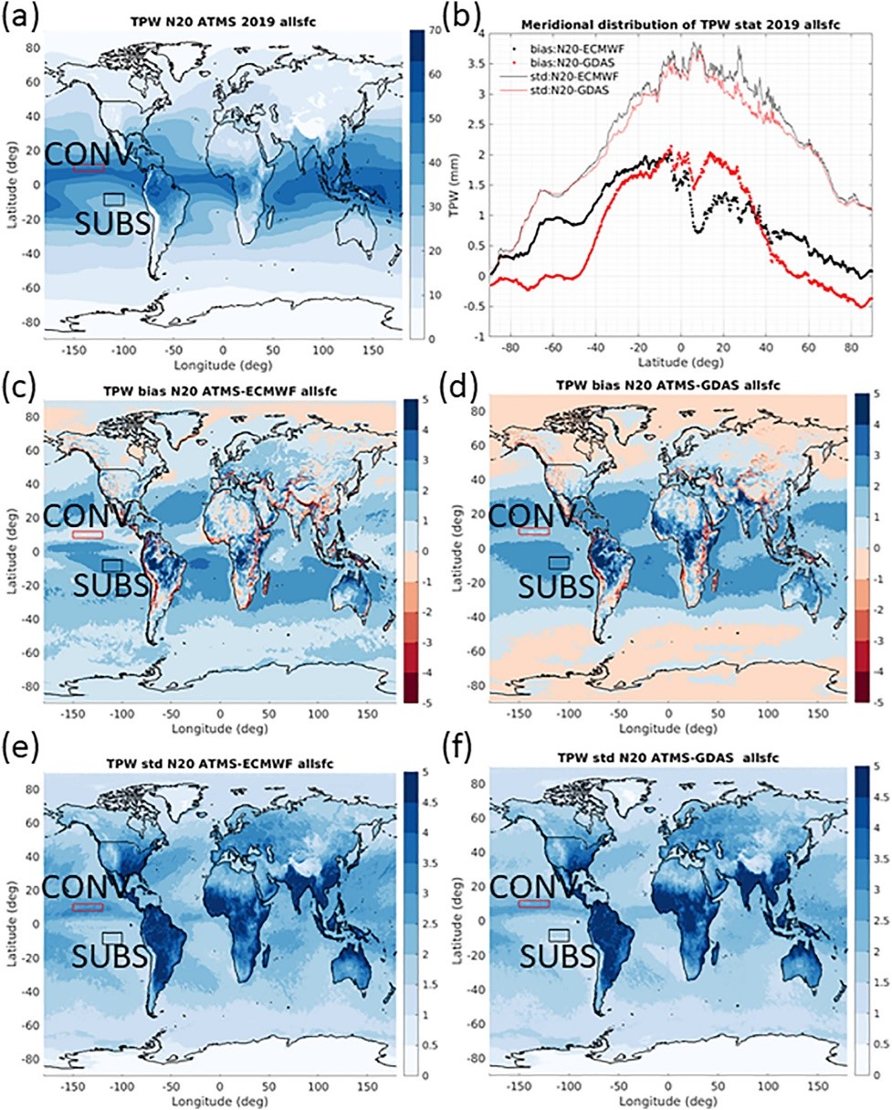
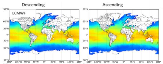
The MiRS Science Team, composed of ESSIC/CISESS scientists Yong-Keun Lee and Christopher Grassotti, as well as NOAA STAR scientist Mark Liu, published a paper this week titled “In‐Depth Evaluation of MiRS Total Precipitable Water From NOAA‐20 ATMS Using Multiple Reference Data Sets” in Earth and Space Science. Lee was the first author of the study.
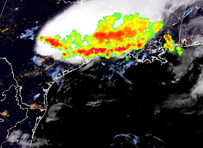
The ESSIC/CISESS Geostationary Lightning Team team, which includes Scott Rudlosky and Daile Zhang, have released a new ArcGIS Story Map via the NOAA GeoPlatform titled “Longest Lightning Flash Ever?”. This website provides stunning visualizations of a recently documented world record flash that covered a horizontal distance of 768 km (477.2 miles) on April 29, 2020. This is equivalent to the distance between New York City and Columbus, Ohio. This flash was recently certified as the longest single flash world record, as covered in an ESSIC press release.
The American Meteorological Society (AMS) Annual Meeting was held virtually this year from January 23 to 27. Simultaneously, AMS held a number of specialized conferences and symposiums, focusing on topics including hydrology, climate variability and change, and atmospheric chemistry. ESSIC/CISESS scientists contributed a large number of talks and posters at the event. Talks included: