Portions of Western Alaska were devastated over the weekend as a hurricane-force low with connection to ex-Typhoon Halong struck the state as a hurricane-force low, bringing intense winds and storm surge. The NWS Weather Prediction Center (WPC) Alaska Extended Forecast Discussion on October 5th, nearly a week before impacts, noted a ‘potentially deepened extratropical low should have favorable upper support and connection to Halong. The approach offers an ample maritime threat and may then prove impactful from Southwest Alaska through the Alaskan southern tier’.
Four days prior to the event, the NWS Ocean Prediction Center (OPC) forecasted a hurricane-force low in the Bering Sea, valid at 1200 UTC 12 October 2025. Indeed, 96 hours later, a hurricane-force low was barreling down on western Alaska.
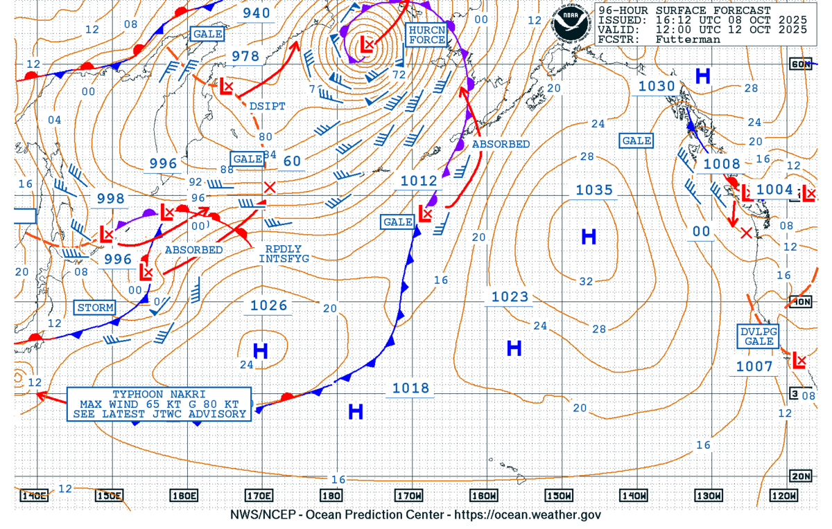
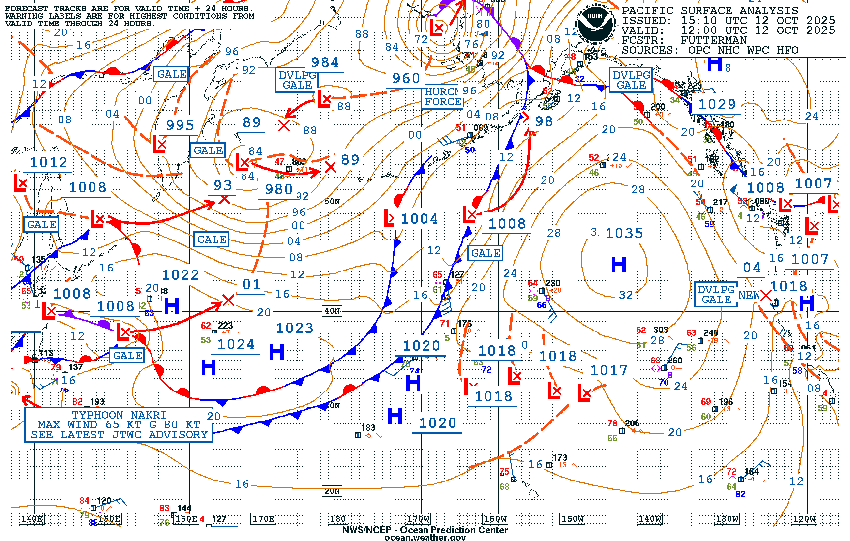
Figure 2: NWS OPC 96-Hour Surface Forecast (left) issued at 1612 UTC 08 October and the Pacific Surface Analysis (right), valid at 1200 UTC 12 October 2025.
GOES-West Air Mass RGB imagery showed a trailing shortwave trough becoming immersed with the larger low pressure system from 1200 UTC 11 October to 1200 UTC 12 October 2025, resulting in the extratropical cyclone strengthening from storm to hurricane-force. High levels of potential vorticity can be seen wrapping into the system with the bright orange and red colors in the imagery. The low pressure in the western Bering Sea that slowly stretches out and becomes elongated by the end of the animation is associated with ex-Typhoon Halong.
Figure 3: GOES-West Full Disk 10-minute Air Mass RGB imagery from 1200 UTC 11 October to 1200 UTC 12 October 2025. Credit: NESDIS/STAR
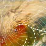
Geocolor imagery for the same timeframe also provided a look as the low pressure system raced towards western Alaska, with a brief period of mid-autumn daylight. A classic “baroclinic leaf” structure can be identified early in the animation before a well-defined occlusion develops by the end.
Figure 4: GOES-West Full Disk Geocolor imagery from 1200 UTC 11 October to 1200 UTC 12 October 2025. Credit: NESDIS/STAR
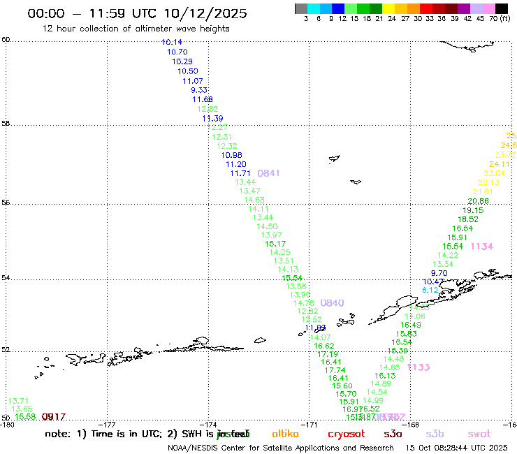
The intense storm system resulted in extremely dangerous maritime weather. Sentinel-3B altimeter significant wave height (the average height of the highest one-third of waves) observations topped 17 feet with the ~0840 UTC pass, while a SWOT altimeter pass a few hours later at ~1130 UTC 12 October 2025 had observations over 25 feet approaching southern Alaska.
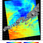
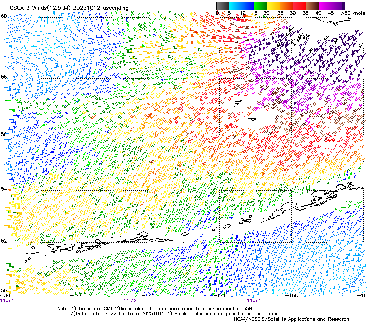
At nearly the exact time as the SWOT altimeter pass, the OSCAT-3 satellite provided a scatterometer pass across the same area. OSCAT-3 observed a large region with wind speeds in excess of 50 knots across Bristol Bay, with wind observations as high as 70 knots – making it easy to understand why such large wave heights were also observed.
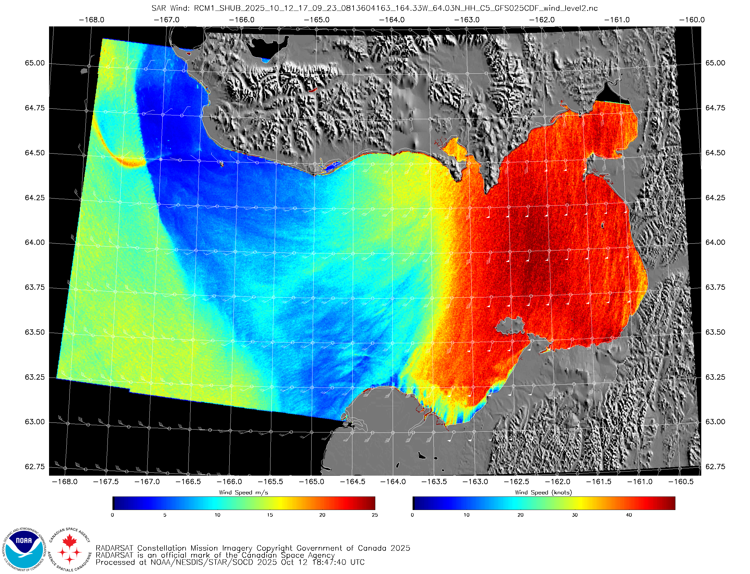
A Synthetic Aperture Radar (SAR) pass from RadarSat Constellation Mission -1 (RCM-1) at ~1710 UTC 12 October 2025 over the Norton Sound provided an impressive look at the wind field as the low pressure crashed ashore. Winds in the eastern quadrant were screaming out of the south up to 60 knots, while lighter winds could be seen near the circulation.
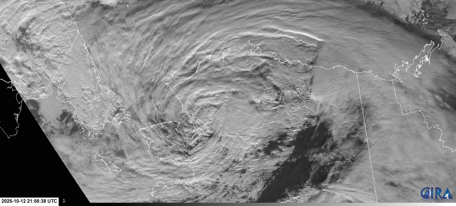
A few hours later, the extratropical cyclone was ashore even further north, just inland of Kotzebue Sound. JPSS/VIIRS Visible Imagery Band I1 at 0.64 micron provided a look at the system with 375-meter resolution.
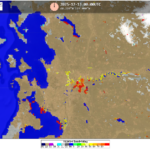
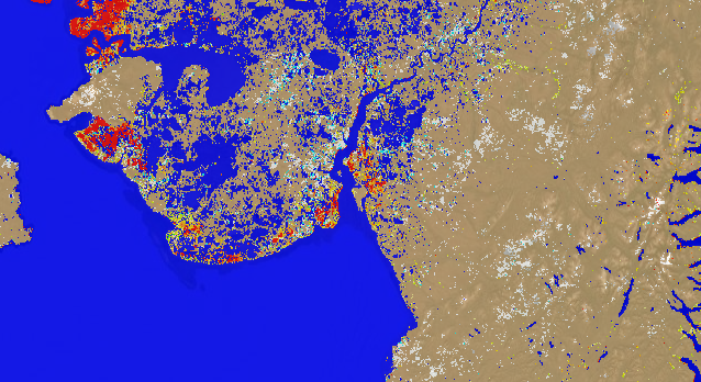
The powerful wind field drove water into many coastal communities across western Alaska. The Cooperative Institute for Meteorological Satellite Studies (CIMSS) VIIRS 5-day Flood Composite showed significant flooding with flood water fractions above 90 percent (bright red) across much of the shoreline, including communities like Kipnuk.
The system brought destructive wind gusts as high as 100 mph and record storm surge to communities like Kwigillingok.


