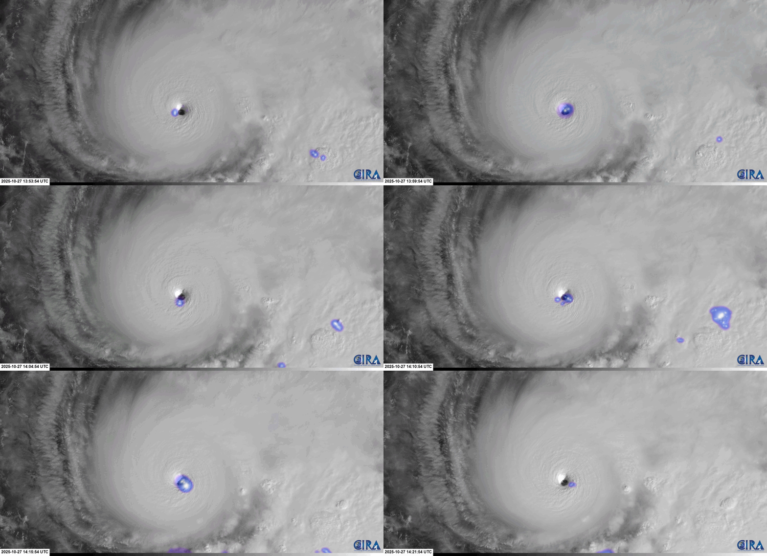
Category 5 Hurricane Melissa struck Jamaica on Wednesday as “one of the most powerful hurricane landfalls on record in the Atlantic Basin”, delivering a catastrophic blow to the island nation. GOES satellite imagery provided a continuous look at the evolving tropical cyclone as it traversed the Caribbean. Throughout its 35-hour life cycle as a Category 5 hurricane, ample lightning was observed in Melissa’s inner-core by the GOES Geostationary Lightning Mapper (GLM), especially prior to landfall. Mesosectors also provided 1-minute imagery for Melissa’s journey through the Caribbean. From ~1355 to ~1425 UTC 27 October 2025, GOES-East Mesosector imagery overlaid with the GLM Group Extent Density showed the lightning activity near the hurricane’s eyewall with high cloud-tops in the 0.5-km resolution Visible Band 2 imagery. At this time, Melissa had sustained winds of 160 mph and a minimum central presssure of 913 mb.
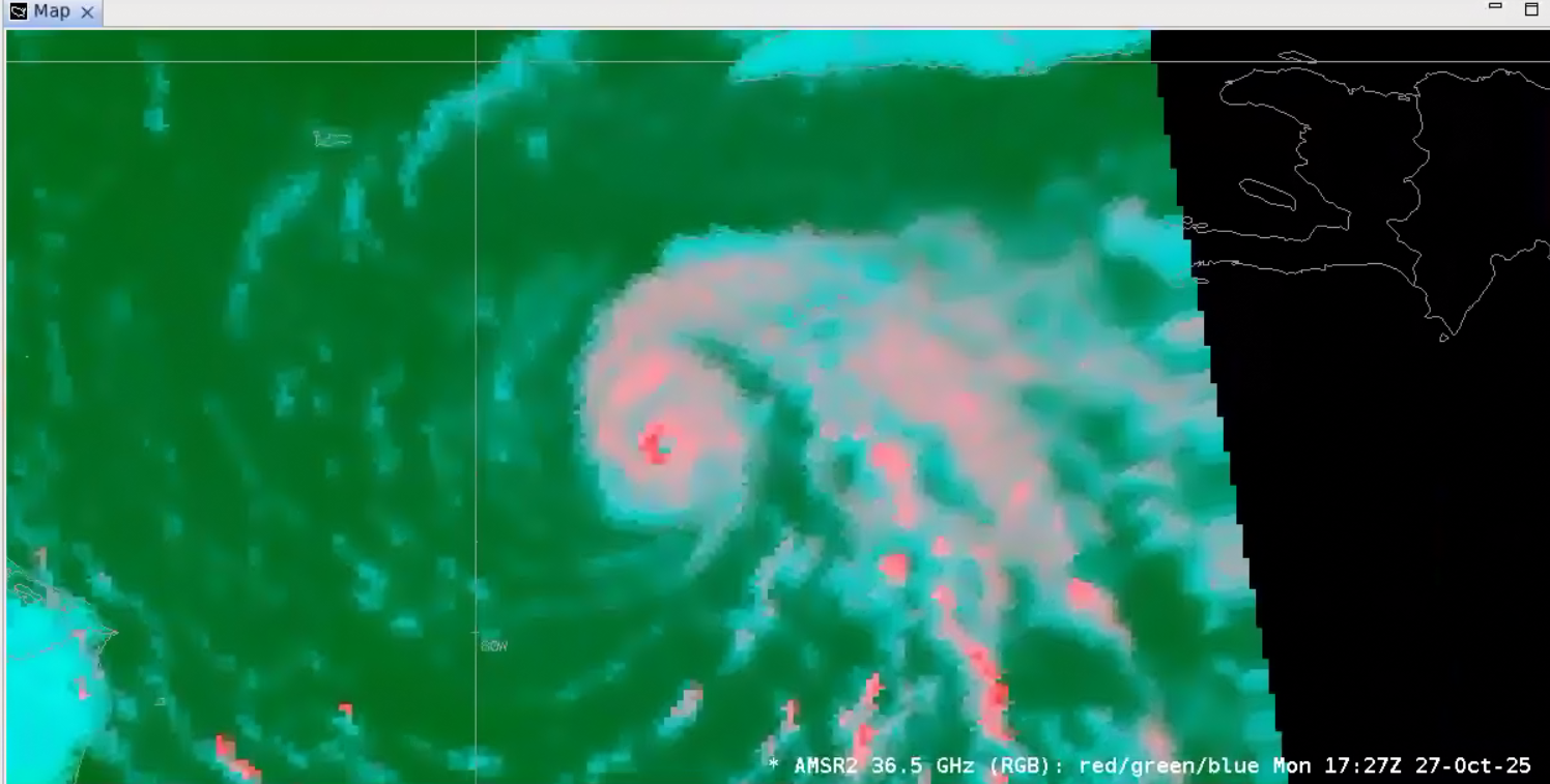
Over the next few hours, Hurricane Melissa continued to strengthen. A GCOM-W/AMSR2 microwave imager pass provided a look beneath the thick cloud canopy on the structure of the system. The 36.5 GHz imagery indicated a very intense core, especially in the western quadrant, which was upstream of light wind shear. Outerbands of convection are also seen stretching back towards Haiti.
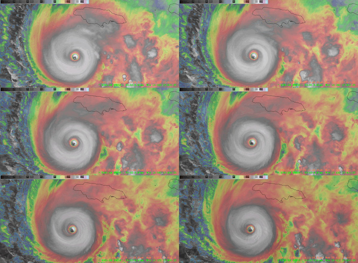
By the National Hurricane Center (NHC) advisory at 1800 UTC 27 October 2025, maximum sustained winds had reached 175 mph and the minimum central pressure had dropped to 906 mb. A Weather Prediction Center (WPC) forecaster created an alternative to the VIS/IR Sandwich RGB that’s found in AWIPS, overlaying the “Clean” Longwave Infrared Band 13 imagery over the Visible imagery, altering colorbars that create a lighter background than the traditional AWIPS VIS/IR Sandwich RGB. A large ring of cold cloud top temperatures can be seen rotating around the eye of the hurricane, where mesovortices are also found, as Melissa drifted westwards south of Jamaica.
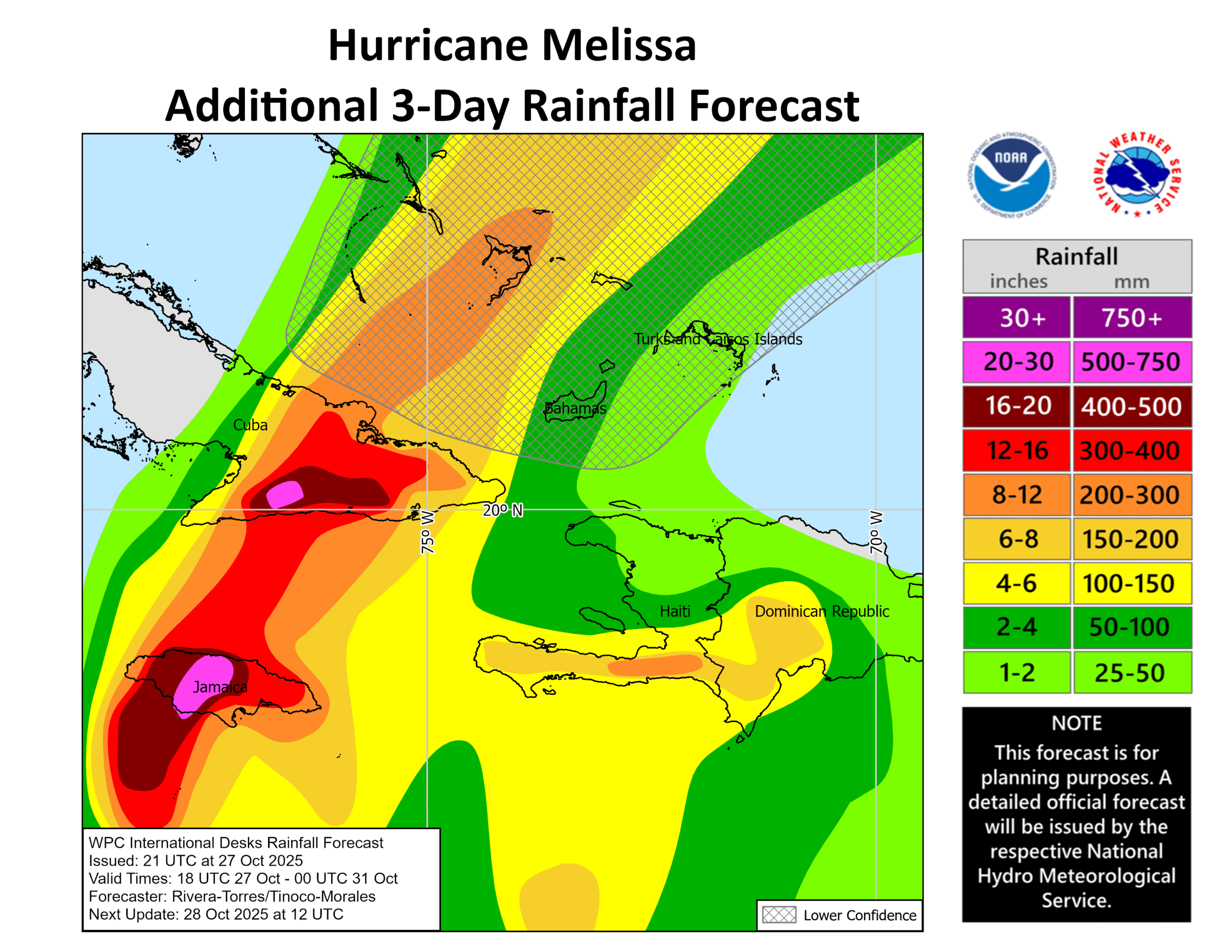
Melissa’s slow movement through the Caribbean meant that destructive winds and storm surge weren’t the only threats. Extremely heavy rain was forecasted by the WPC International Desks on the afternoon of 27 October 2025, with rainfall amounts up to 30″ across central Jamaica and southeastern Cuba.
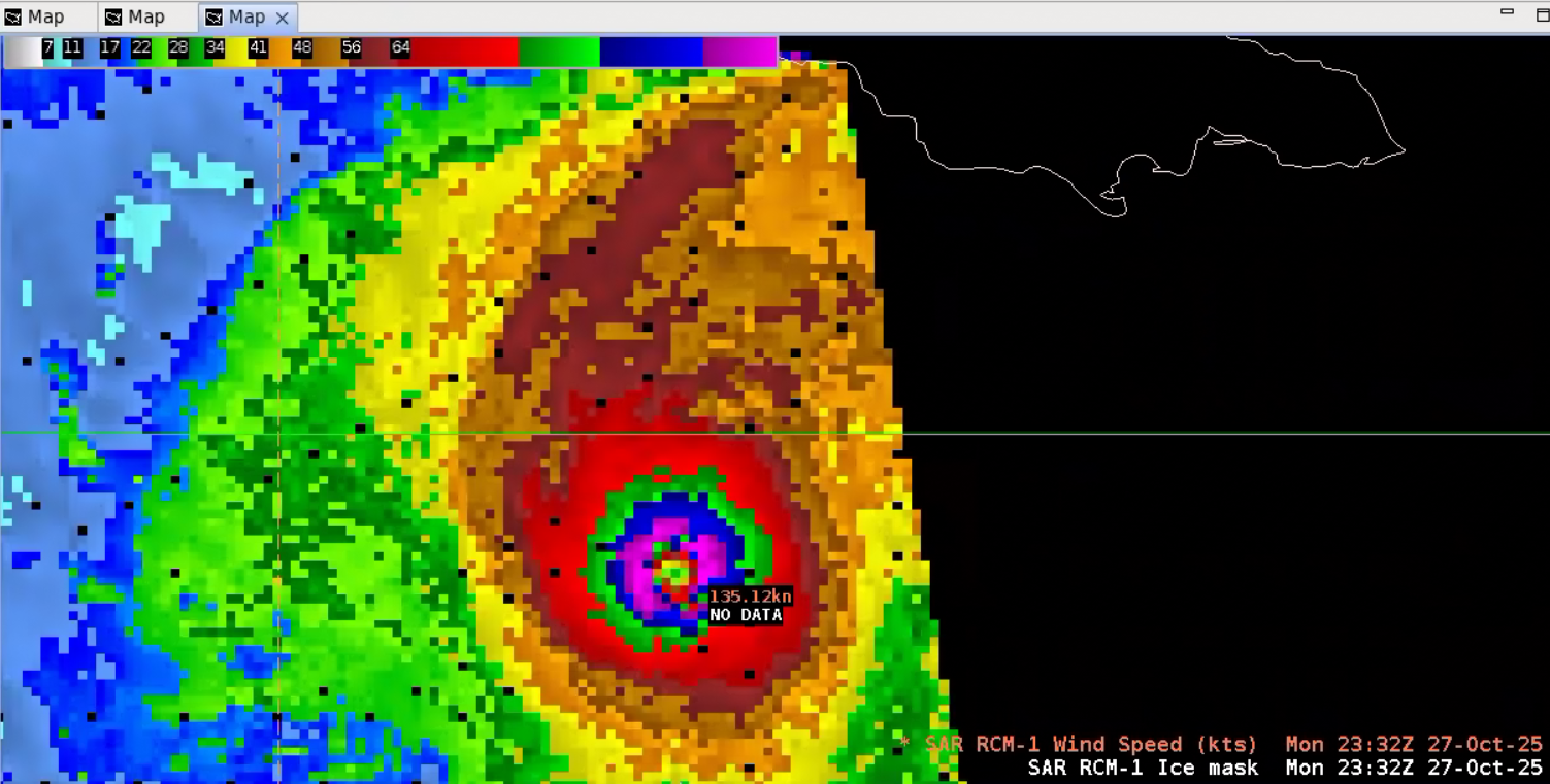
As the system inched northwestward, a Synthetic Aperture Radar (SAR) pass provided a look at the hurricane’s wind field. Scatterometer winds often become saturated and cannot record winds as extreme as those observed in tropical cyclones, however SAR can often observe much higher wind speeds. A Radar Constellation Mission RCM-1 SAR pass at ~2330 UTC 27 October 2025 was very noisy in AWIPS, but when sampling, wind speeds in excess of 135 knots, or 155 mph, nearly Category 5 strength, were observed. NESDIS/STAR provides a Tropical Cyclone Algorithm to adjust SAR Winds for hurricanes.
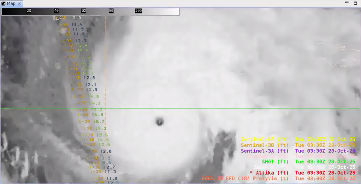
The intense wind field from Melissa also generated very dangerous waves. A Senintel-3B pass at ~0300 UTC 28 October 2025 observed significant wave heights as high as 17 feet on the edge of Melissa’s convective shield.
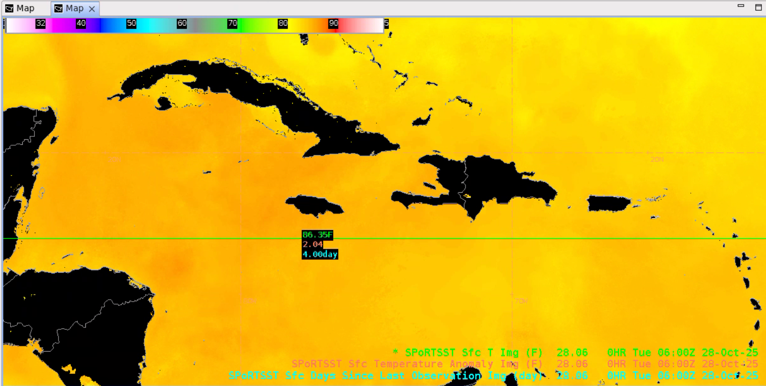
One reason for Melissa’s rapid intensification and long tenure as a Category 5 hurricane was the extremely warm sea surface temperatures (SSTs) found in the Caribbean. The NASA Short-term Prediction Research and Transition (SPoRT) Center’s SST Product observed SST values in excess of 86 degrees F.
Melissa took a unique track on its approach to Jamaica, drifting westward and looping southward before turning towards the north and slowly accelerating as it neared landfall. GOES-East Full Disk IR imagery showed that the hurricane remained well-organized with no eyewall replacement cycles as it moved along slowly.
Figure 8: GOES-East Full Disk 10-minute IR imagery as Hurricane Melissa inched towards Jamaica. This animation was created from AWIPS, and display files can be shared upon request.
In the GOES-East Mesosector Mid-Level Water Vapor Band 9 imagery, the very warm eye of the hurricane can be identified in an enviornment surrounding the center with moisture-rich air. Melissa was still strengthening as it began to turn north, with the minimum central pressure dropping to 901 mb by 1200 UTC 28 October 2025.
Figure 9: GOES-East Mesosector Mid-Level Water Vapor Band 9 imagery from ~0815 to ~1315 UTC 28 October 2025. This animation was created from AWIPS, and display files can be shared upon request.
Melissa made a devastating landfall in southwestern Jamaica near New Hope around 1700 UTC 28 October 2025 with maximum sustained winds of 185 mph and a minimum central pressure of 892 mb. GOES-East visible and infrared imagery provided a sustained view of the destructive hurricane as it moved ashore, maintaining its clear eye.
Figure 10: GOES-East CONUS Visible Band 2 imagery from ~1205 to ~1725 UTC 28 October 2025. This animation was created from AWIPS, and display files can be shared upon request.
Figure 11: GOES-East CONUS IR Band 13 imagery from ~1205 to ~1725 UTC 28 October 2025. This animation was created from AWIPS, and display files can be shared upon request.
Once Hurricane Melissa began pushing across Jamaica’s mountainous terrain, the system began to weaken and the clear eye quickly became obscured. Once re-emerging into the Caribbean, the eye appeared once again. Hurricane Melissa made a second landfall in southeastern Cuba as a major Category 3 hurricane with sustained winds of 120 mph and a minimum central pressure of 952 mb around 0710 UTC 29 October 2025. Hurricane Melissa then pushed through the southeastern Bahamas.
Figure 12: GOES-East Full Disk Proxyvis imagery from 1600 UTC 28 October to 1720 UTC 29 October 2025. This animation was created from AWIPS, and display files can be shared upon request.
Figure 13: GOES-East IR imagery from 1600 UTC 28 October to 1720 UTC 29 October 2025. This animation was created from AWIPS, and display files can be shared upon request.
The VIIRS Day-Night Band (0.7 um) captured widespread power outages, especially across western Jamaica, when comparing imagery from 0637 UTC 23 October to 0638 31 October 2025. Comparing passes under near clear-sky conditions makes it easy to see the reduced nighttime lights across the island.
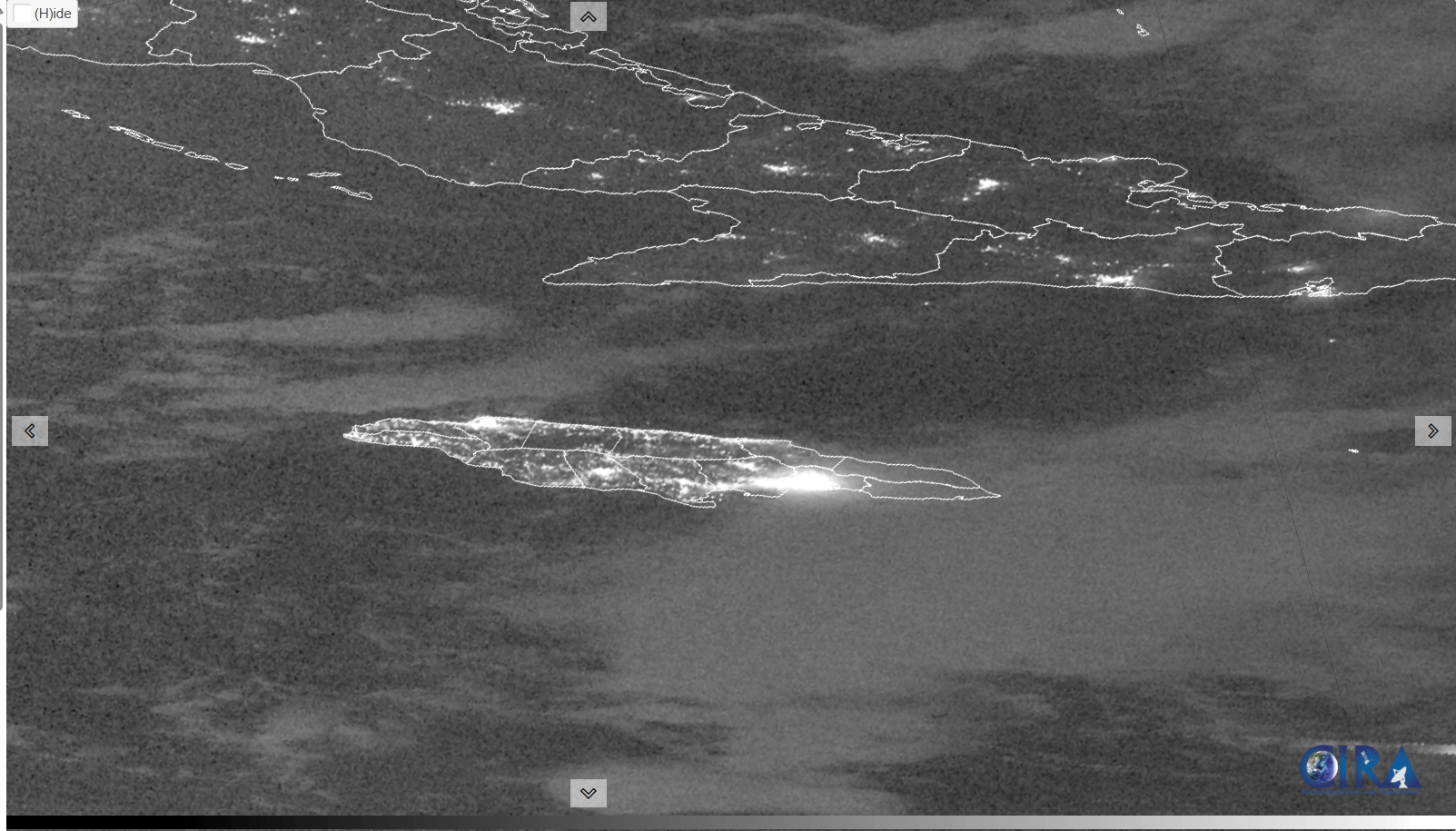
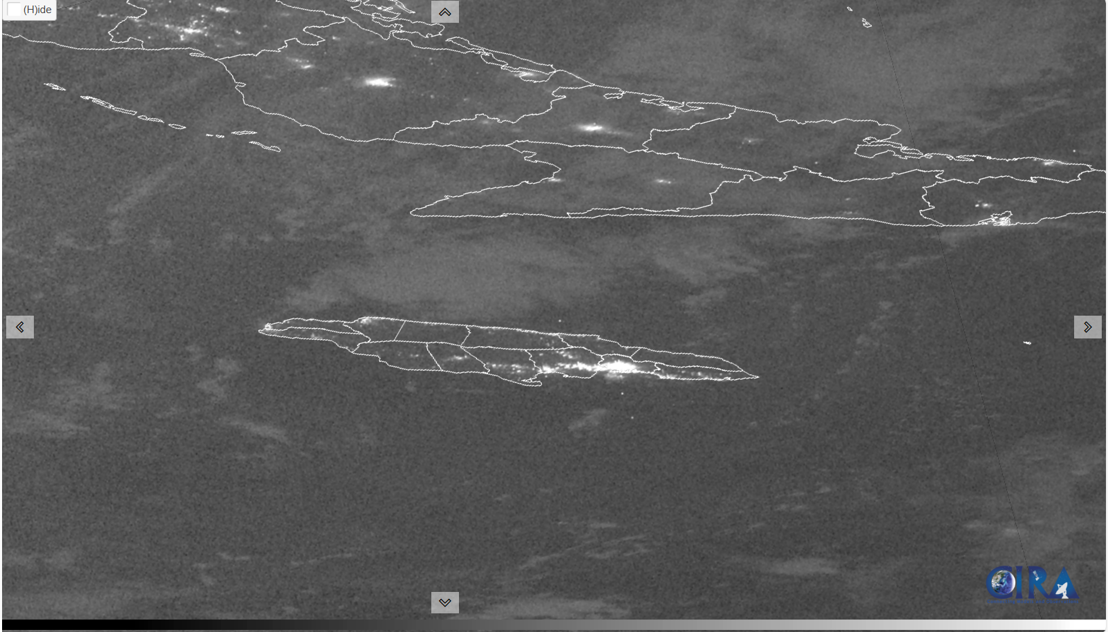
Figure 14: VIIRS Day-Night Band passes valid 0637 UTC 23 October 2025 (left) and 0638 UTC 31 October 2025 (right). From CIRA
In addition, Sentinel-2 10-m True Color imagery showed the change in vegetation and runoff near Melissa’s landfall. Clear blue waters and green vegetation on 23 October 2025 are replaced by turbid waters and browner vegetation by 30 October 2025, signaling significant runoff and potential loss of leaves and trees due to high winds.
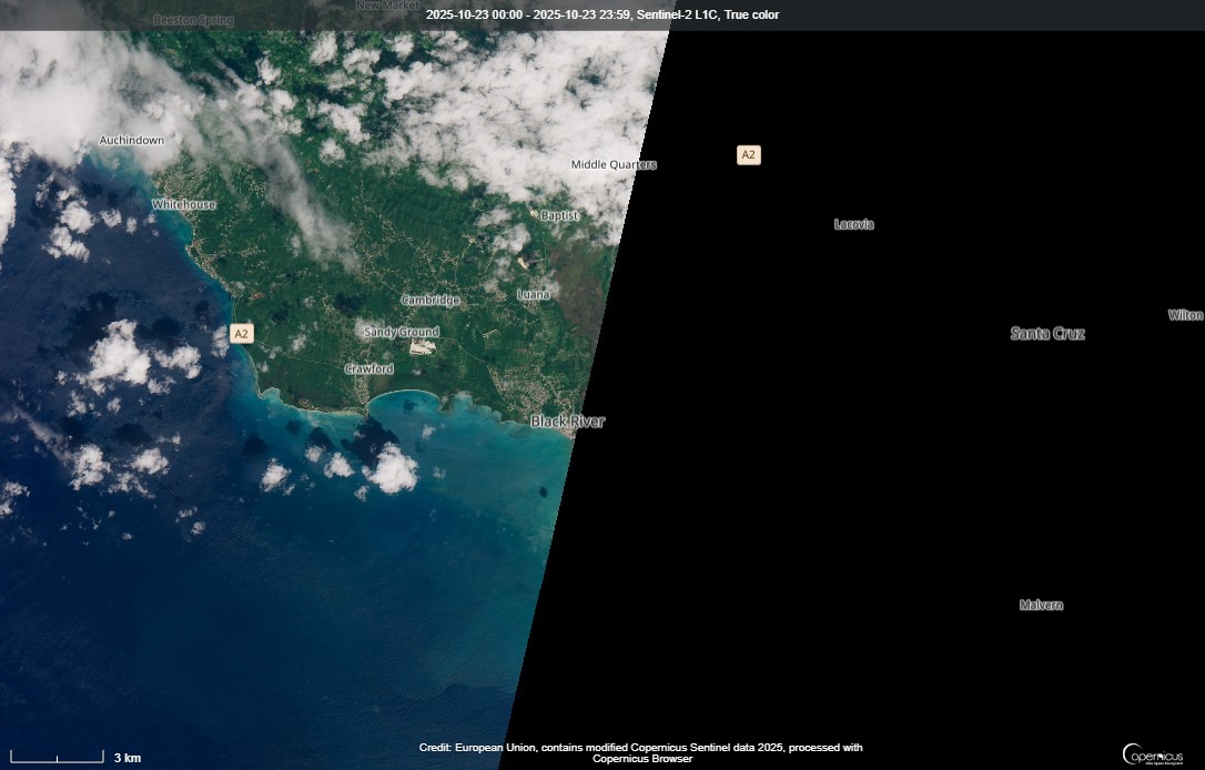
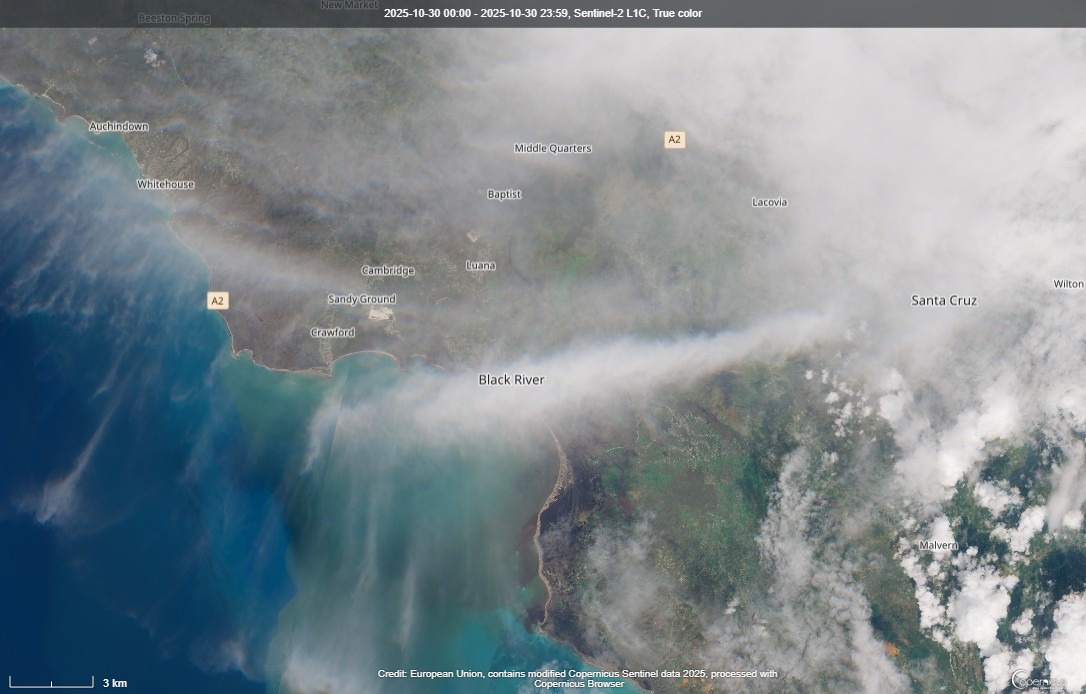
Figure 15: Sentinel-2 True Color imagery from 23 October 2025 (left) and 30 October 2025 (right). From https://browser.dataspace.copernicus.eu/
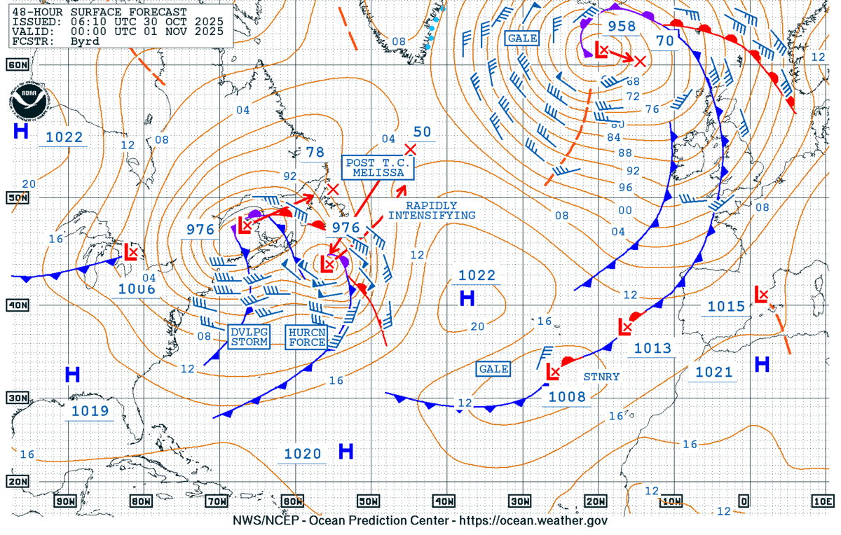
Hurricane warnings are now in effect for Bermuda and the NWS Ocean Prediction Center (OPC) expects the system to be a hurricane-force low after it goes through extratropical transition by 0000 UTC 01 November 2025.
