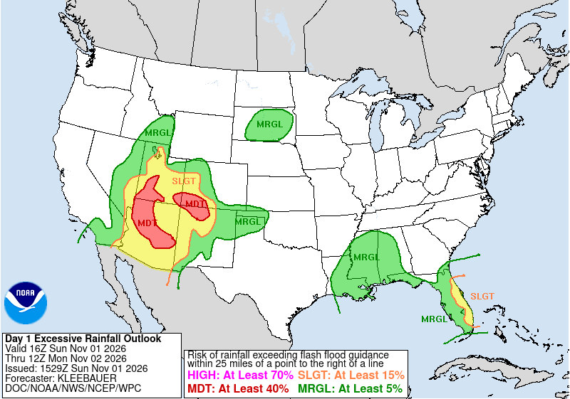
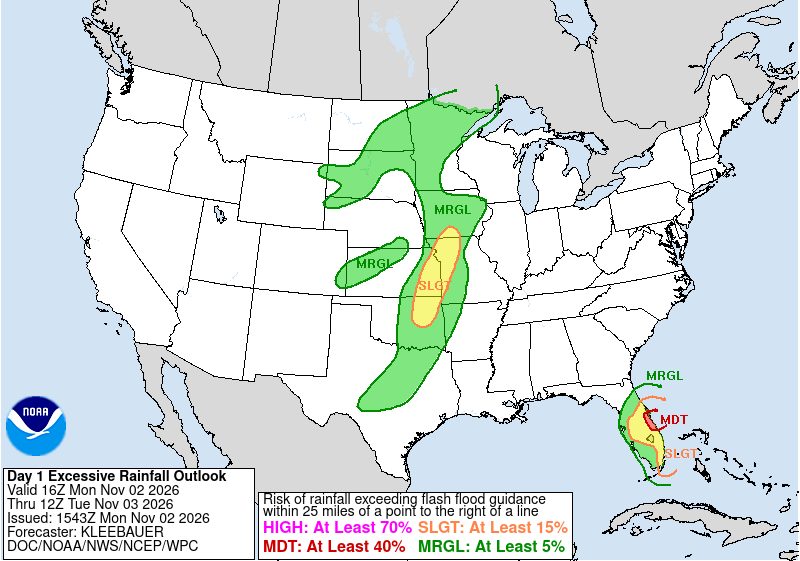
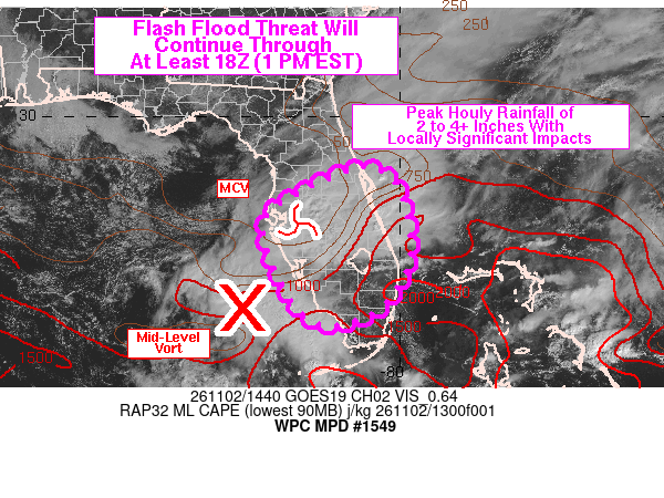
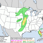
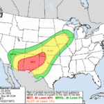
Slow-moving storms impacted Florida’s Atlantic Coast to kick off November, bringing over 20″ of rain to some locations. The NWS Weather Prediction Center (WPC) issued a Day 1 Slight Risk Excessive Rainfall Outlook (ERO) for most of Florida’s East Coast for the period ending at 1200 UTC 02 November 2026, followed by a Moderate Risk for central areas the next day.
Figure 1: NWS WPC Day 1 EROs ending at 1200 UTC 01 November (left) and 1200 UTC 02 November 2026 (right).
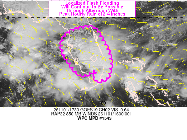
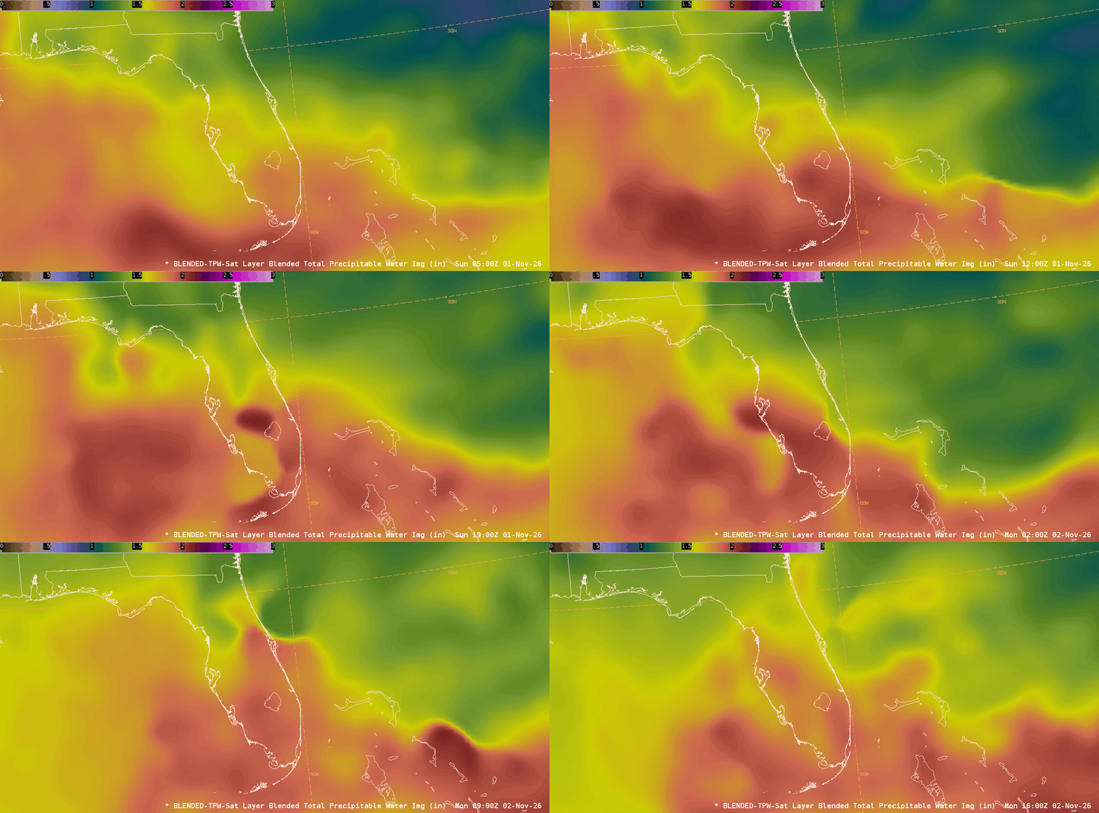
The NWS WPC MetWatch Desk issued a Mesoscale Precipitation Discussion (MPD) for most of the FL Peninsula during the early afternoon of 01 November 2026, noting “a very moist environment containing PWs of 1.7 to 2.2 inches”. The flux of moisture coming off the Atlantic was trackable in the NESDIS Blended Total Precipitable Water (bTPW) product, with PW values near or above 2″ slowly creeping northward through the afternoon of 01 November 2026.
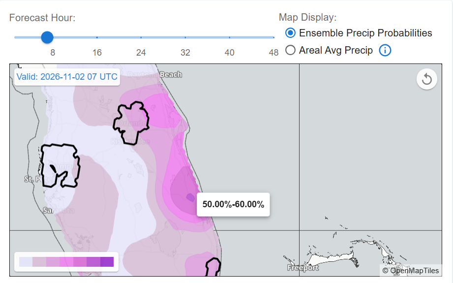
Heading into the overnight, WPC’s Urban Rain Rate Dashboard (URDD) showed that 50-60% of the 0000 UTC HREF ensemble members had 1-hour rainfall exceeding 2-Year Average Recurrence Interval (ARI) amounts at 0700 UTC 02 November 2026 just south of Melbourne, FL.
The GOES-East CONUS Optical Flow Code for Tracking, Atmospheric motion vector, and Nowcasting Experiments (OCTANE) Cloud-top Cooling Sandwich product tracked convection across Central FL through the morning and early afternoon of 02 November 2026. There was a switch with OCTANE derived from coarser, infrared spatial resolution (2 km) to visible spatial resolution (0.5 km) as the sun rose. Near Melbourne, FL, you’ll notice periods of intense cloud top cooling (greens and yellows) followed by intense cloud top divergence (bright pinks) as storms stalled over Florida’s Atlantic Coast. The stalled storms led to NWS WFO Melbourne issuing a Flash Flood Emergency.
Figure 5: GOES-East CONUS OCTANE Cloud-top Cooling Sandwich output from 1001-1846 UTC 02 November 2026. From CIRA Slider
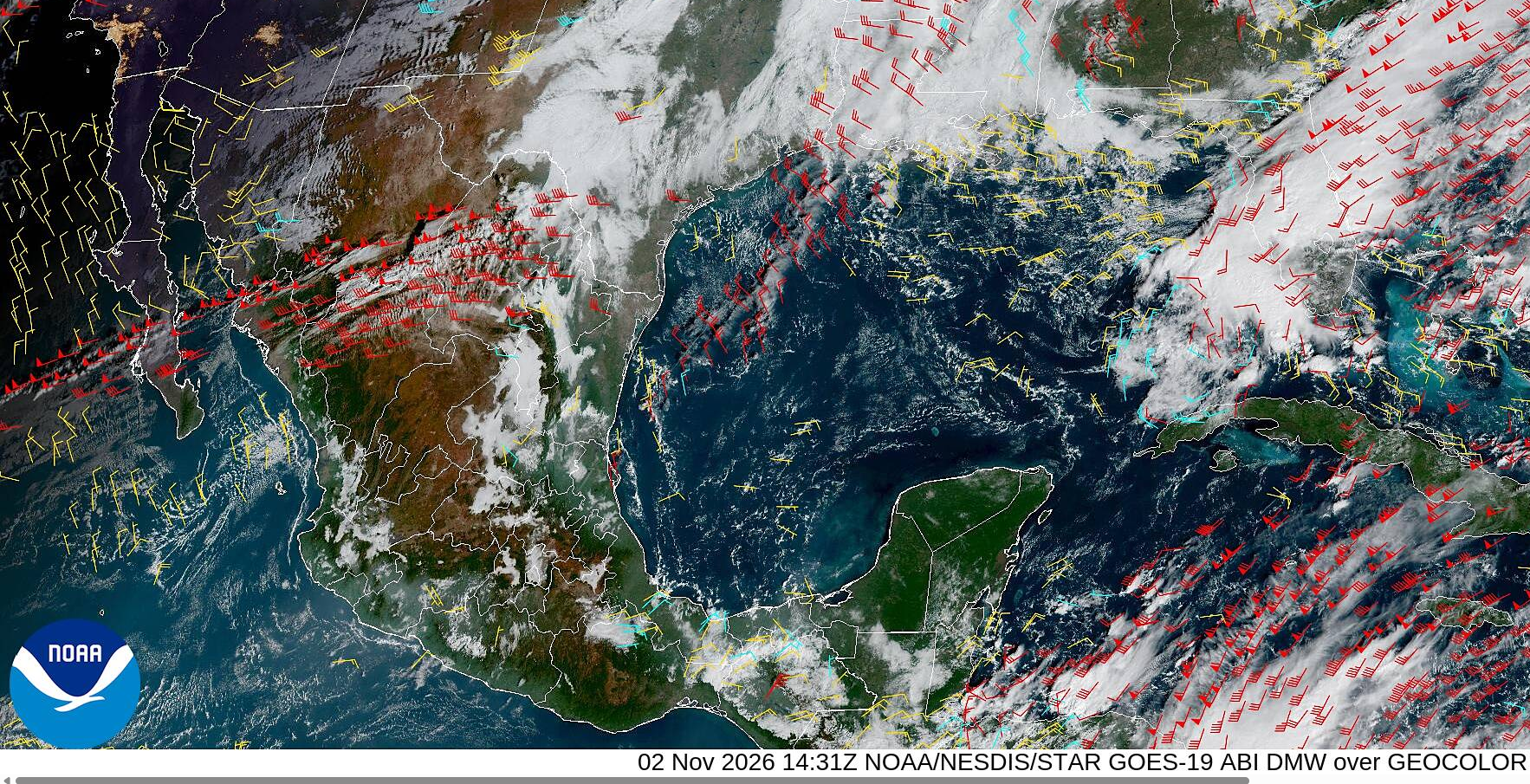
An MPD issued by WPC during the morning of 02 November 2026 messaged the flash flood potential: “Low level easterly winds of 20-30 kt in the 925-850 mb layer are expected to maintain over the next few hours with areas of mesoscale low level convergence aiding in the production of slow moving convective cores”. GOES-East CONUS Derived Motion Winds (DMWs) indeed showed lower-level (below 700 hPa) easterly winds (yellow) exceeding 20 knots off the South Florida Atlantic Coast. The GOES-East CONUS OCTANE Speed Sandwich Product also observed low-level cloud top speeds approaching 20 knots as they pushed inland off the Atlantic Ocean. You’ll notice the higher convective clouds were pushing northeastward at similar speeds, aiding the training of convection. GOES-Mesosector OCTANE products are available for AWIPS implementation.
Figure 8: GOES-East CONUS OCTANE Speed Sandwich product output from 1001-1846 UTC 02 November 2026. From CIRA Slider
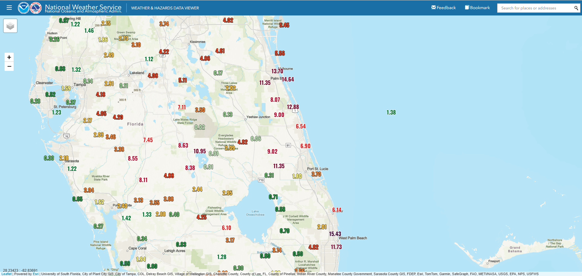
The repeating rounds of convection were captured by GOES-East CONUS Clean Infrared Window Band 13 imagery from the morning of 01 November to the morning of 02 November 2026, leading to multiple Flash Flood Warnings. Widespread 3-day rainfall totals leading up to 1800 UTC 04 November 2026 totaled in the 4-8″ range across Central and South FL, with the West Palm Beach and Melbourne areas receiving over a foot of rainfall. One station just north of Melbourne recorded 26.02″, or over two feet of rainfall.