University of Maryland

The Tropical and Extratropical Transitions of Josephine

UMD/ESSIC/CISESS GOES-R Satellite Liaison for NWS WPC

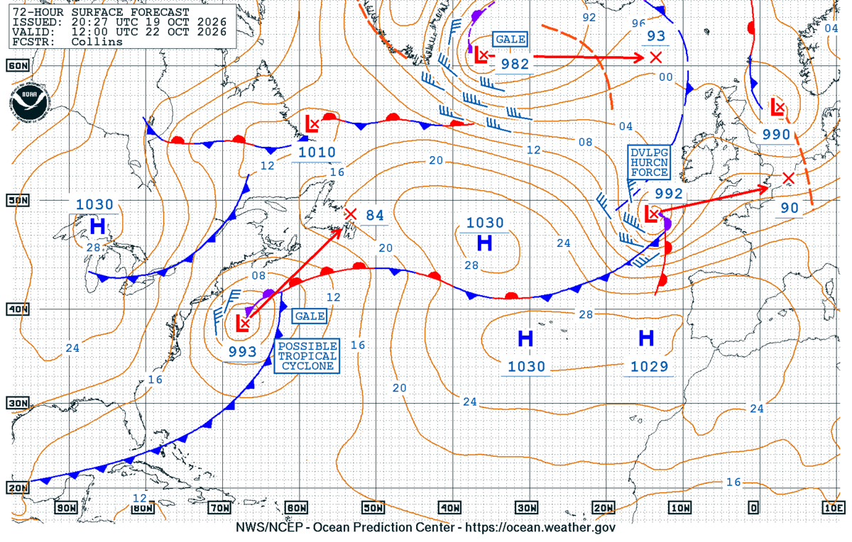
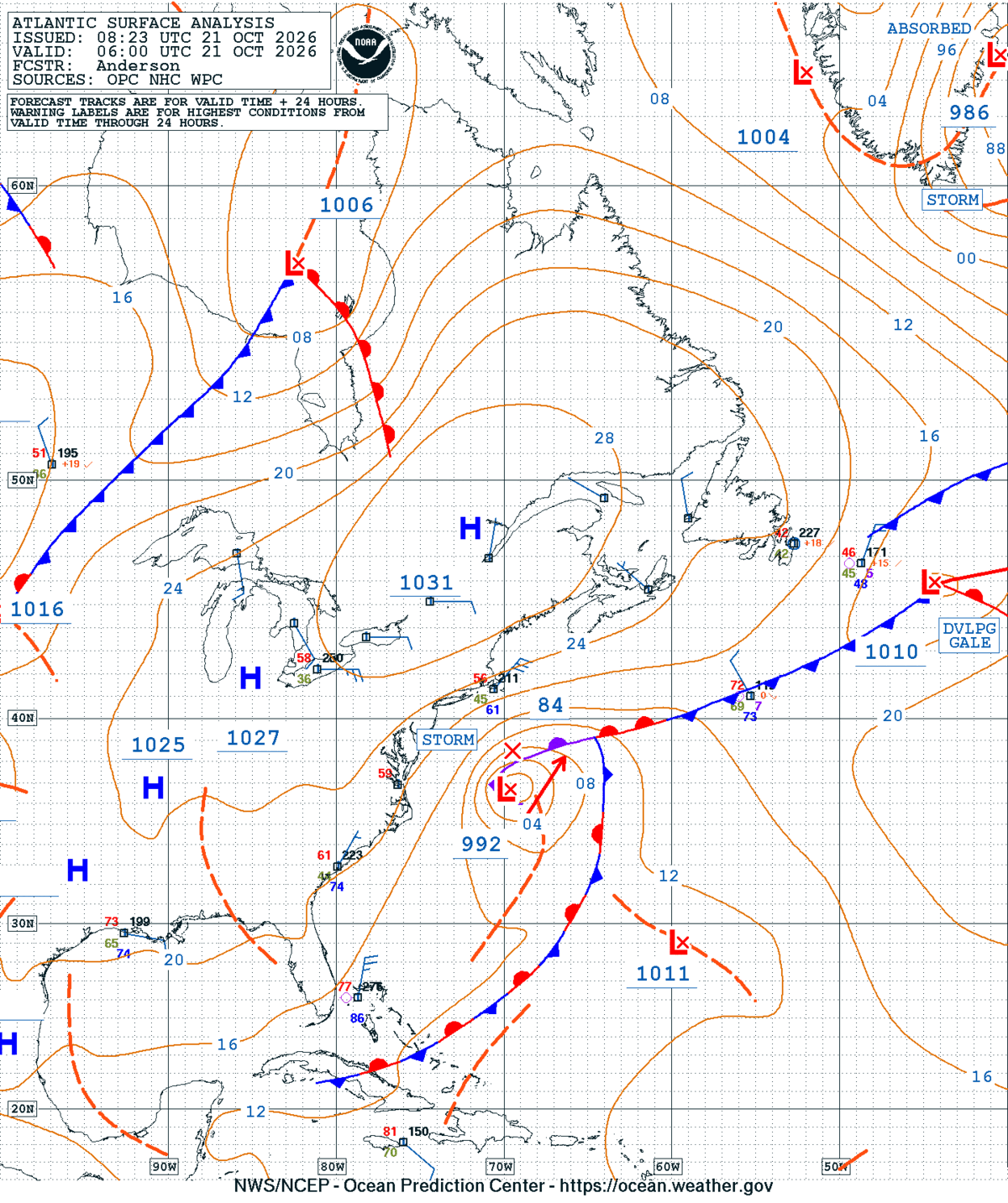
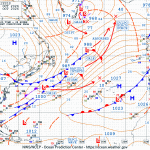
A low meandering off the East Coast last week slowly gained tropical characteristics to become Subtropical Storm Josephine before undergoing an explosive extratropical transition. The NWS Ocean and Tsunami Center (OTC) signaled a ‘Possible Tropical Cyclone’ in its North Atlantic 72 Hour Surface Forecast, valid for 1200 UTC 22 October 2026. At 0600 UTC 21 October 2026 a mature 992 mb storm-force low was located off of the Eastern Seaboard, with a well defined occluded front. With a high pressure to the north, onshore flow brought coastal flooding to much of the Mid-Atlantic.

NWS OTC North Atlantic 72-Hour Surface Forecast
Figure 1: NWS OTC North Atlantic 72-Hour Surface Forecast issued at 2027 UTC 19 October, valid for 1200 UTC 22 October 2026.
NWS OTC Atlantic Surface Analysis
Figure 2: NWS OTC Atlantic Surface Analysis valid at 0600 UTC 21 October 2026.

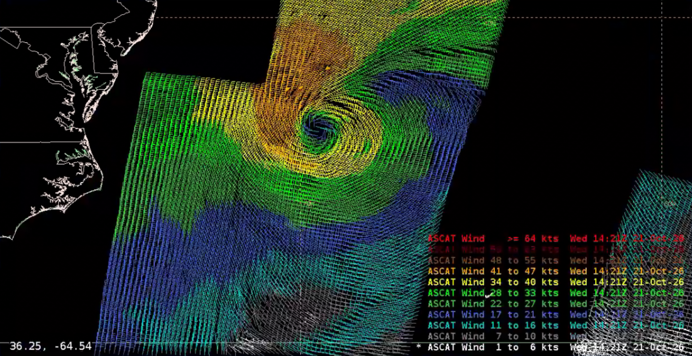
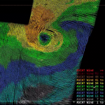
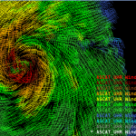
Metop-B and Metop-C ASCAT passes around ~1400 UTC 21 October 2026 showed the strongest winds were located in the system’s northern and western quadrants, with speeds up to ~50 knots. The cyclone had a tight core, but subtle differences in the wind speed and direction signaled a weakening occluded front was still present.

Metop-B and -C ASCAT output
Figure 3: Metop-B and -C ASCAT output around ~1400 UTC 21 October 2026. This image was exported from AWIPS, and display files can be shared upon request.

GOES-East Full Disk Air Mass RGB imagery from 1700 UTC 21 October – 1700 UTC 22 October 2026 captured the system as Subtropical Storm Josephine was named by the NWS National Hurricane Center at 2100 UTC 21 October. Fronts are clearly detached from the cyclone, and the circulation is surrounded by a modest amount of warm, tropical air (dark green colors). Towards the end of the animation, the circulation bordered a much drier air mass (oranges) as the extratropical transition began.

Figure 4: GOES-East FD Air Mass RGB imagery from ~1700 UTC 21 October – 1700 UTC 22 October 2026. This video was created from AWIPS, and display files can be shared upon request.

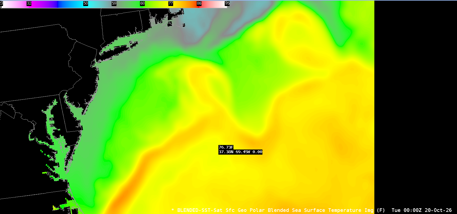
Fueling the tropical transition were warm sea surface temperatures (SSTs) and the proximity of the Gulf Stream. The NESDIS Geo-Polar Blended Sea Surface Temperature product, recently operational, captured SSTs above 76 degrees near the location where Subtropical Storm Josephine was named. The Geo-Polar Blended SST product is now available for AWIPS implementation.

NESDIS Geo-Polar Blended SST output
Figure 5: NESDIS Geo-Polar Blended SST output at 0000 UTC 20 October 2026. This image was exported from AWIPS, and display files can be shared upon request.

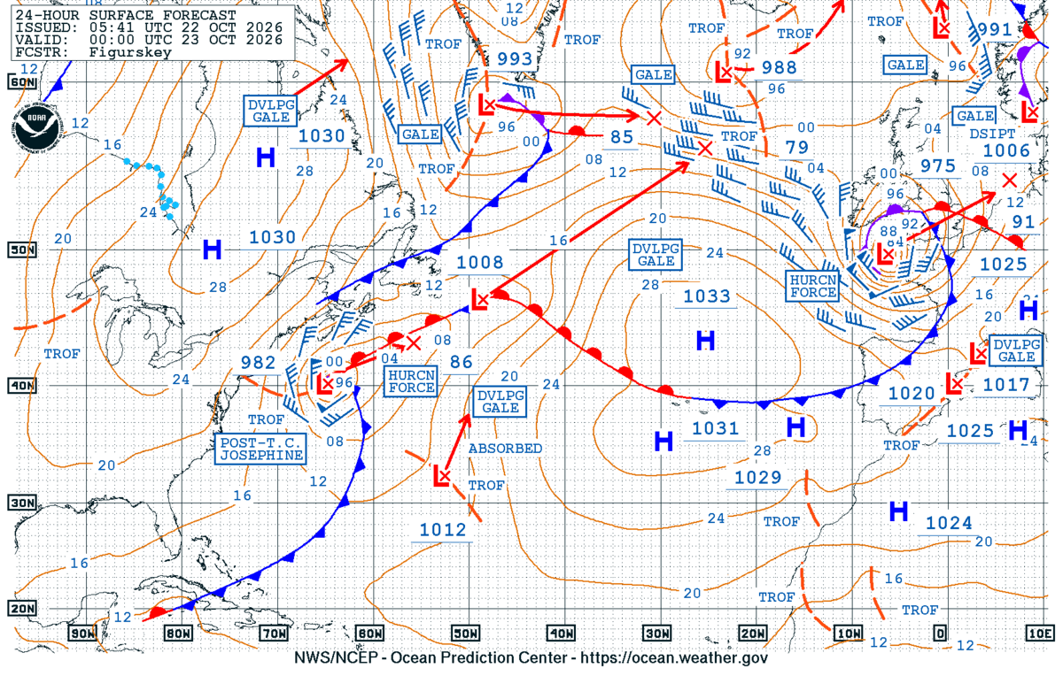
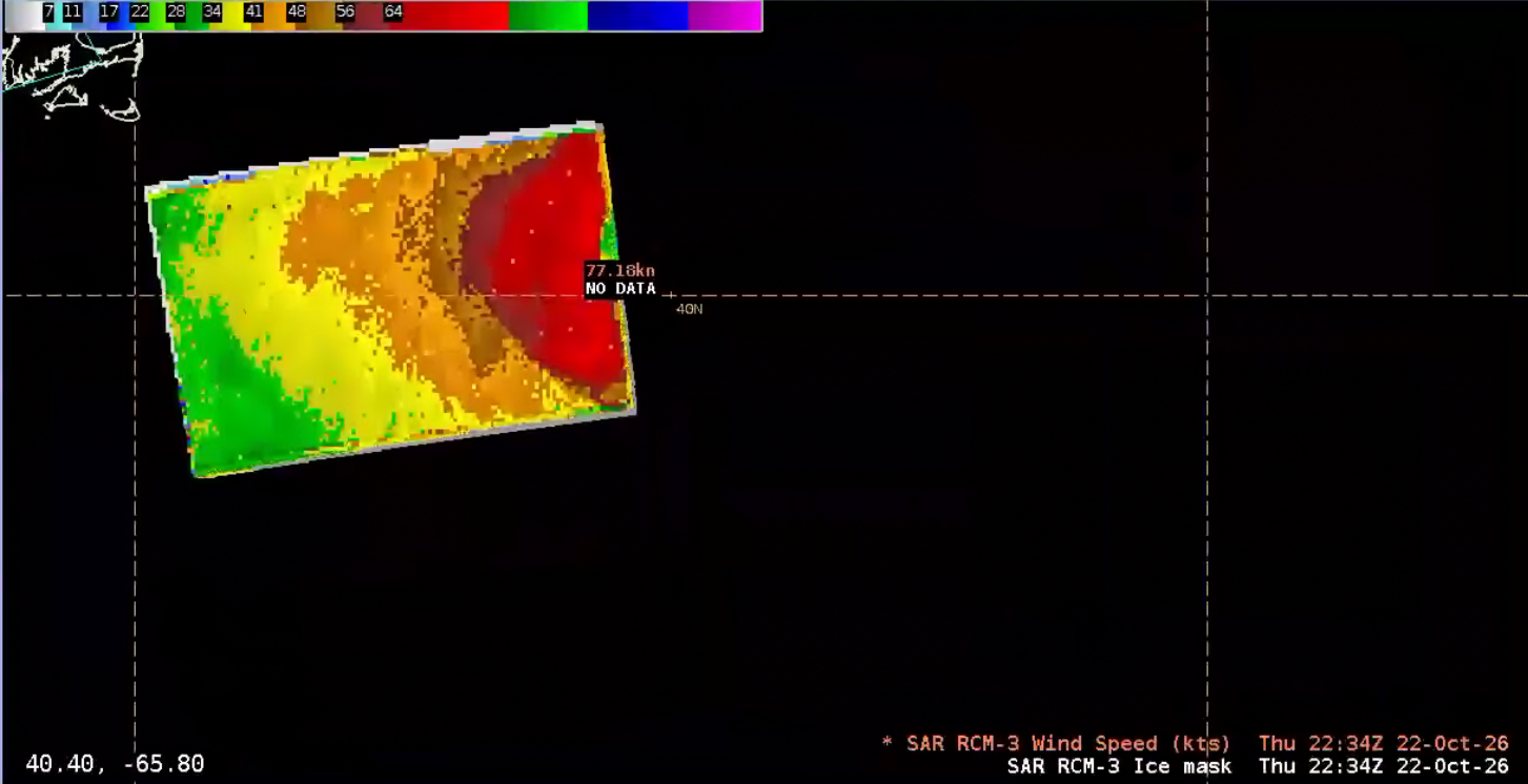
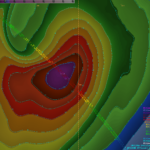
It wasn’t long after Subtropical Storm Josephine was named that an explosive extratropical transition was forecasted to propel the system to hurricane-force. The NWS OTC North Atlantic 24-Hour Surface Forecast had post-tropical cyclone Josephin off the Northeast Coast as a hurricane-force low, with strongest winds in the western quadrant. Josephine became an extratropical low at 2100 UTC 22 October 2026 and a RADARSAT Constellation Mission-3 (RCM-3) synthetic aperture radar (SAR) pass at ~2230 UTC October 2026 confirmed winds exceeding 75 knots!

NWS OTC North Atlantic 72-Hour Surface Forecast
Figure 6: NWS OTC North Atlantic 72-Hour Surface Forecast issued at 0541 UTC 22 October, valid for 0000 UTC 23 October 2026.
RCM-3 SAR output
Figure 7: RCM-3 SAR output at ~2234 UTC 22 October 2026. This image was exported from AWIPS, and display files can be shared upon request.

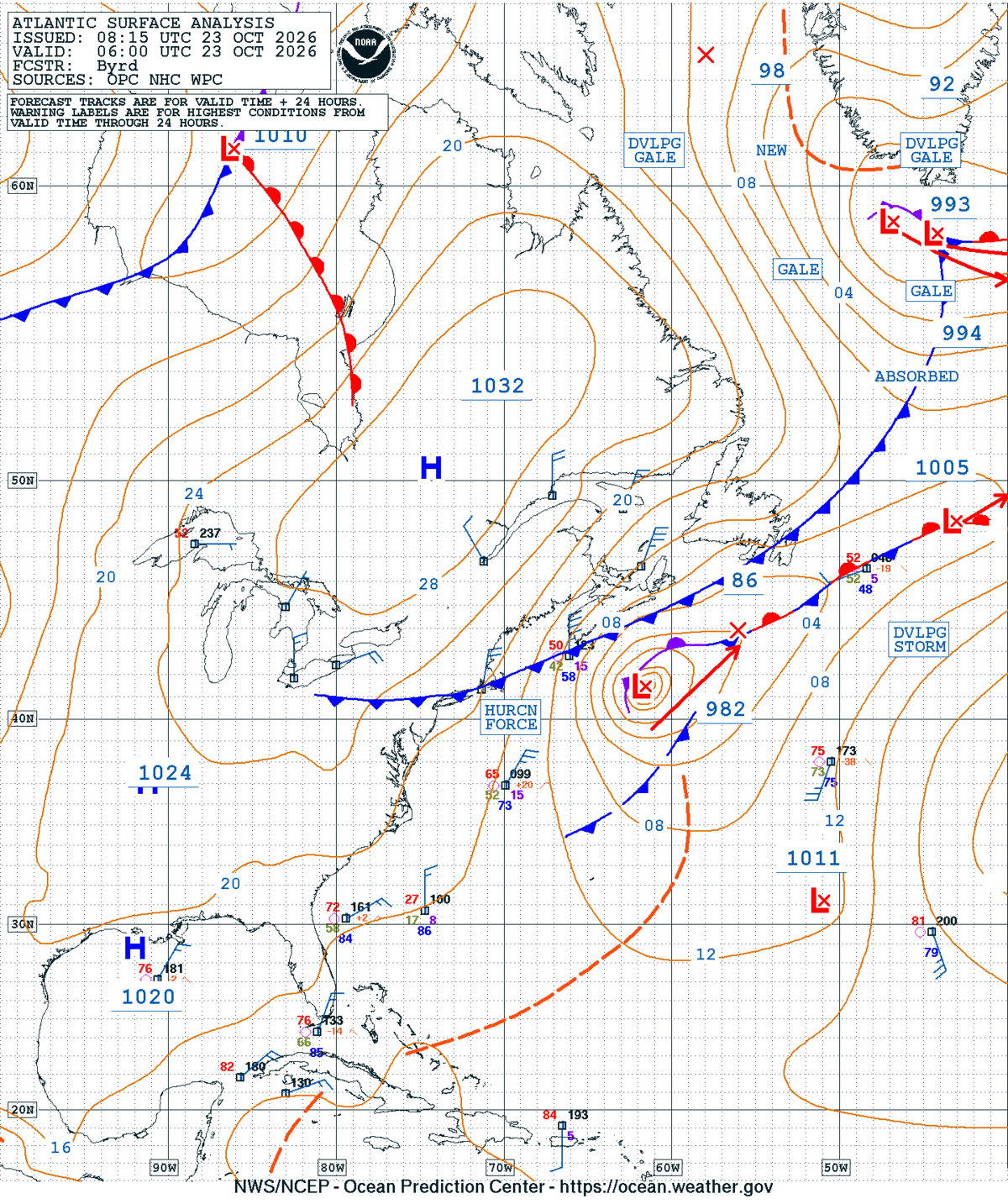
At 0600 UTC 23 October 2026, a 982 mb hurricane-force low was analyzed pushing away from the East Coast.

NWS OTC Atlantic Surface Analysis
Figure 8: NWS OTC Atlantic Surface Analysis valid at 0600 UTC 23 October 2026.
Picture of Christopher Smith

Christopher Smith

Christopher Smith joined ESSIC/CISESS, University of Maryland in 2023 and is the GOES-R Satellite Liaison to the NWS Weather Prediction Center and Ocean and Tsunami Center. Smith works to interpret experimental satellite imagery and products, and make such products available to forecasters and the NWS for a route to operations. He trains forecasters how to use satellite imagery in weather forecasting, while also delivering forecaster feedback to satellite developers to maximize meteorological satellite capabilities. Smith is an alumni of the UMD Atmospheric & Oceanic Science (AOSC) Department, and his long-term interests include infusing AI-Satellite Products to increase lead time in decision making for forecasters.