University of Maryland

Hurricane Polo Remnants, Moisture Fuel More Southwest Flooding

UMD/ESSIC/CISESS GOES-R Satellite Liaison for NWS WPC

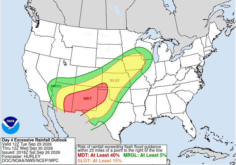
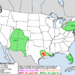
Like a broken record, a new week brought more flash flooding to the Desert Southwest. This time, the flash flooding was largely fueled by remnant moisture from Hurricane Polo. The NWS WPC Medium Range Forecast Desk highlighted the heavy rainfall potential in the Extended Forecast Discussion up to a week in advance, stating “the slower moving upper low in the Four Corners states could pull energy and moisture from Polo north into it.” WPC also issued a rare Day 4 Moderate Risk Excessive Rainfall Outlook (ERO) for the 24-hour period ending at 1200 UTC 30 September 2026.

NWS WPC Day 4 ERO issued at 2018 UTC 26 September 2026
Figure 1: NWS WPC Day 4 ERO issued at 2018 UTC 26 September 2026, valid for the 24-hour period ending at 1200 UTC 30 September.

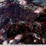
GOES-West Full Disk (FD) GeoColor imagery on the morning of 28 September showed what was then Polo as a Category 3 Major Hurricane as it approached the Baja California Peninsula. In the animation, clouds can be seen both streaming north from Hurricane Polo, while also pushing eastward as the upper-level trough was digging into the Southwest.

Figure 2: GOES-West FD GeoColor imagery from ~0330 to ~1330 UTC 28 September 2026. This video was exported from AWIPS, and display files can be shared upon request.

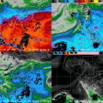
The setup for heavy rainfall is evident in the NESDIS Advected Layered Precipitable Water (ALPW) imagery, with abundant moisture streaming northward at the mid-to-upper levels (850-700 hPa layers and higher) as the upper-level low (ULL) pushed southward to fuel atmospheric lift.

Figure 3: NESDIS ALPW imagery from 0700 UTC 28 September to 0900 UTC 29 September 2026. This video was exported from AWIPS, and display files can be shared upon request.

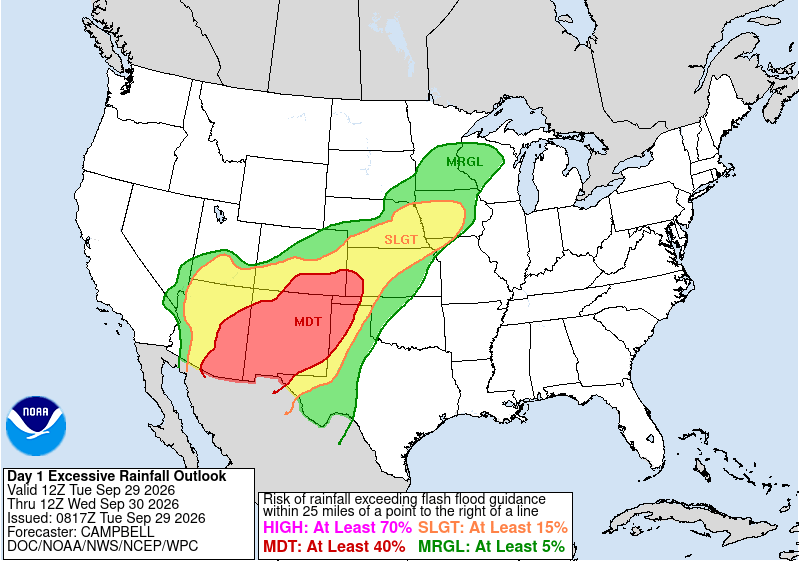
The Day 1 ERO issued by WPC for the 24-hour period ending at 1200 UTC 30 September 2026 was strikingly similar to the Day 4 ERO (Figure 1). This was the largest Moderate Risk ERO issued by WPC in its history.

NWS WPC ERO
Figure 4: NWS WPC ERO valid for the 24-hour period ending at 1200 UTC 30 September 2026, issued at 0817 UTC 29 September.

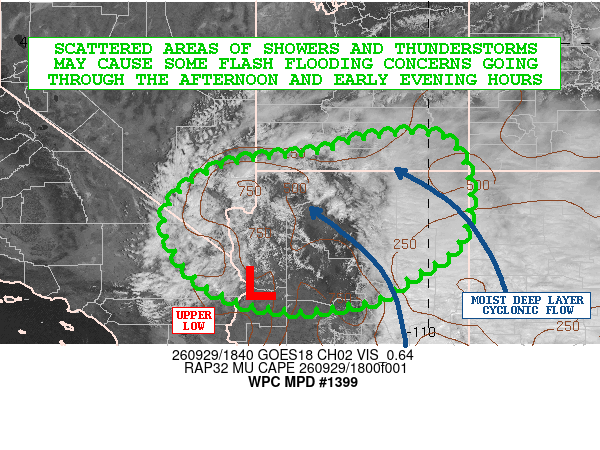
The WPC MetWatch Desk issued a Mesoscale Precipitation Discussion (MPD) at 1902 UTC 29 September 2026, noting “The latest GOES-W visible satellite imagery shows a very well-defined depiction of the deep layer closed low and associated upper trough which is pivoting east into areas of western AZ.” The ULL spin is clear in GOES-West FD Visible Band 02 imagery.

Figure 5: GOES-West FD Visible imagery from 1310-1710 UTC 29 September 2026. This video was exported from AWIPS, and display files can be shared upon request.

NWS WPC MPD
Figure 6: NWS WPC MPD issued at 1902 UTC 29 September 2026, overlaid on GOES-West Visible imagery.

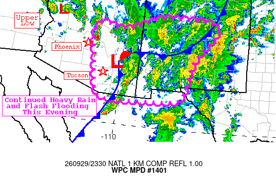
An additional MPD was issued at 2331 UTC stating “latest GOES imagery shows an upper low over western Arizona with a pronounced dry conveyor belt wrapping around and extending east through southern Arizona”. GOES-East FD Mid-Level (ML) Water Vapor (WV) Band 9 imagery observed the pronounced dry conveyor belt pushing into AZ as convection fired eastward.

Figure 7: GOES-East FD ML WV imagery from ~2100 UTC 29 September to ~0000 UTC 30 September 2026. This animation was exported from AWIPS, and display files can be shared upon request.

NWS WPC MPD
Figure 8: NWS WPC MPD issued at 2333 UTC 29 September 2026.

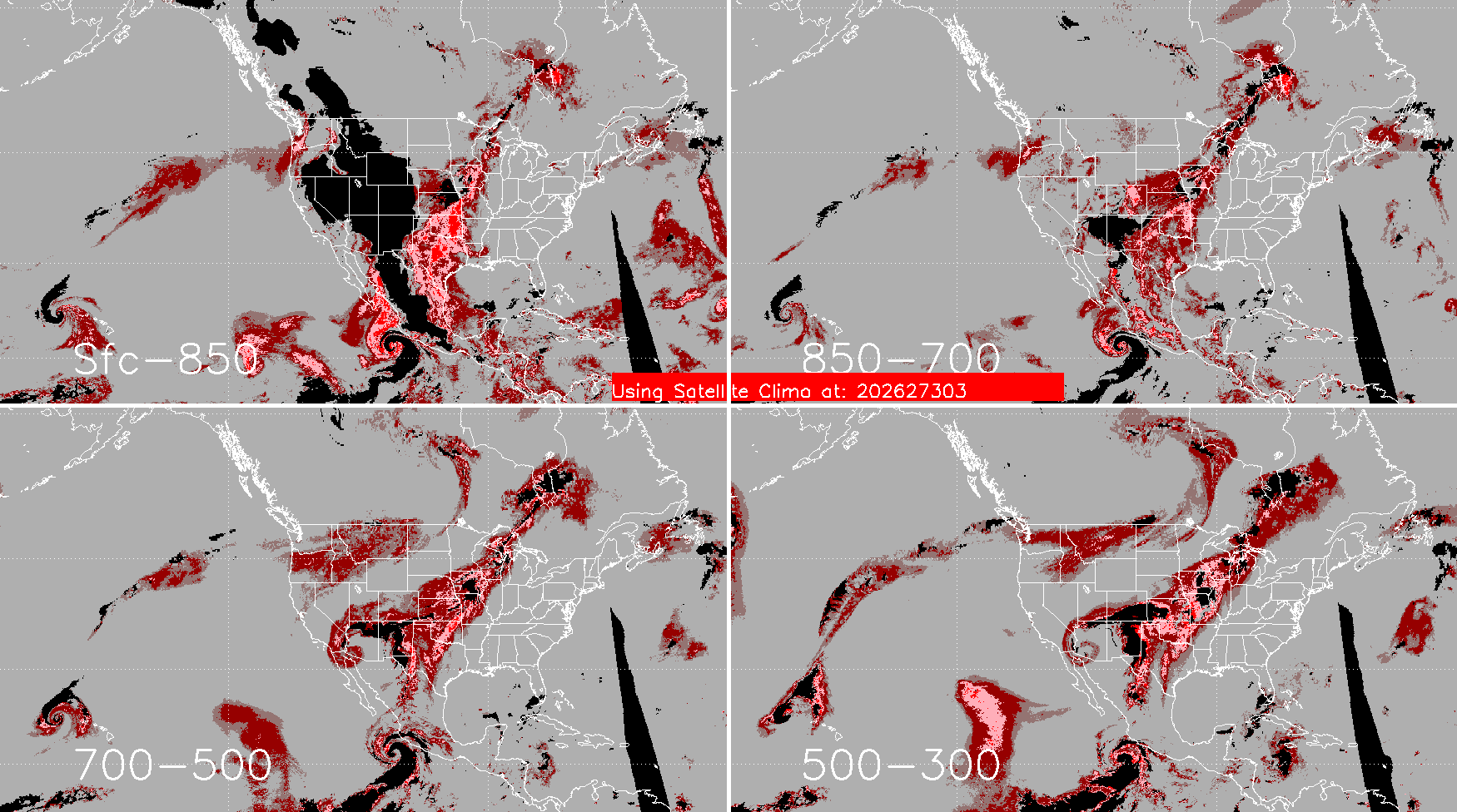
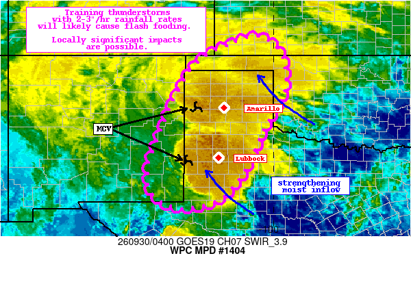
The CIRA ALPW Percentile product a few hours later at 0300 UTC 30 September 2026 observed extremely high PW values in all four layers across the Lone Star state. This was referenced in an MPD issued at 0414 UTC, “Recent CIRA LPW measurements indicate PWs from the surface all the way to 500mb are at or above the 99th percentile”. The CIRA ALPW Percentile product will soon be available for AWIPS implementation.

ALPW Percentile output
Figure 9: ALPW Percentile output at 0300 UTC 30 September 2026. From CIRA
NWS WPC MPD
Figure 10: NWS WPC MPD issued at 0414 UTC 30 September 2026, overlaid on GOES-East Shortwave Infrared (IR) Band 07 imagery.

GOES-East CONUS Band 13 IR imagery tracked the repeating rounds of convection slowly pushing northeastwards with the ULL from the morning of 29 September through the morning of 30 September 2026. Multiple Flash Flood Warnings (FFWs) were issued, including a Flash Flood Emergency issued by NWS WFO El Paso at 1947 UTC 29 September 2026 for the near failure of McLeod Dam in Dona Ana County, NM.

Figure 11: GOES-East CONUS IR imagery overlaid with NWS WFO FFWs (yellow) from 1116 UTC 29 September to 1201 UTC 30 September 2026. This video was exported from AWIPS, and display files can be shared upon request.

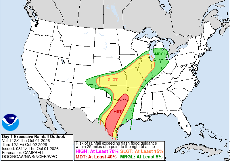
The flash flood threat continued as the calendar flipped to October, pushing into the Southern and Central Plains. The NWS WPC issued a large Slight Risk ERO, stretching from TX to Chicago, with an embedded Moderate Risk ERO in TX and Southeastern OK. Training convection near the ongoing ULL caused an additional Flash Flood Emergency to be issued by NWS WFO Dodge City at 1932 UTC 01 October 2026 for the Dodge City area.

NWS WPC ERO
Figure 12: NWS WPC ERO issued at 0811 UTC 01 October, valid for the 24-hour period ending at 1200 UTC 02 October 2026.

Figure 13: GOES-East CONUS IR imagery overlaid with NWS WFO FFWs from 1306 UTC 01 October to 0321 UTC 02 October 2026. This video was exported from AWIPS, and display files can be shared upon request.

Picture of Christopher Smith

Christopher Smith

Christopher Smith joined ESSIC/CISESS, University of Maryland in 2023 and is the GOES-R Satellite Liaison to the NWS Weather Prediction Center and Ocean and Tsunami Center. Smith works to interpret experimental satellite imagery and products, and make such products available to forecasters and the NWS for a route to operations. He trains forecasters how to use satellite imagery in weather forecasting, while also delivering forecaster feedback to satellite developers to maximize meteorological satellite capabilities. Smith is an alumni of the UMD Atmospheric & Oceanic Science (AOSC) Department, and his long-term interests include infusing AI-Satellite Products to increase lead time in decision making for forecasters.