University of Maryland

September Flash Flooding Strikes Desert Southwest

UMD/ESSIC/CISESS GOES-R Satellite Liaison for NWS WPC

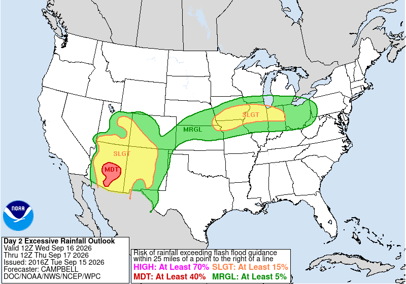
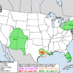
Rounds of heavy rain have soaked the Desert Southwest over the past week, leading to flash flooding. The first round last week targeted Arizona. The NWS Weather Prediction Center (WPC) issued a Day 2 Moderate Risk Excessive Rainfall Outlook (ERO) for much of South-Central AZ, including the Phoenix metro area.

NWS WPC ERO
Figure 1: NWS WPC ERO issued at 2016 UTC 15 September, valid for the 24-hour period ending at 1200 UTC 17 September 2026.

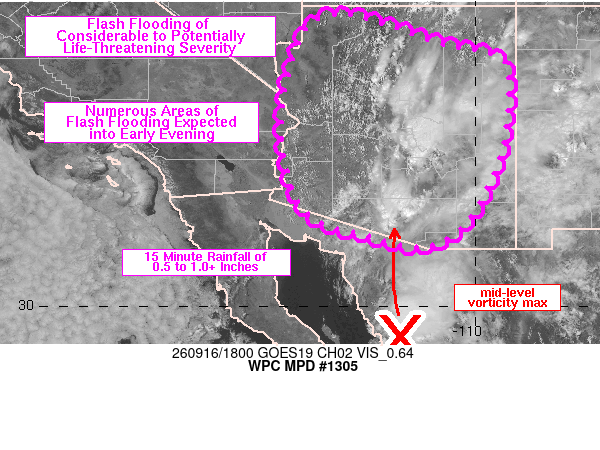
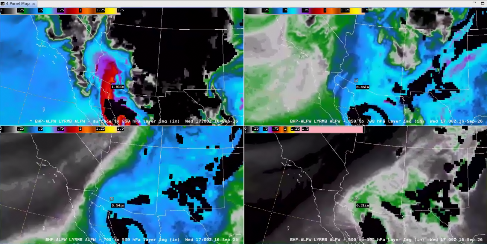
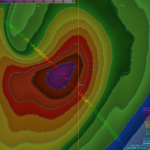
Late in the morning on 16 September 2026, the WPC MetWatch Desk issued a Mesoscale Precipitation Discussion (MPD), noting the risk for flash flooding over the next six hours as “Visible satellite imagery and regional radar imagery has shown a steady increase in the coverage of thunderstorms from central to south-central AZ” and “an anomalously moist environment containing precipitable water (PW) values near 1 inch in northern AZ to over 2 inches just south of the border and north of the Gulf of California”. Shortly after, the Tucson, AZ, NWS Weather Forecast Office (WFO) Area Forecast Discussion described the catalyst for heavy rainfall as “the low level circulation that has moved inland into Mexico is showing renewed signs of rapidly cooling cloud tops on satellite.” The NESDIS/OSPO Advected Layered Precipitable Water (ALPW) output confirmed PW values in excess of 2″ when summing all four layers across Southern AZ at 1700 UTC 16 September 2026.

NWS WPC MPD
Figure 2: NWS WPC MPD issued at 1823 UTC 16 September 2026, overlaid on GOES-East Visible Band 2 imagery.
NESDIS ALPW output
Figure 3: NESDIS ALPW output at 1700 UTC 16 September 2026. This image was exported from AWIPS, and display files can be shared upon request.

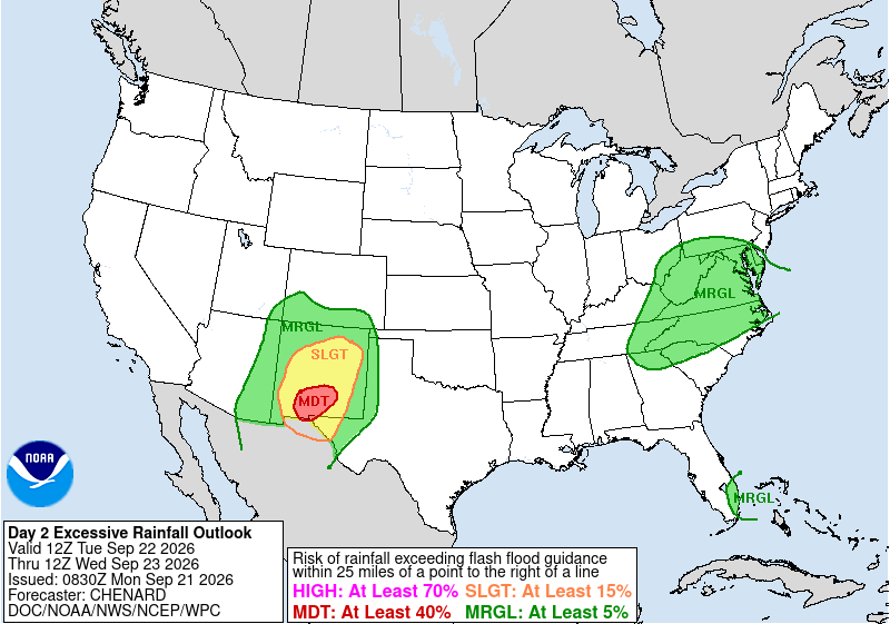
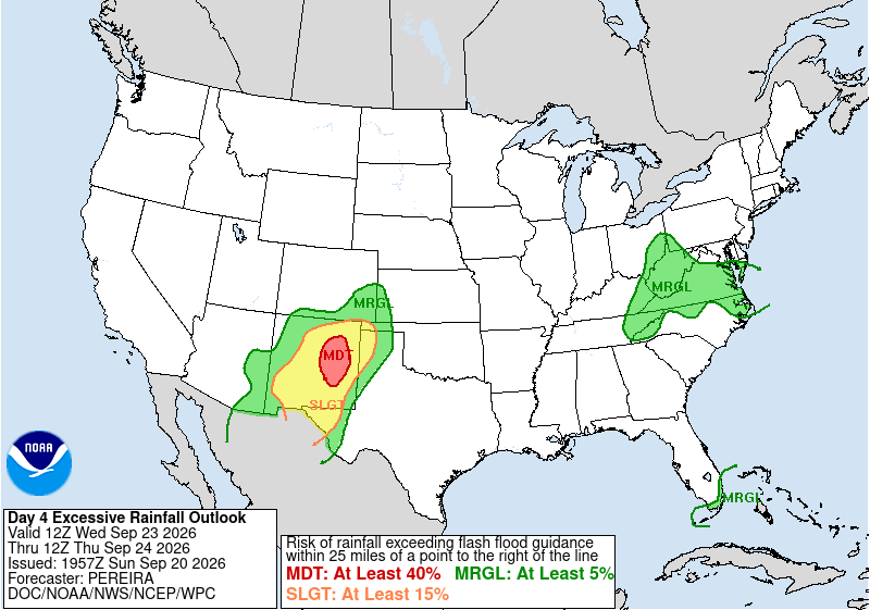
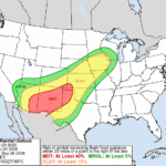
This week, the second round of heavy rainfall targeted New Mexico. The NWS WPC ERO Desk issued relatively rare Moderate Risks, on Day 2 for the 24-hour period ending at 1200 UTC 23 September, and Day 4 ending at 1200 UTC 24 September 2026.

NWS WPC Day 2 ERO
NWS WPC Day 2 ERO

Figure 4: NWS WPC Day 2 ERO valid for the 24-hour period ending at 1200 UTC 23 September (left) and Day 4 ERO ending at 1200 UTC 24 September 2026 (right).

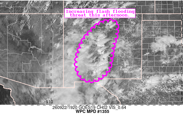
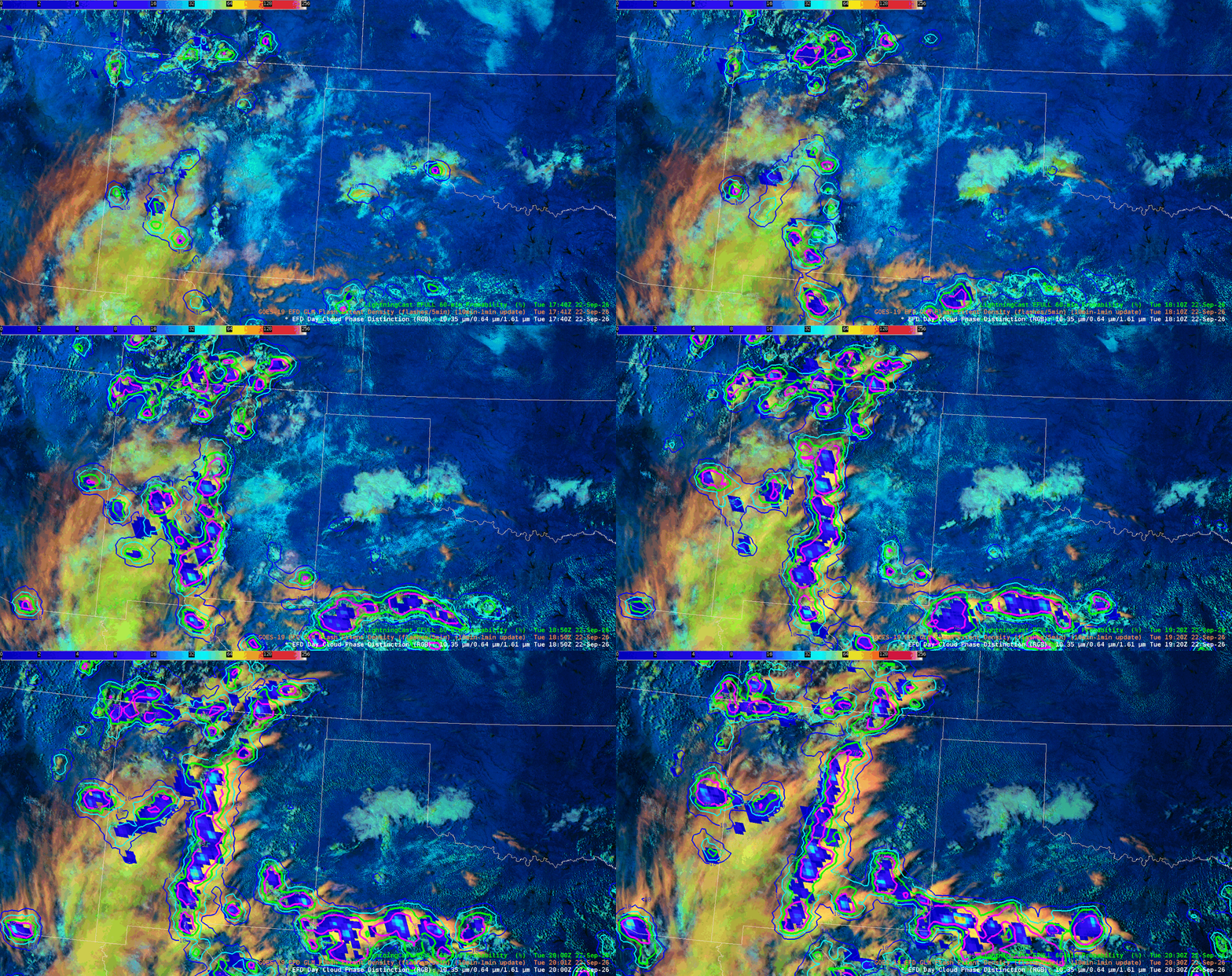
In the early afternoon of 22 September 2026, the WPC MetWatch Desk issued an MPD for Central NM based as “Trends in Day Cloud Phase and LightningCast imagery show rapidly increasing showers and thunderstorms along and west of the Sacramento Mountains in Central New Mexico”. Indeed when viewing GOES-East Full Disk (FD) Day Cloud Phase Distinction (DCPD) RGB imagery, overlaid with the LightningCast and GLM Flash Extent Density, glaciating clouds (greens to yellows and pinks) and rising LightninCast probabilities can be seen preceding widespread lightning.

NWS WPC MPD
Figure 5: NWS WPC MPD issued at 1937 UTC 22 September 2026, overlaid on GOES-East Visible imagery.
GOES-East FD DCPD RGB imagery
Figure 6: GOES-East FD DCPD RGB imagery, overlaid with LightningCast probabilities and GLM FED from ~1740-2040 UTC 22 September 2026.

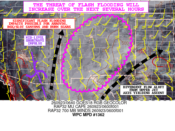
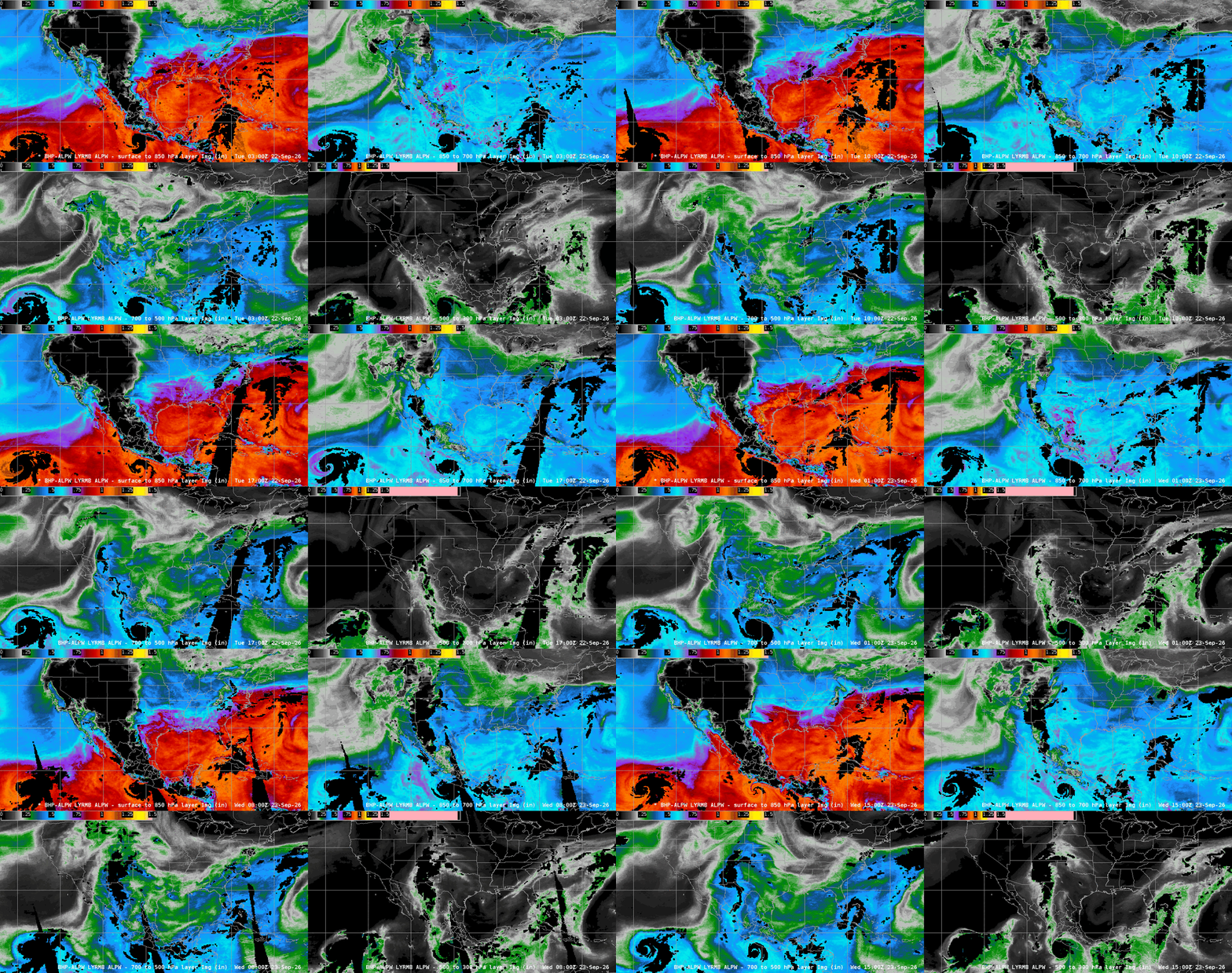
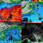
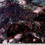
An additional MPD issued overnight heading into 23 September 2026 noted “The latest GOES-W GeoColor/WV satellite imagery along with OSPO ALPW data confirms a deep tropical moisture axis lifting north out of northern Mexico and across sizable areas of the Southwest with an emphasis on central and southern NM”. NM is just along the longitude line (105 degrees West) where GOES-East and GOES-West have comparable parallax and performance. In the GOES-West FD GeoColor imagery, the moisture transport from Mexico is easily observable. Likewise, the ALPW confirmed moisture transport connected to what was Category 5 Hurricane Polo at upper-levels.

WPC MPD
Figure 7: WPC MPD issued at 0705 UTC 23 September 2026, overlaid on GOES-West Geocolor imagery.

Figure 8: GOES-West FD Geocolor imagery from 2050 UTC 22 September – 1630 UTC 23 September 2026. This animation was exported from AWIPS, and display files can be shared upon request. 

NESDIS ALPW output
Figure 9: NESDIS ALPW output from ~0400 UTC 22 September to ~1500 UTC 23 September 2026, showing a connection of moisture in the 700-500 & 500-300 hPa layers from NM to Hurricane Polo in the Eastern Pacific. This animation was exported from AWIPS, and display files can be shared upon request.

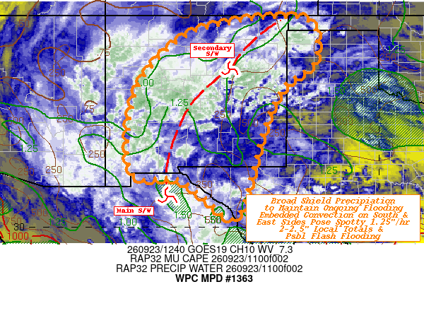
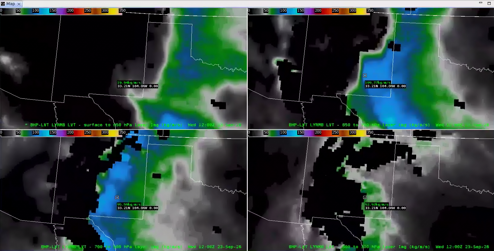
The CIRA Layered Vapor Transport (LVT), recently made available in AWIPS at WPC, was referenced in an MPD issued at 1254 UTC 23 September 2026. The discussion stated “GOES-E WV suite shows strong shortwave with classic baroclinic leaf/comma shape across the Desert Southwest entering S NM” and “CIRA LVT values are fairly impressive if not obstructed by active rainfall/attenuation, with 850-700 and 700-500mb layers both shows broad 75-125 kg/m/s values, along and east of 106W”. CIRA LVT output at 1200 UTC confirmed these values, and the shortwave was easily trackable in GOES-East Full Disk Band 10 Low Level Water Vapor imagery as it pushed northward from Mexico into NM.

NWS WPC MPD
Figure 10: NWS WPC MPD issued at 1254 UTC 23 September 2026, overlaid on GOES-East Low-Level WV imagery.
CIRA LVT output at 1200 UTC 23 September
Figure 11: CIRA LVT output at 1200 UTC 23 September, showing moisture transport values near 100 kg/m/s in the 850-700 & 700-500 hPa layers around ~105 W. This image was exported from AWIPS, and display files can be shared upon request.

Figure 12: GOES-East FD Low-Level WV imagery from 2100 UTC 22 September to 1640 UTC 23 September 2026. This animation was exported from AWIPS, and display files can be shared upon request.

Convection shown in GOES-East FD Infrared (IR) Band 13 imagery lead to multiple Flash Flood Warnings and even a Flash Flood Emergency, issued by NWS WFO Albuquerque at 2227 UTC 22 September 2026.

Figure 13: GOES-East FD IR imagery, overlaid with Flash Flood Warnings from 20250 UTC 22 September to 1620 UTC 23 September 2026. This animation was exported from AWIPS, and display files can be shared upon request.

Picture of Christopher Smith

Christopher Smith

Christopher Smith joined ESSIC/CISESS, University of Maryland in 2023 and is the GOES-R Satellite Liaison to the NWS Weather Prediction Center and Ocean and Tsunami Center. Smith works to interpret experimental satellite imagery and products, and make such products available to forecasters and the NWS for a route to operations. He trains forecasters how to use satellite imagery in weather forecasting, while also delivering forecaster feedback to satellite developers to maximize meteorological satellite capabilities. Smith is an alumni of the UMD Atmospheric & Oceanic Science (AOSC) Department, and his long-term interests include infusing AI-Satellite Products to increase lead time in decision making for forecasters.