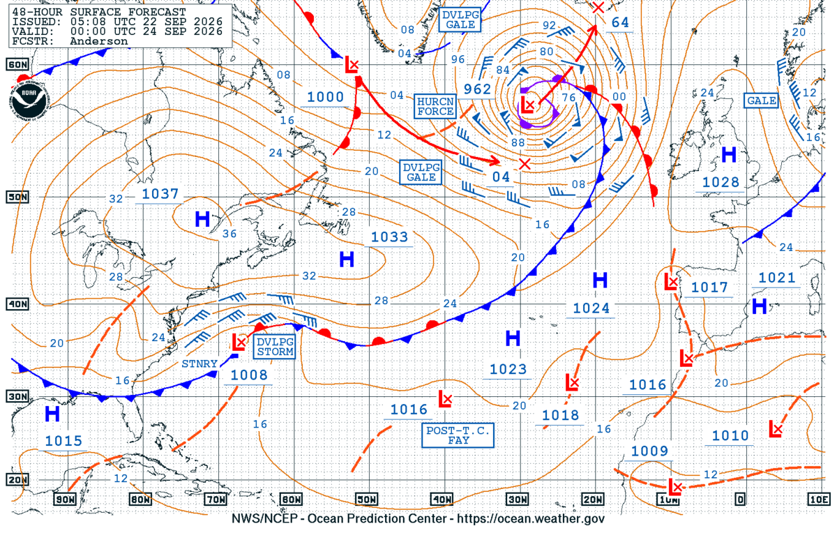
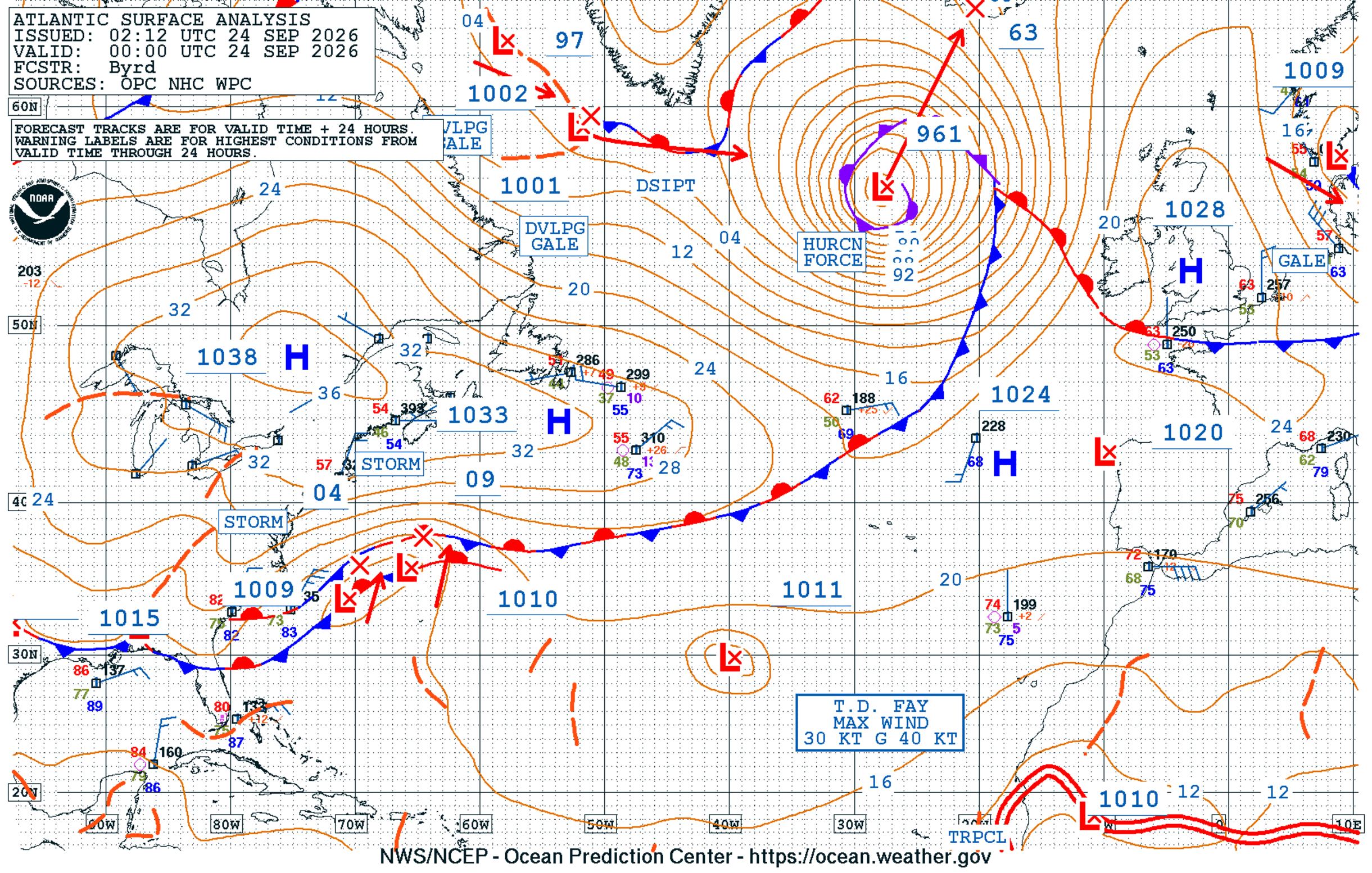
A rapidly developing hurricane-force (HF) extratropical cyclone developed in the North Atlantic last week, just as the calendar flipped to astronomical Fall. The NWS Ocean and Tsunami Center (OTC) highlighted a 962 mb HF low in its North Atlantic 48 Hour Surface Forecast valid for 0000 UTC 24 September 2026.
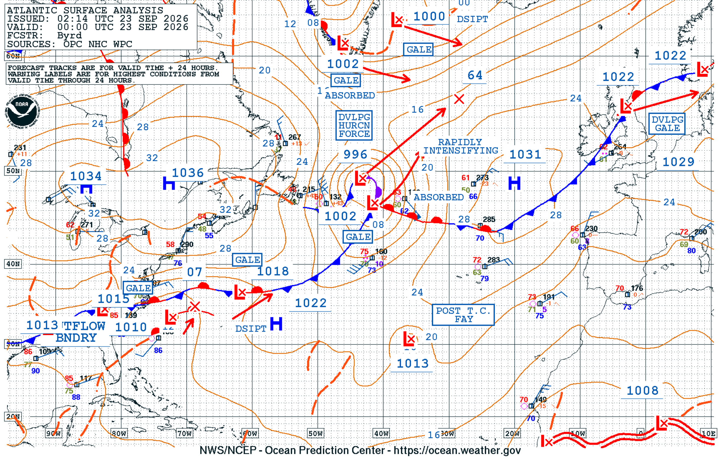
The forecast verified well, with a 961 mb HF low analyzed at this time. In the 24-hour period leading up to 0000 UTC 24 September 2026, the minimum central pressure of the system dropped 35 mb as it rapidly intensified.
GOES-East Full Disk Air Mass RGB imagery showed the rapid evolution of this system, fueled by a troposphere fold and associated potential vorticity intrusion (deep oranges and reds). From 1600 UTC 22 September to 1540 UTC 23 September 2026, the low evolved from having a classic baroclinic leaf structure towards the beginning of the animation to a mature extratropical cyclone with a well-defined occlusion.
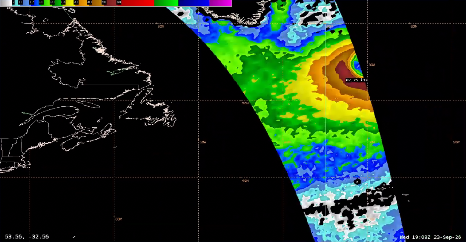
SMAP-derived ocean surface winds (OSWs) observations at ~1900 UTC 23 September 2026 confirmed that the system was likely HF, capturing the southwestern quadrant of the cyclone. OSWs near 63 knots were observed by the L-band radiometer, but with its coarse, 60 km spatial resolution, higher wind speeds were likely occurring.
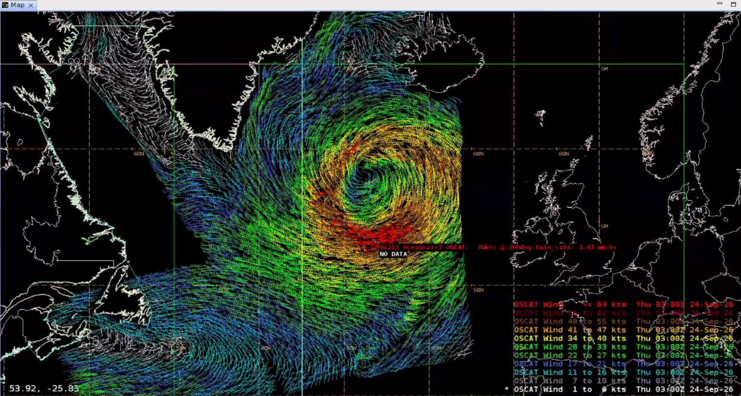
An OceanSat-3 (OSCAT) pass several hours later managed to capture the entire system with its wide swath. OSWs up to 70 knots were observed in the southern quadrant. With a uniform wind direction from the east and sampling in AWIPS showing very light rainfall rates (~3.5 mm/hr), rain contamination likely wasn’t too much of an issue for this pass.
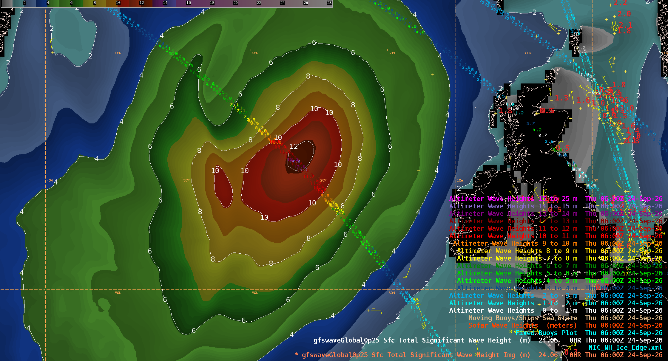
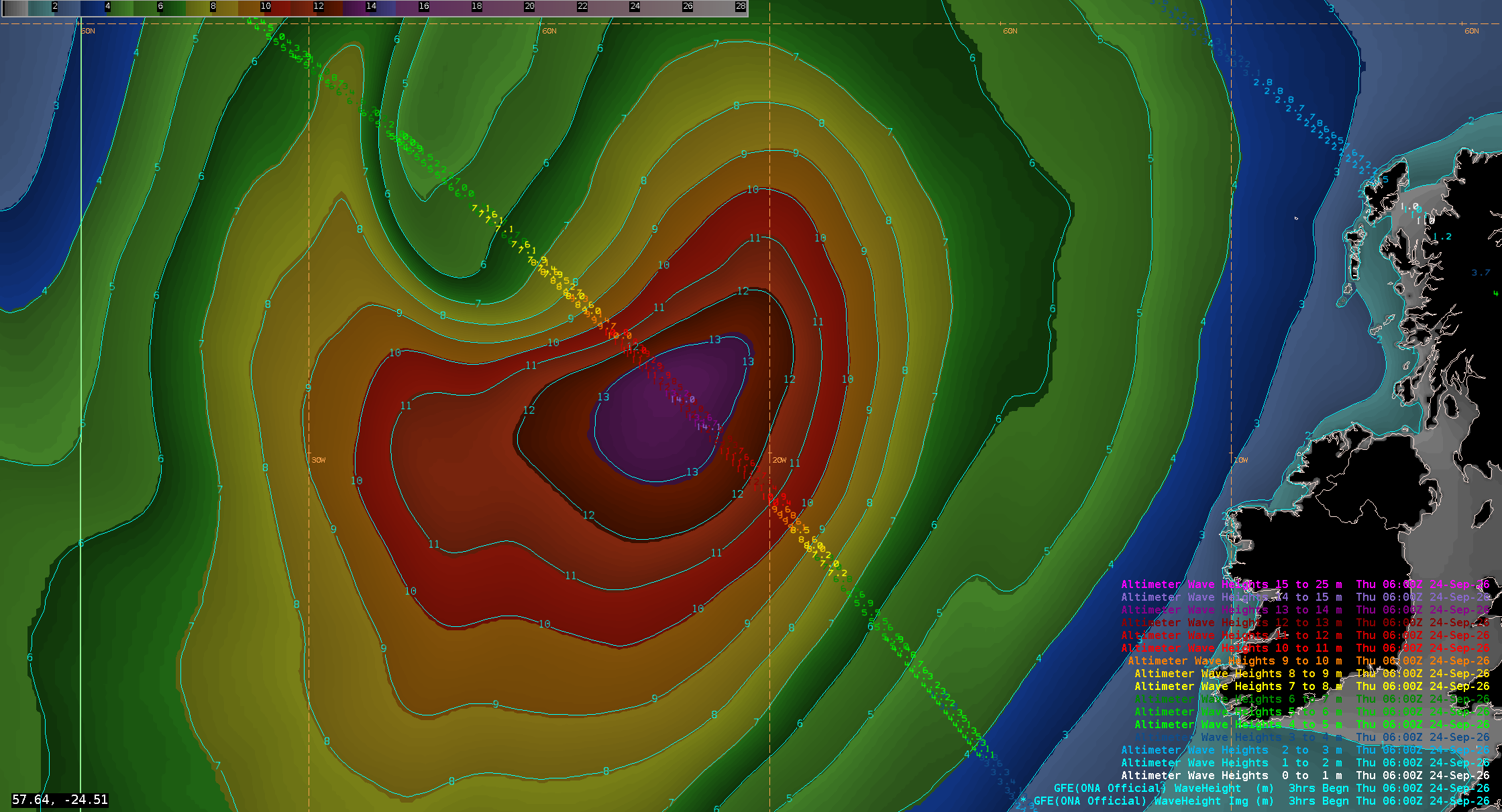
An NWS OTC Senior Marine Forecaster noted that NWP model output often has a low bias when forecasting significant wave height (Sig WH) for intense HF lows. While the GFS model had Sig WH values just exceeding 12 meters at 0600 UTC 24 September 2026, the OTC official forecast had values exceeding 13 meters. A Jason-3 altimeter pass near this time confirmed the GFS low bias, with observations touching 14 meters, or a whopping ~46 feet!
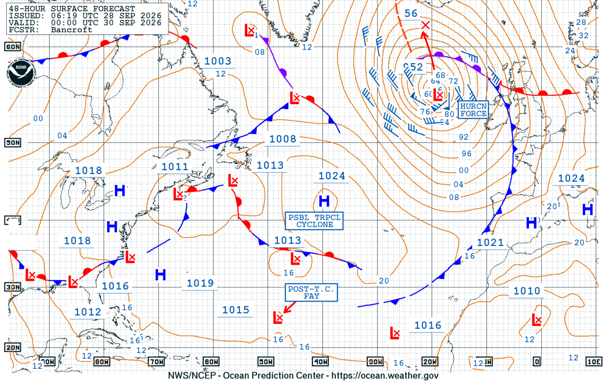
The active weather continues across the North Atlantic this week, with the NWS OTC 48-Hour Surface Forecast indicating another HF low west of Ireland by 0000 UTC 30 September 2026.