University of Maryland

Severe Storms Slam the Nation’s Capital

UMD/ESSIC/CISESS GOES-R Satellite Liaison for NWS WPC

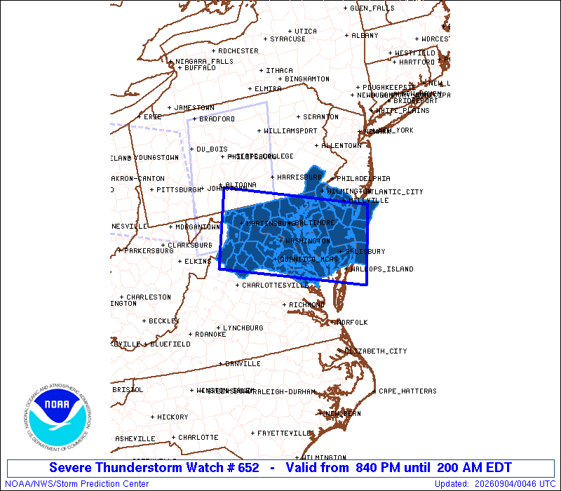
Damaging storms struck the D.C. region late last week, bringing strong winds, frequent lightning, and torrential downpours. The NWS Storm Prediction Center (SPC) issued a Severe Thunderstorm Watch at 0040 UTC 04 September, valid through 0600 UTC for “Scattered damaging wind gusts up to 70 mph possible”. A Severe Thunderstorm Warning was issued by NWS WFO Sterling at 0337 UTC for “70 mph wind gusts” that “will cause some trees and large branches to fall.”

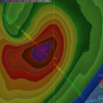
UHR Metop-B ASCAT Winds
Figure 1: UHR Metop-B ASCAT Winds at 1555 UTC 01 September 2026. Credit: NESDIS/STAR

GOES-East CONUS Geocolor Imagery, overlaid with the GLM Flash Extent Density (FED) showed a line of storms track southeastward from PA and WV before crossing the Mid-Atlantic. A cell approaching D.C. had a lightning jump before approaching the city. With the storm over the district, GLM FED values approached the top of the colorbar range (purples to light blues), observing 100-200 strikes over a grid cell (~8 km) within 5 minutes. The CIRA GOES-East Mesoscale GLM Group Energy Density product provided a complementary look, with very energetic flashes (bright white) coinciding with the high number of flashes seen in the FED product.

Figure 2: GOES-East CONUS GLM FED output, overlaid on GeoColor Imagery, from 0111-0651 UTC 04 September 2026. Credit: NESDIS/STAR

Figure 3: 1-Minute GOES-East Mesoscale GLM Group Energy Density output, overlaid on GeoColor Imagery, from 0300-0438 UTC 04 September 2026. From CIRA Slider

The intensifying storms were easily detectable in the GOES-East CONUS Band 13 Infrared (IR) Imagery, with rapidly cooling cloud tops as the convection entered Northern Virginia before pushing eastward into Washington, D.C., and Maryland.

Figure 4: GOES-East CONUS IR Imagery from 0101-0656 UTC 04 September 2026. Credit: NESDIS/STAR

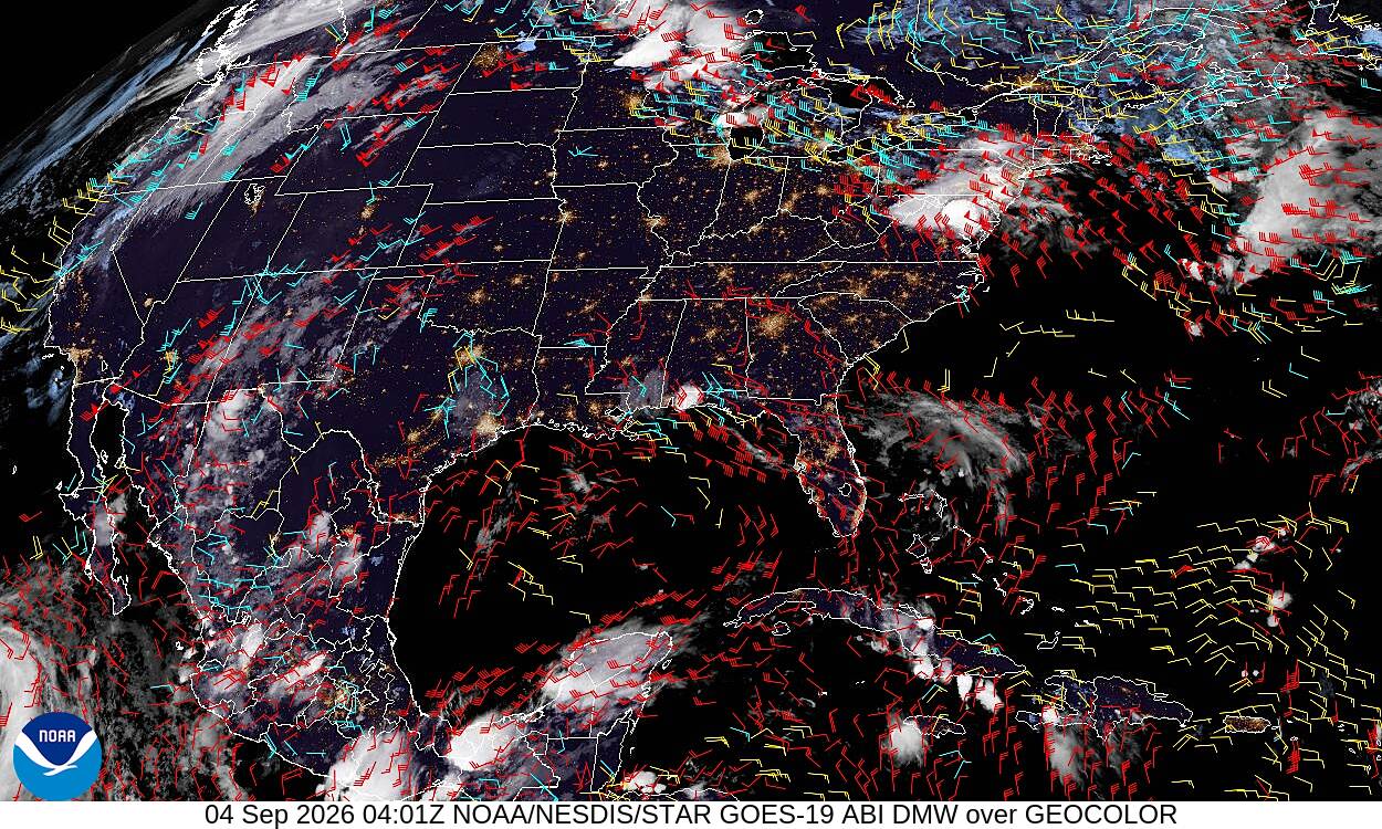
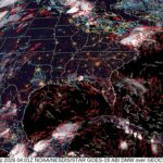
Zoomed out to CONUS-scale, GOES-Derived Motion Wind (DMW)s indicated the overshooting cloud tops from the storm complex had wind speeds in excess of 50 knots at upper-levels (100-400 hPa), confirming the mature nature of the convection.

Figure 5: GOES-East CONUS GeoColor Imagery overlaid with DMWs at 0401 UTC 04 September 2026. Credit: NESDIS/STAR

The GOES Mesosector Optical flow Code for Tracking, Atmospheric motion vectors, and Nowcasting Experiments (OCTANE) Speed Sandwich product allows for cloud motion to be determined by tracking subsequent satellite images. In the product output, a burst of higher cloud-top wind speeds (40-50 m/s, or ~80-100 knots) is seen expanding outward downstream of much slower wind speeds (10-20 m/s, or ~20-40 knots), signaling cloud-top divergence, and confirming the mature storm detected in the GOES DMW output.

Figure 6: GOES-East Mesosector OCTANE Speed Sandwich output from 0300-0437 UTC 04 September 2026. From CIRA Slider

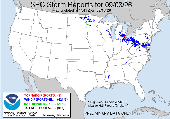
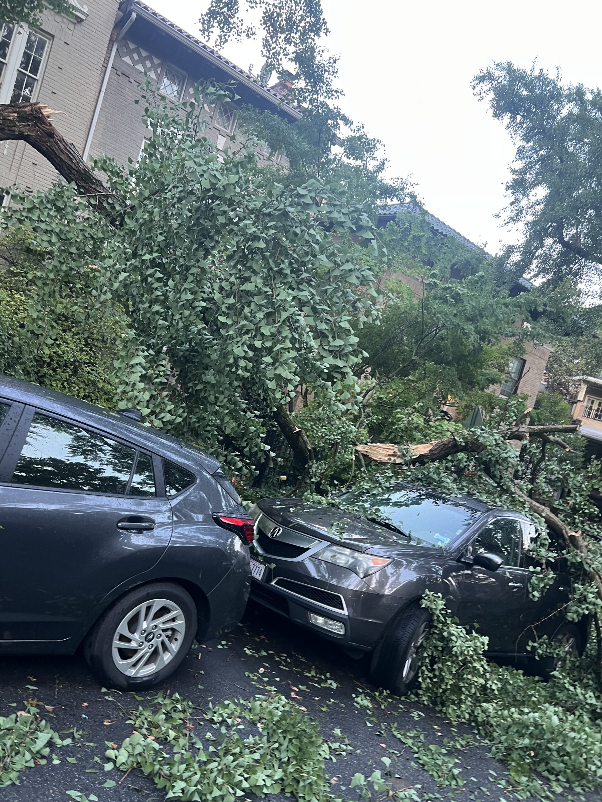
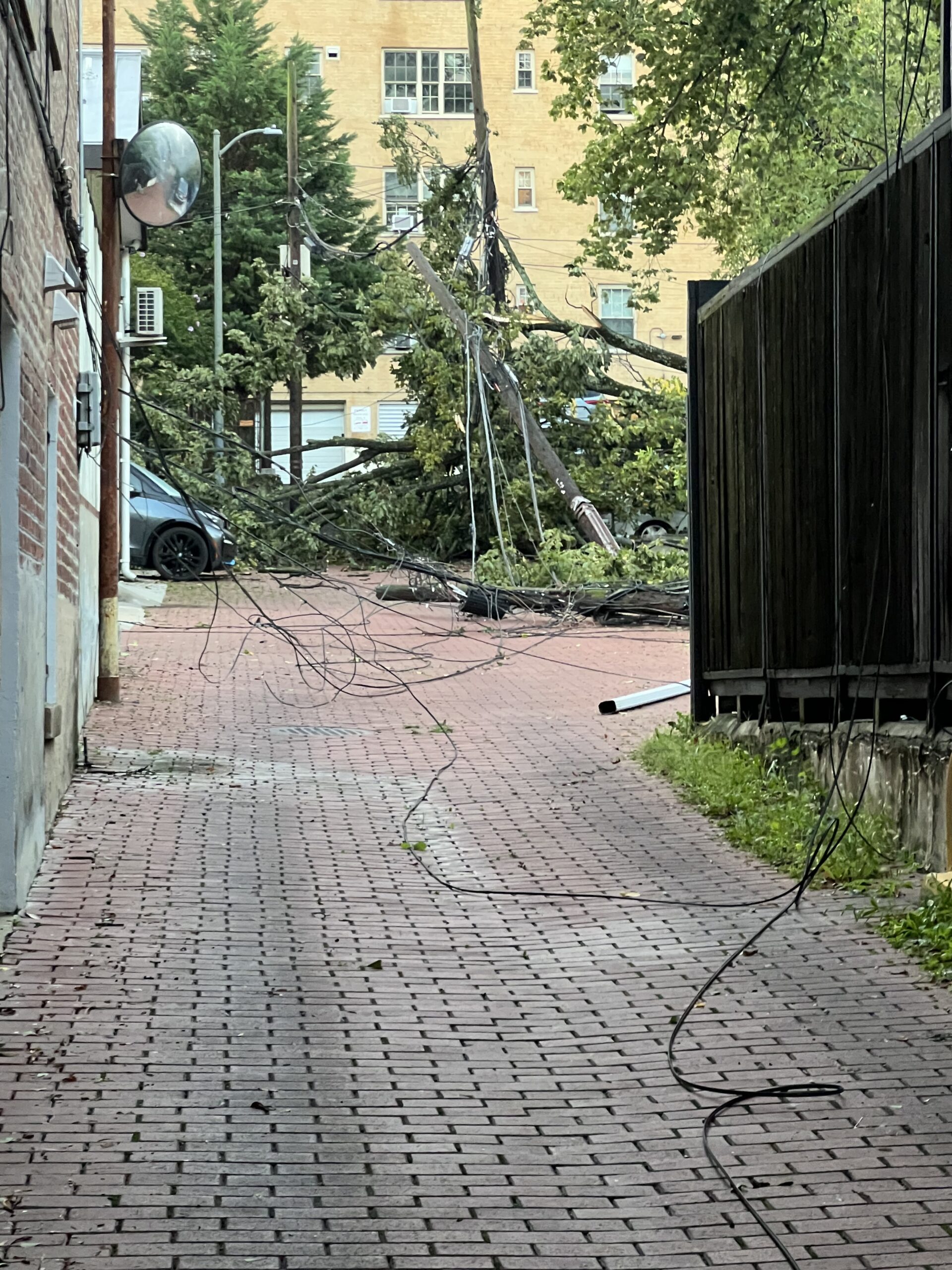
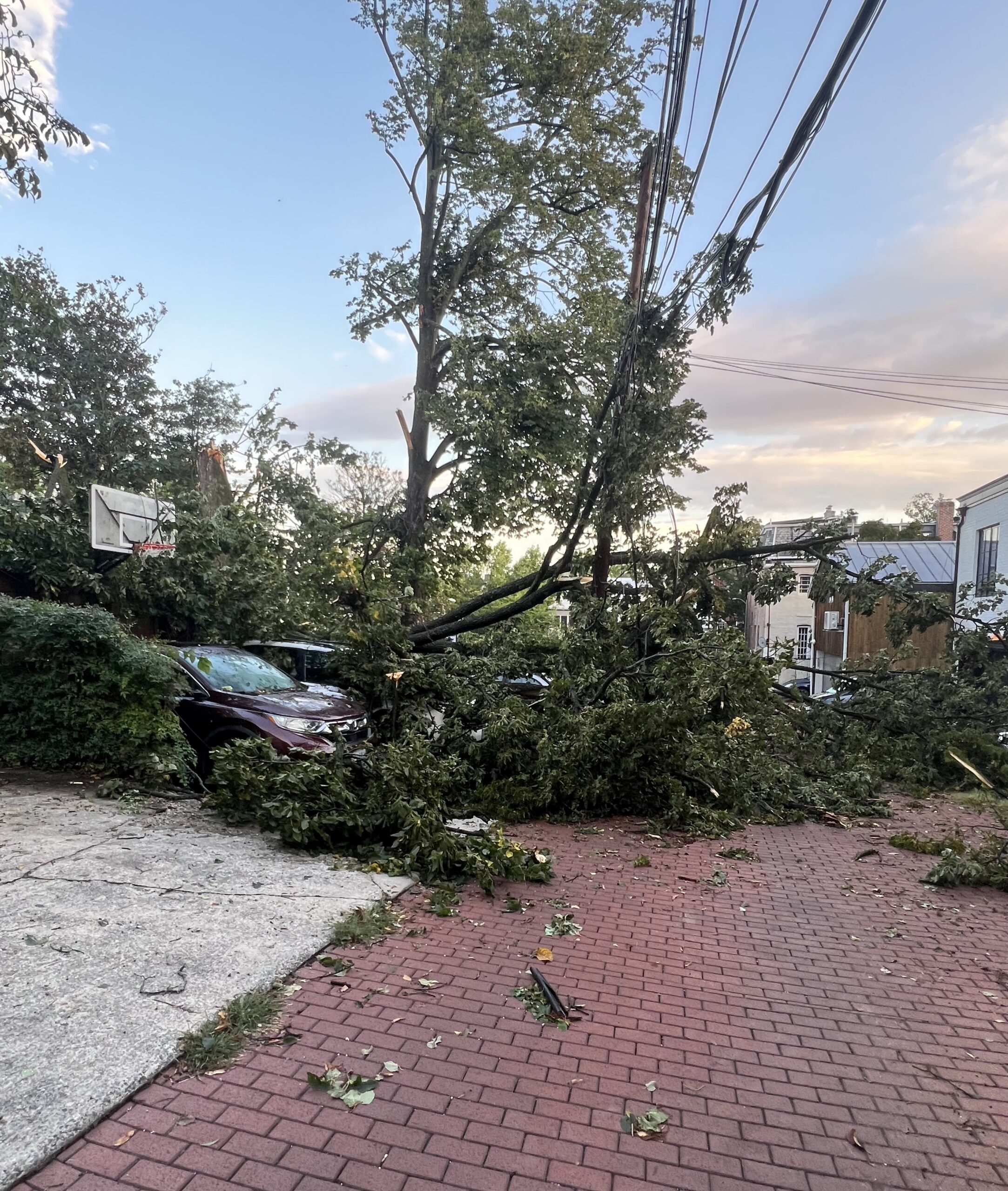
Storm Reports from the NWS SPC confirmed hundreds of Wind Reports from Michigan to Delaware due to the long-lived line of storms, including a wind gust up to 71 mph in the D.C. suburb of Ballston, VA. Photos of damage in Washington, D.C. confirmed fallen limbs on vehicles along with downed trees and power lines.

Figure 7: NWS SPC Storm Reports from 1200 UTC 03 September to 1159 UTC 04 September 2026.
Picture of Christopher Smith

Christopher Smith

Christopher Smith joined ESSIC/CISESS, University of Maryland in 2023 and is the GOES-R Satellite Liaison to the NWS Weather Prediction Center and Ocean and Tsunami Center. Smith works to interpret experimental satellite imagery and products, and make such products available to forecasters and the NWS for a route to operations. He trains forecasters how to use satellite imagery in weather forecasting, while also delivering forecaster feedback to satellite developers to maximize meteorological satellite capabilities. Smith is an alumni of the UMD Atmospheric & Oceanic Science (AOSC) Department, and his long-term interests include infusing AI-Satellite Products to increase lead time in decision making for forecasters.