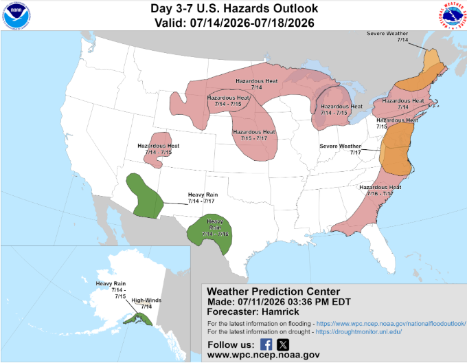
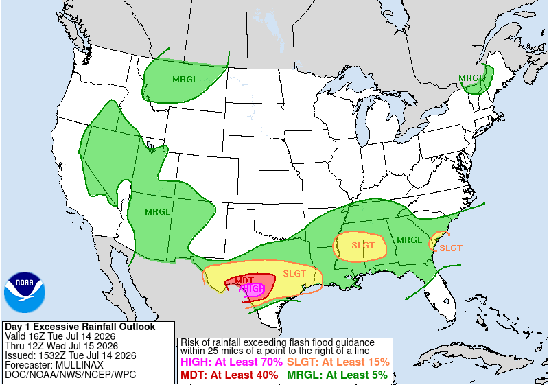
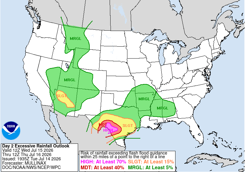
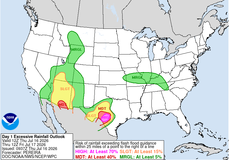
This week brought repeating rounds of heavy rainfall to the Texas Hill Country, resulting in 9 Flash Flood Emergencies. The NWS Weather Prediction Center (WPC) noted the threat for heavy rainfall up to five days in advance in its Hazards Outlook issued on 11 July 2026.
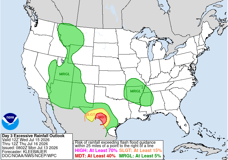
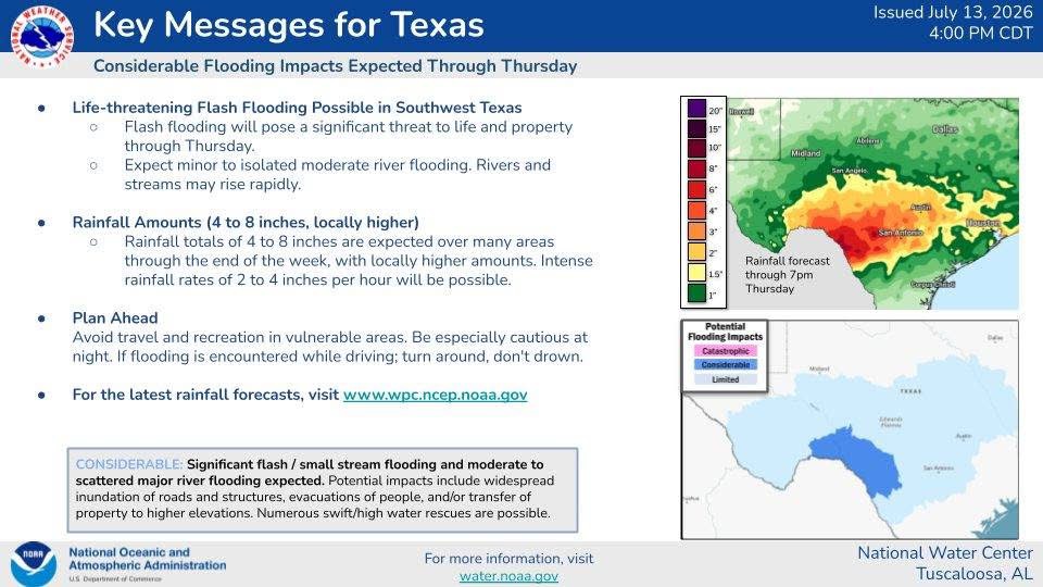
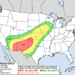
The NWS WPC also issued a rare Day 3 Moderate Risk Excessive Rainfall Outlook (ERO) across the TX Hill Country at 0802 UTC 13 July for the 24-hour period ending at 1200 UTC 16 July 2026. By the afternoon of 13 July 2026, Key Messsages were initiated by the NWS National Water Center (NWC) in conjunction with NWS WPC, noting ‘Life-threatening Flash Flooding Possible in Southwest Texas’ and ‘Considerable’ Potential Flooding Impacts.
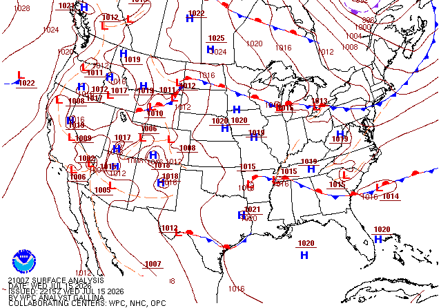
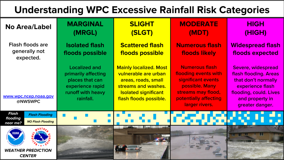
The rainfall event ended up being long duration, fueled by a stationary front draped across the region and a mesoscale convective vortex (MCV). There were three consecutive days of High Risk EROs, days with ‘Widespread flash floods expected’. For the 24-hour period ending at 1200 UTC 16 July 2026, there was even a Day 2 High Risk ERO issued.
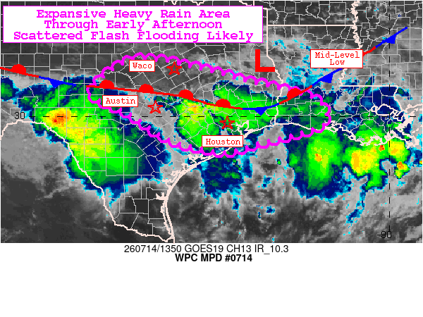
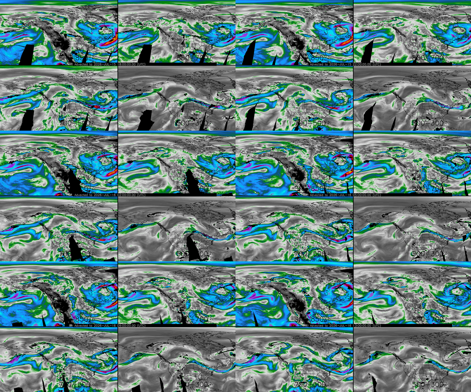
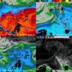
The WPC MetWatch Desk issued a Mesoscale Precipitation Discussion (MPD) on the morning of 14 July 2026 with a ‘Flash flooding likely’ tag due to ‘extreme moisture and PW of 2 to 2.3″. The NESDIS Advected Layered Precipitable Water (ALPW) product confirmed PW values in excess of 2″ when summing all four layers. In the ALPW animation, moisture can be seen streaming in from the Gulf at lower levels, but also a connection to the tropical East Pacific in the 700-500 hPa layer.
Figure 7: NESDIS/OSPO ALPW output from 0900 UTC 13 July to 2000 UTC 14 July 2026. This animation was exported from AWIPS, and display files can be shared upon request.
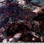
Heading into the overnight and early morning hours of 15 July 2026, the GOES-East GLM Flash Extent Density (FED) captured an intense flare-up of convection after ~0700 UTC west of San Antonio that lasted several hours. The resulting spin of the MCV can be tracked in the Geocolor imagery through the early afternoon.
Figure 8: GOES-East Full Disk (FD) Geocolor imagery overlaid with GLM FED from 1900 UTC 14 July to 1920 UTC 15 July 2026. This animation was exported from AWIPS, and display files can be shared upon request.
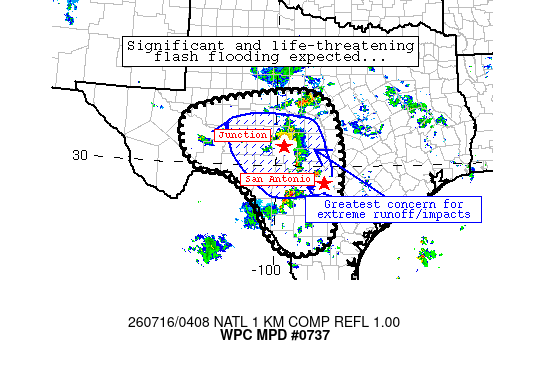
An MPD issued by the WPC MetWatch Desk issued overnight heading into 16 July stated ‘significant, life-threatening impacts from flash flooding are expected tonight’, in part due to ‘backbuilding’ cells. There was a GOES-East outage at this time, but GOES-West FD imagery in AWIPS provides imagery over Texas (with a degree of parallax). The backbuilding cells are apparent in the GOES-West FD IR imagery by 0600 UTC. In the animation, Flash Flood Warnings are also overlaid, with Flash Flood Emergencies in the bold pink color. The Cooperative Institute for Research in the Atmosphere (CIRA) Layered Vapor Transport (LVT) product at this time showed moisture was being readily replaced, transported from the east at lower levels and from the southwest at upper levels. The CIRA LVT is ready for AWIPS implementation.
Figure 10: GOES-West FD IR imagery overlaid with Flash Flood Warnings (pink) and Flash Flood Emergencies (bold) from 1810 UTC 15 July to 1720 UTC 16 July 2026. This animation was exported from AWIPS, and display files can be shared upon request.
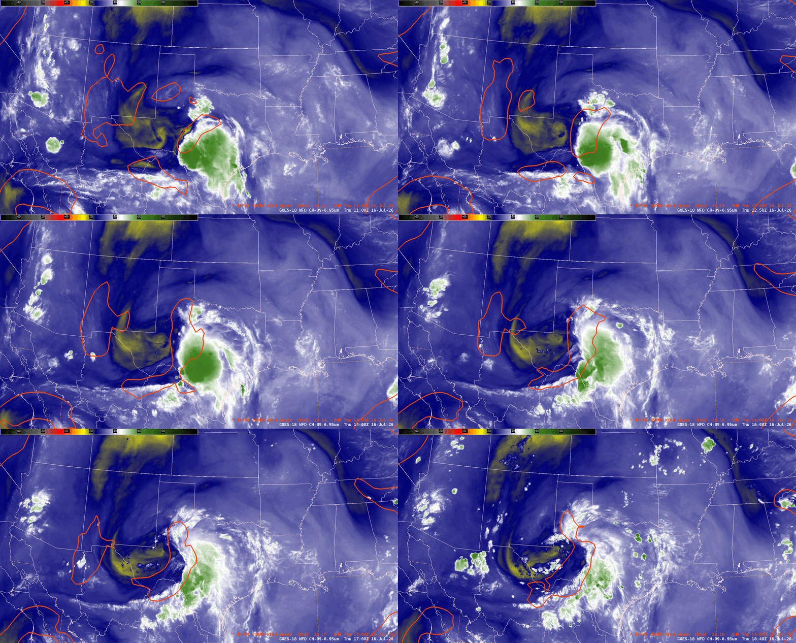
GOES-West FD Mid-Level Water Vapor Band 9 imagery overlaid with RAP analysis of 250 hPa winds showed a localized upper-level jet through much of 16 July 2026, with convection firing in the right-entrance region. In a longer duration loop of the WV imagery, a mid-level disturbance responsible for maintaining convection is easy to track.
Figure 13: GOES-West FD Mid-Level WV imagery from 1900 UTC 15 July to 1940 UTC 16 July 2026. This animation was exported from AWIPS, and display files can be shared upon request.
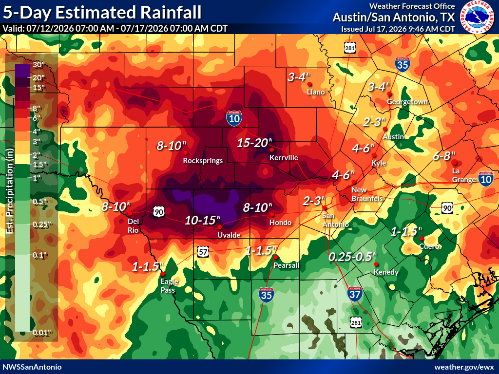
Rainfall over the past five days has reached double digits in much of Southwest TX, with parts of hard-hit Uvalde County receiving between 20 and 30 inches of rain.