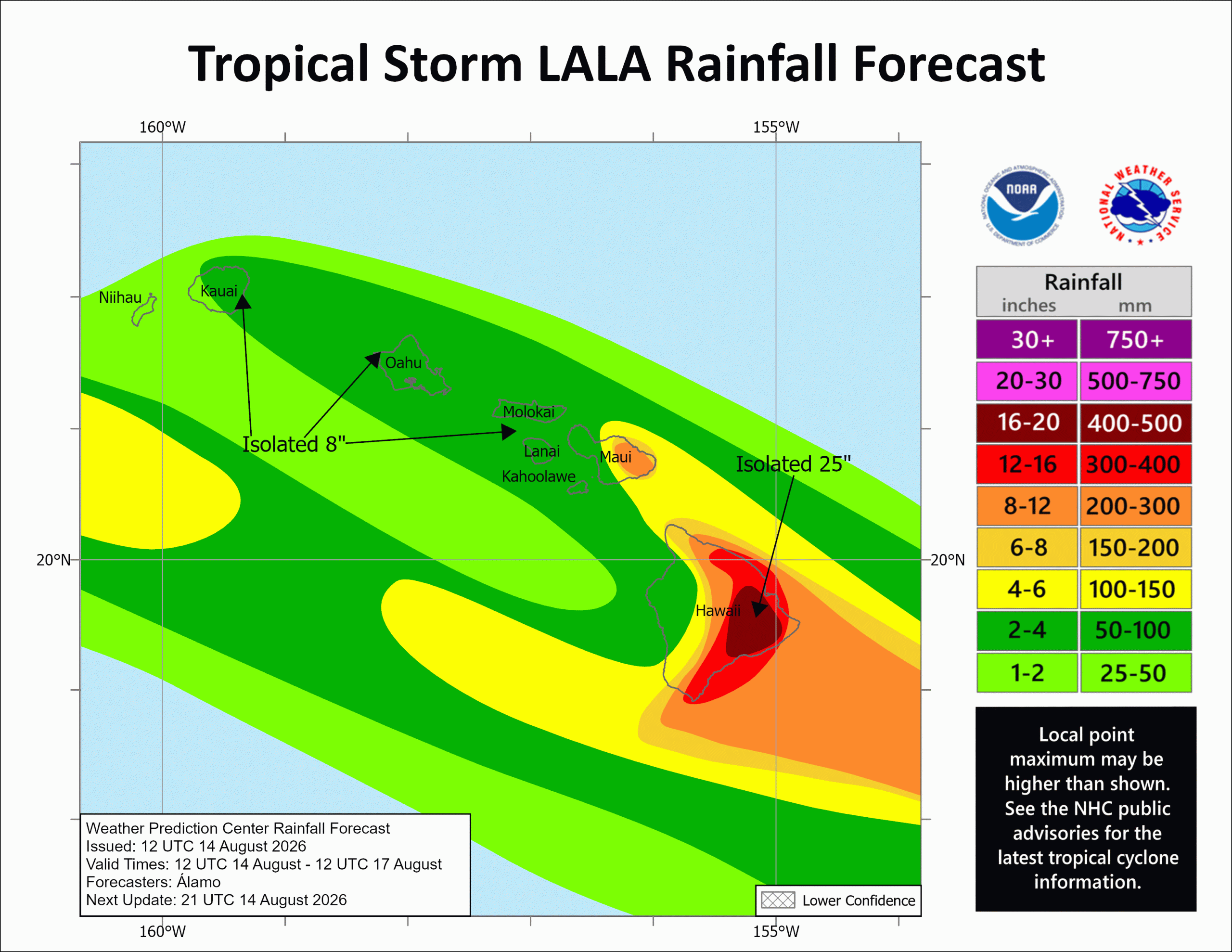
Hurricane Lala caused power outages and flooding rains in Hawaii over the weekend after tracking just south of the island chain. The NWS Weather Forecast Office (WFO) in Honolulu began issuing Hurricane Local Statements (HLS) at 1510 UTC 13 August 2026 as a Hurricane Watch was issued for the Big Island. By 0306 UTC 14 August 2026, the Big Island was upgraded to a Hurricane Warning while Tropical Storm Watches expanded, before being upgraded to warnings. The NWS Weather Prediction Center (WPC) began producing Rainfall Forecasts at 1200 UTC 14 August 2026, showing the potential for several inches of rain across the state, especially across eastern-flacing slopes, with parts of the Big Island expected to exceed 2 feet of rainfall.
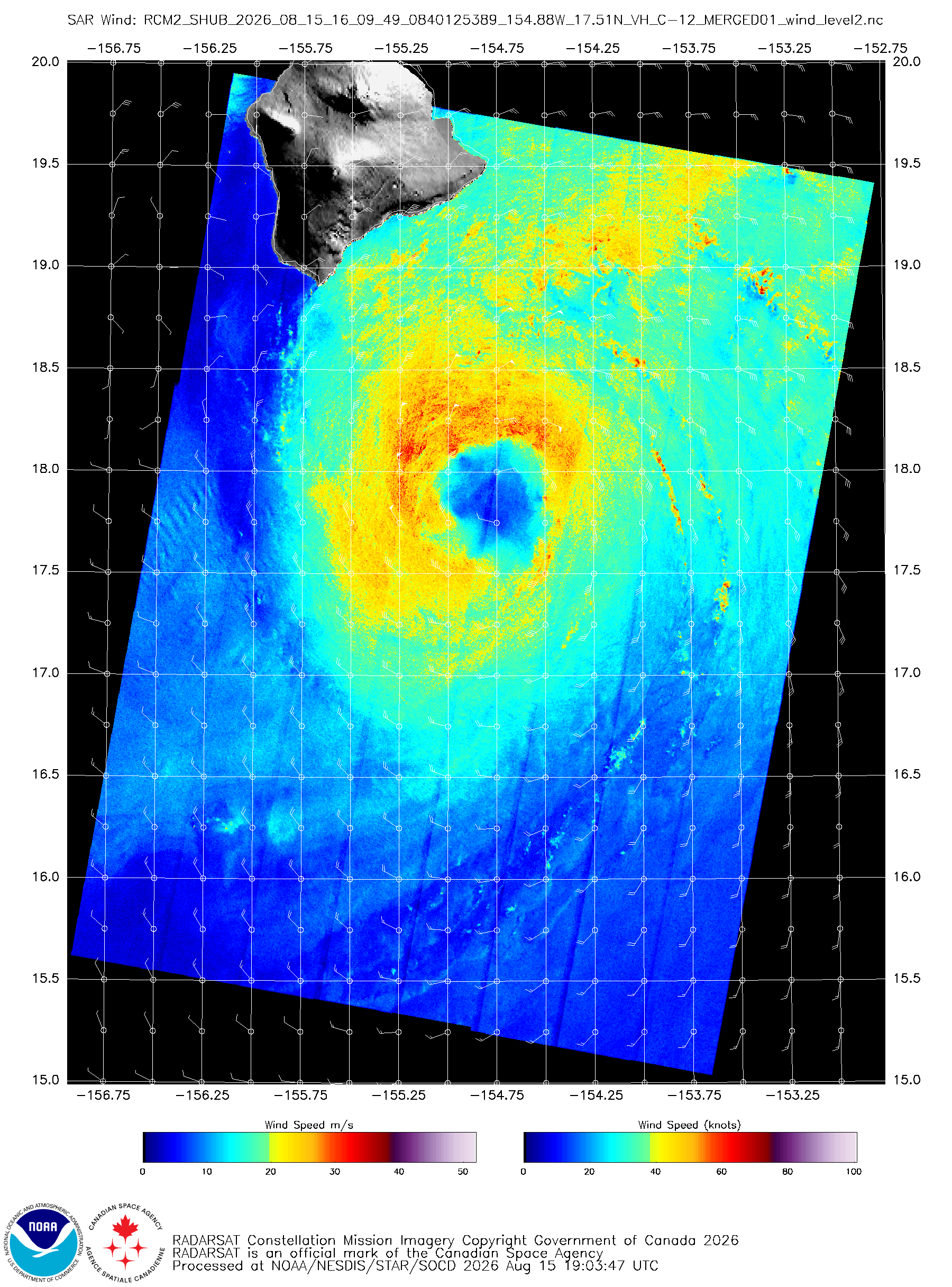
Just prior to reaching hurricane-force at 1900 UTC 15 August 2026, the Tropical Cyclone Winds Algorithm for Synthetic Aperture Radar (SAR) RadarSat Constellation Mission – 2 (RCM-2) Winds captured winds approaching 55-60 knots across in the northern quadrants.
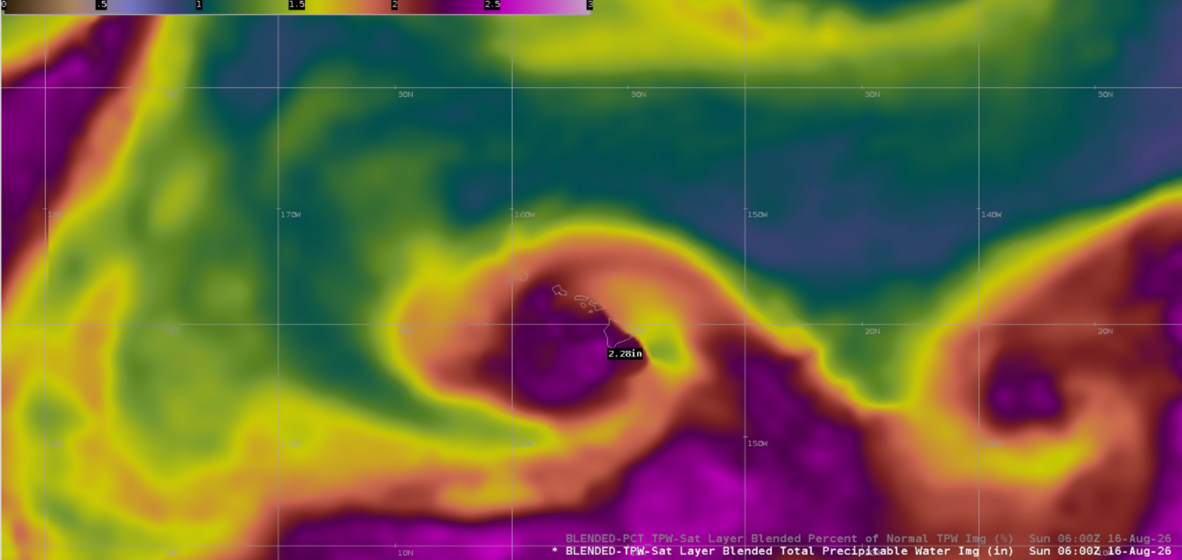
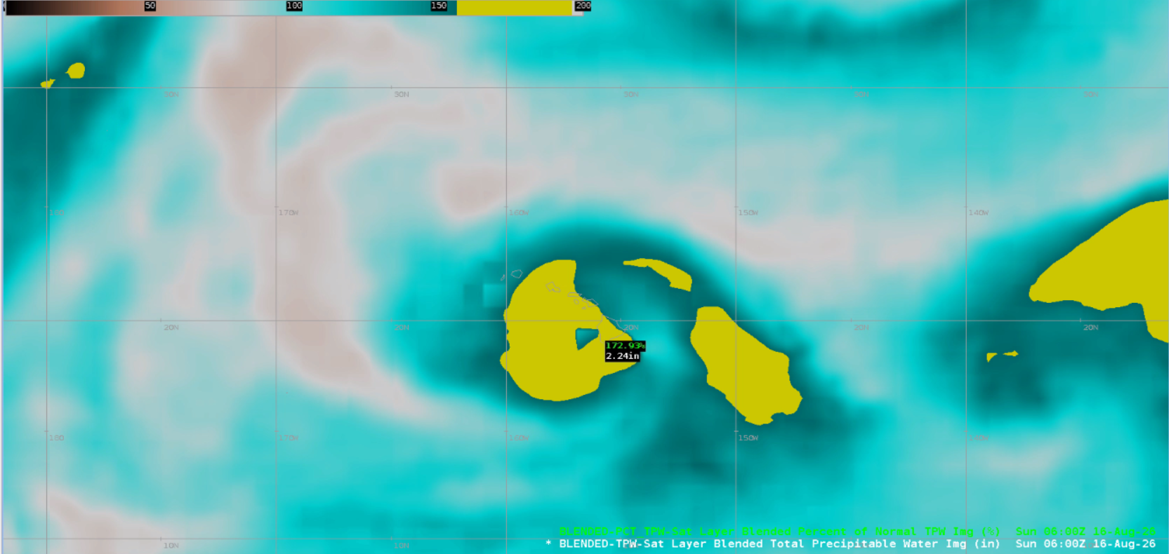
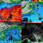
As Hurricane Lala tracked just south of Hawaii, its surge of tropical moisture was transported overhead. The NESDIS/OSPO bTPW output at 0600 UTC 16 August 2026 had PW values exceeding 2″ across much of the state, approaching 2.25″ across the Big Island. The bTPW Anomaly output showed these bTPW values were well-above normal, exceeding 170%.
Figure 3: NESDIS/OSPO bTPW (left) and bTPW Anomaly (right) output at 0600 UTC 16 August 2026.
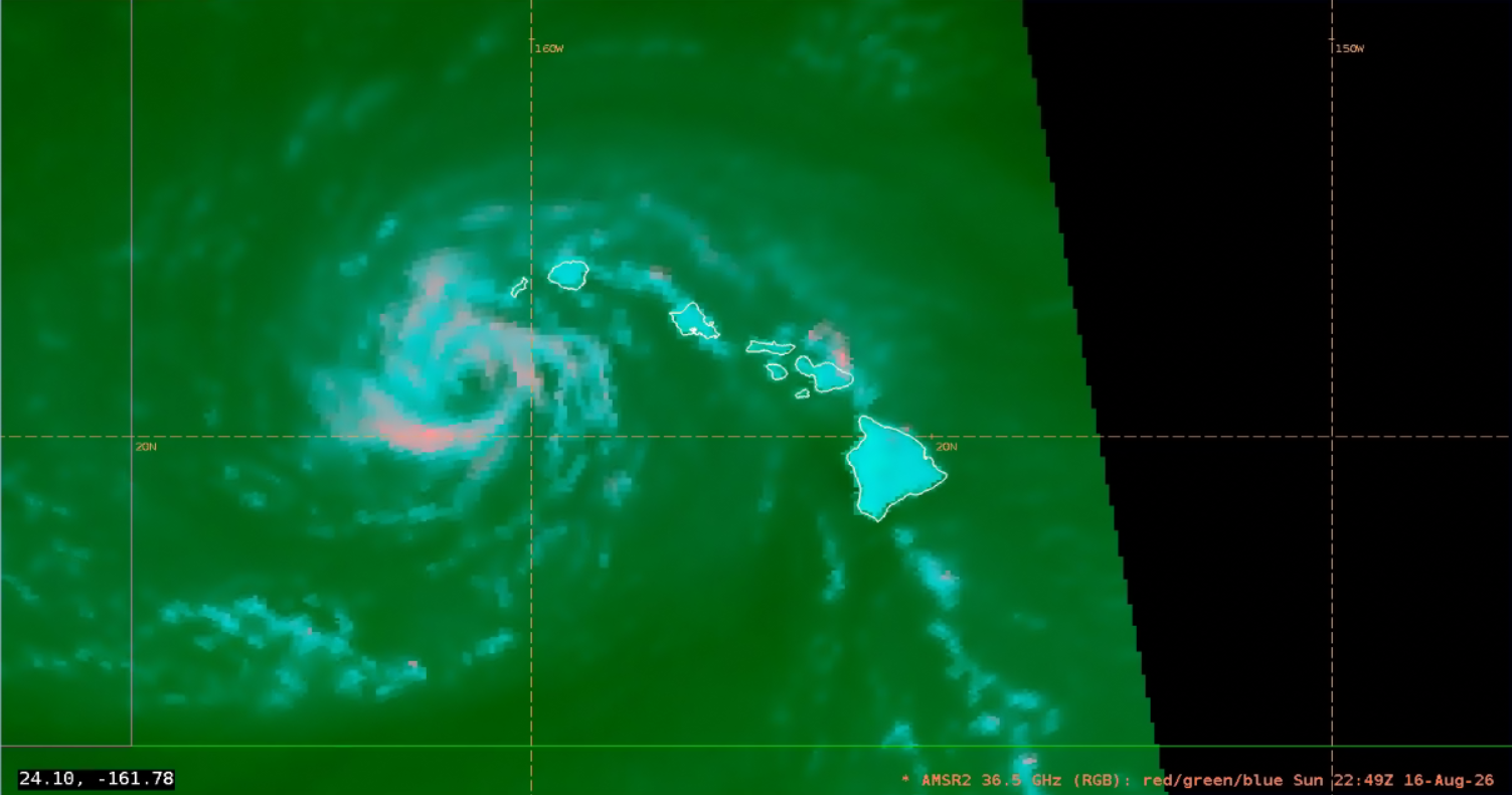
Lala weakened back into a tropical storm on 16 August 2026, and a 36.5 GHz GCOM-W/AMSR2 pass at ~2249 UTC indicated an exposed low-level circulation with less intense convection, especially on the southeast side of the circulation. AMSR2 products will be decommissioned and transitioned to AMSR3 on September 2, but 36.5 and 89 GHz AMSR3 microwave imagery bands are ready for AWIPS implementation.
The evolution of Lala can be seen in the GOES-West Full Disk GeoProxy imagery, a combination of GeoColor and Proxyvis (which helps identify low-level clouds over warm waters at night), as the tropical cyclone moved nearly parallel to the south of the state. The repeating rounds of convection that caused flooding rain are easily trackable in the GOES-West Infrared (IR) Band 13 imagery.
Â
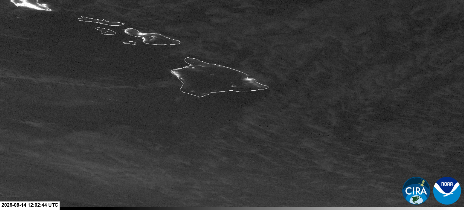
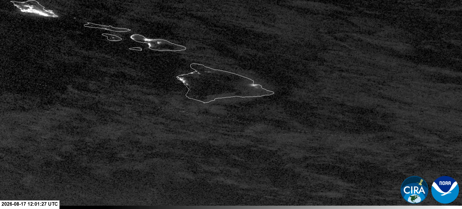
Hawaii, Honolulu, and Maui counties all observed wind gusts exceeding hurricane-force, causing power outages. The JPSS/VIIRS Day/Night Band captured the power outages on Hawaii’s Big Island. Comparing two nights with some clear skies, there’s a noticeable reduction in city lights across southern parts of the island from 14 August to 17 August 2026.
In addition to powerful winds, rains caused instances of flooding such as in Naalehu in the Kau District as homes were swept away by flood waters and a Flash Flood Emergency was issued.